Bestand:Rottumeroog Rottumerplaat 6.53663E 53.54001N.jpg

Grootte van deze voorvertoning: 800 × 599 pixels. Andere resoluties: 320 × 240 pixels | 640 × 479 pixels | 1.024 × 766 pixels | 1.280 × 958 pixels.
Oorspronkelijk bestand (1.280 × 958 pixels, bestandsgrootte: 444 kB, MIME-type: image/jpeg)
| Dit is een bestand van Wikimedia Commons. Onderstaande beschrijving komt van de beschrijving van het bestand daar. |
| Beschrijving |
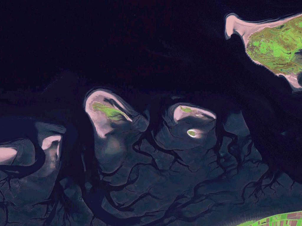
English: Some West Frisian Islands (Netherlands) and some East Frisian Islands (Germany), from left to right: part of Schiermonnikoog, Simonszand, Rottumerplaat, Rottumeroog (north) with Zuiderduintjes (south) and part of Borkum. |
|||
| Datum | voor 2005 | |||
| Bron |
English: NASA World Wind screenshot |
|||
| Auteur | – (NASA World Wind) | |||
| Toestemming (Hergebruik van dit bestand) |
|

| Aantekeningen | Deze afbeelding is aangetekend: Bekijk de aantekeningen op Commons |
Bestandsgeschiedenis
Klik op een datum/tijd om het bestand te zien zoals het destijds was.
| Datum/tijd | Miniatuur | Afmetingen | Gebruiker | Opmerking | |
|---|---|---|---|---|---|
| huidige versie | 13 okt 2013 21:06 | | 1.280 × 958 (444 kB) | Jahoe | stretched contrast |
| 15 mei 2005 15:53 |  | 1.280 × 958 (59 kB) | Rex | NASA World Wind screenshot. {{PD-USGov-NASA}} Category:Maps of The Netherlands |
Bestandsgebruik
Dit bestand wordt op de volgende 4 pagina's gebruikt:
Globaal bestandsgebruik
De volgende andere wiki's gebruiken dit bestand:
- Gebruikt op arz.wikipedia.org
- Gebruikt op br.wikipedia.org
- Gebruikt op ca.wikipedia.org
- Gebruikt op ceb.wikipedia.org
- Gebruikt op de.wikipedia.org
- Gebruikt op en.wikipedia.org
- Gebruikt op eo.wikipedia.org
- Gebruikt op es.wikipedia.org
- Gebruikt op frr.wikipedia.org
- Gebruikt op fr.wikipedia.org
- Gebruikt op fy.wikipedia.org
- Gebruikt op nds-nl.wikipedia.org
- Gebruikt op nds.wikipedia.org
- Gebruikt op nn.wikipedia.org
- Gebruikt op no.wikipedia.org
- Gebruikt op ru.wikipedia.org
- Gebruikt op stq.wikipedia.org
- Gebruikt op www.wikidata.org