Bestand:River Trent map.png

Grootte van deze voorvertoning: 527 × 600 pixels. Andere resoluties: 211 × 240 pixels | 422 × 480 pixels | 675 × 768 pixels | 900 × 1.024 pixels | 1.761 × 2.004 pixels.
Oorspronkelijk bestand (1.761 × 2.004 pixels, bestandsgrootte: 3,54 MB, MIME-type: image/png)
| Dit is een bestand van Wikimedia Commons. Onderstaande beschrijving komt van de beschrijving van het bestand daar. |
Beschrijving
| Beschrijving |
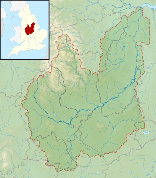
English: Map of the River Trent and its catchment in England.
Map is on British National Grid with limits at grid refs SD5530 (top left), TA0030 (top right), SO5565 (bottom left), TL0065 (bottom right). |
| Datum | |
| Bron |
|
| Auteur | Nilfanion, created using Ordnance Survey data |
| Toestemming (Hergebruik van dit bestand) |
Dit bestand is gelicenseerd onder de Creative Commons-licentie Naamsvermelding-Gelijk delen 3.0 Unported Naamsvermelding: Contains Ordnance Survey data © Crown copyright and database right
|
Bestandsgeschiedenis
Klik op een datum/tijd om het bestand te zien zoals het destijds was.
| Datum/tijd | Miniatuur | Afmetingen | Gebruiker | Opmerking | |
|---|---|---|---|---|---|
| huidige versie | 6 mrt 2014 01:41 | | 1.761 × 2.004 (3,54 MB) | Nilfanion | == {{int:filedesc}} == {{Information |Description= {{en|Map of the River Trent and its catchment in England. Map is on British National Grid with limits at grid refs SD5530 (top left), TA0030 (top right), SO5565 (bottom left), TL0065 (bottom right).}}... |
Bestandsgebruik
Dit bestand wordt op de volgende pagina gebruikt:
Globaal bestandsgebruik
De volgende andere wiki's gebruiken dit bestand:
- Gebruikt op en.wikipedia.org
- Gebruikt op he.wikipedia.org