Bestand:1946 Map of Pyongyang, Army Map Service, US Army.jpg

Grootte van deze voorvertoning: 558 × 600 pixels. Andere resoluties: 223 × 240 pixels | 446 × 480 pixels | 714 × 768 pixels | 952 × 1.024 pixels | 1.905 × 2.048 pixels | 4.168 × 4.481 pixels.
Oorspronkelijk bestand (4.168 × 4.481 pixels, bestandsgrootte: 7,74 MB, MIME-type: image/jpeg)
| Dit is een bestand van Wikimedia Commons. Onderstaande beschrijving komt van de beschrijving van het bestand daar. |
Beschrijving
| Beschrijving |
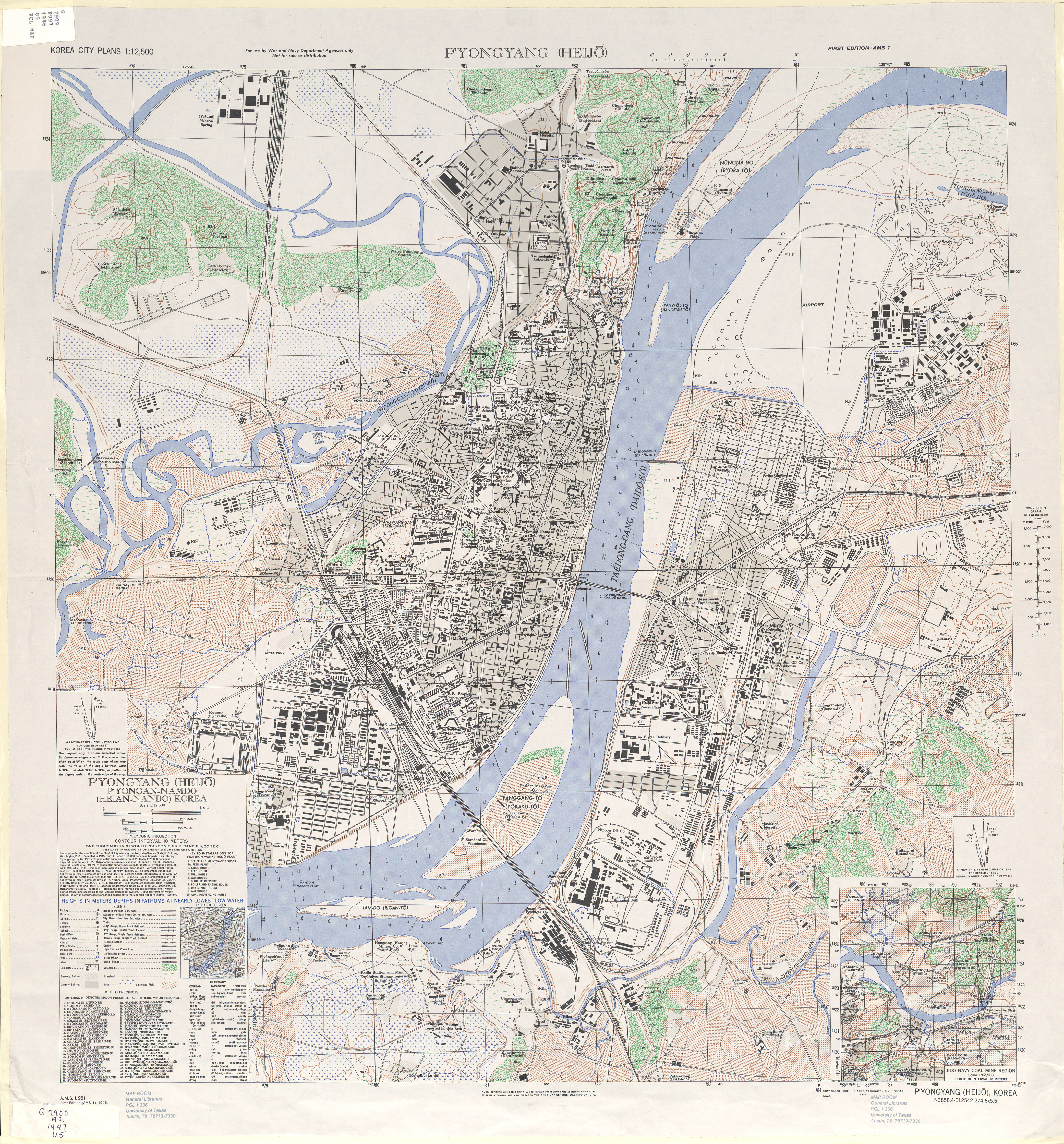
English: 1946 Map of Pyongyang (Heijo), North Korea by the Army Map Service, U.S. Army |
| Datum | |
| Bron | http://www.lib.utexas.edu/maps/ams/korea_city_plans/txu-oclc-6565231.jpg |
| Auteur | Army Map Service, U.S. Army, Washington D.C. |
| Andere versies |


Licentie
Deze afbeelding is een werk van een soldaat of werknemer van de U.S. Army, genomen of gemaakt tijdens de uitvoering van diens officiële taken. Als werk van de federale overheid van de Verenigde Staten bevindt deze afbeelding zich in het publiek domein.
|
 |

|
Deze old map-afbeelding zou opnieuw moeten worden aangemaakt als een SVG-bestand door vectorafbeeldingen te gebruiken. Dit heeft een aantal voordelen; zie Commons:Media for cleanup voor meer informatie. Als er een SVG-formaat van deze afbeelding bestaat, dan deze graag uploaden. Nadat u dit heeft gedaan, gelieve dit sjabloon te vervangen door het sjabloon {{vector version available|nieuwe bestandsnaam.svg}} op deze afbeeldingspagina.
|


Bestandsgeschiedenis
Klik op een datum/tijd om het bestand te zien zoals het destijds was.
| Datum/tijd | Miniatuur | Afmetingen | Gebruiker | Opmerking | |
|---|---|---|---|---|---|
| huidige versie | 11 feb 2010 09:49 | | 4.168 × 4.481 (7,74 MB) | AniRaptor2001 | {{Information |Description={{en|1=1946 Map of Pyongyang (Heijo), North Korea by the Army Map Service, U.S. Army}} |Source=http://www.lib.utexas.edu/maps/ams/korea_city_plans/txu-oclc-6565231.jpg |Author=Army Map Service, U.S. Army, Washington D.C. |Date=1 |
Bestandsgebruik
Dit bestand wordt op de volgende pagina gebruikt:
Globaal bestandsgebruik
De volgende andere wiki's gebruiken dit bestand:
- Gebruikt op de.wikipedia.org
- Gebruikt op en.wikipedia.org
- Gebruikt op es.wikipedia.org
- Gebruikt op gl.wikipedia.org
- Gebruikt op it.wikipedia.org
- Gebruikt op ja.wikipedia.org
- Gebruikt op ko.wikipedia.org
- Gebruikt op nds.wikipedia.org
- Gebruikt op no.wikipedia.org
- Gebruikt op ps.wikipedia.org
- Gebruikt op th.wikipedia.org
- Gebruikt op www.wikidata.org