Bestand:Palau.PNG
Oorspronkelijk bestand (626 × 832 pixels, bestandsgrootte: 47 kB, MIME-type: image/png)
| Dit is een bestand van Wikimedia Commons. Onderstaande beschrijving komt van de beschrijving van het bestand daar. |

|
Dit bestand kan vervangen worden door File:Un-palau.png. Het wordt aangeraden om het andere bestand te gebruiken. Opmerking: dit bestand zal niet worden verwijderd tenzij het expliciet wordt genomineerd ter verwijdering. empty
|

|
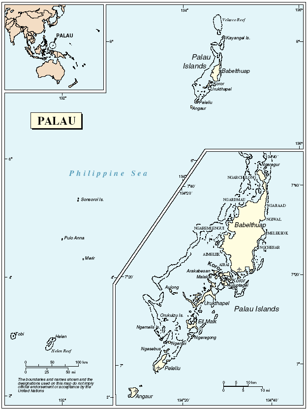
Mapa de la República de Palau.
Fuente: http://www.un.org/Depts/Cartographic/map/profile/palau.pdf
| This image is a map derived from a United Nations map.
Unless stated otherwise, UN maps are to be considered in the public domain. This applies worldwide. UN maps are, in principle, open source material and you can use them in your work or for making your own map. UN requests however that you delete the UN name, logo and reference number upon any modification to the map. Content of your map will be your responsibility. You can state in your publication, if you wish, something like: based on UN map … (map name, map number, revision number and date). See: Geospatial Information Section. And: Geospatial, location data for a better world. |
 |
Bestandsgeschiedenis
Klik op een datum/tijd om het bestand te zien zoals het destijds was.
| Datum/tijd | Miniatuur | Afmetingen | Gebruiker | Opmerking | |
|---|---|---|---|---|---|
| huidige versie | 23 mei 2005 02:54 | | 626 × 832 (47 kB) | Taichi | Mapa de la República de Palau. Fuente: http://www.un.org/Depts/Cartographic/map/profile/palau.pdf {{PD}} |
Bestandsgebruik
Dit bestand wordt op de volgende 2 pagina's gebruikt:
Globaal bestandsgebruik
De volgende andere wiki's gebruiken dit bestand:
- Gebruikt op ar.wikipedia.org
- Gebruikt op ban.wikipedia.org
- Gebruikt op ca.wikipedia.org
- Gebruikt op ckb.wikipedia.org
- Gebruikt op de.wikipedia.org
- Gebruikt op en.wikipedia.org
- Gebruikt op fa.wikipedia.org
- Gebruikt op hu.wikipedia.org
- Gebruikt op id.wikipedia.org
- Gebruikt op ja.wikipedia.org
- Gebruikt op lfn.wikipedia.org
- Gebruikt op mzn.wikipedia.org
- Gebruikt op tg.wikipedia.org
- Gebruikt op uk.wikipedia.org
- Gebruikt op www.wikidata.org
- Gebruikt op zh.wikipedia.org