Bestand:NZASM line map.svg

Afmetingen van deze voorvertoning van het type PNG van dit SVG-bestand: 800 × 498 pixels Andere resoluties: 320 × 199 pixels | 640 × 398 pixels | 1.024 × 637 pixels | 1.280 × 796 pixels | 2.560 × 1.593 pixels | 982 × 611 pixels.
Oorspronkelijk bestand (SVG-bestand, nominaal 982 × 611 pixels, bestandsgrootte: 111 kB)
| Dit is een bestand van Wikimedia Commons. Onderstaande beschrijving komt van de beschrijving van het bestand daar. |
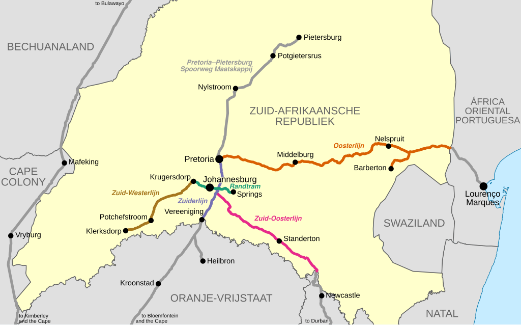
| Beschrijving | Map showing the railway lines of the Netherlands-South African Railway Company in the South African Republic (Transvaal), as they were in 1899 at the outbreak of the Anglo-Boer War. | |||
| Datum | ||||
| Bron |
|
|||
| Auteur | Htonl | |||
| Toestemming (Hergebruik van dit bestand) |
Ik, de auteursrechthebbende van dit werk, maak het hierbij onder de volgende licentie beschikbaar: This file is licensed under the Creative Commons Attribution-Share Alike 4.0 International and 3.0 Unported license.
|
|||
| Andere versies | File:Transvaal railway map 1899.svg |
Bestandsgeschiedenis
Klik op een datum/tijd om het bestand te zien zoals het destijds was.
| Datum/tijd | Miniatuur | Afmetingen | Gebruiker | Opmerking | |
|---|---|---|---|---|---|
| huidige versie | 6 jul 2016 21:45 | | 982 × 611 (111 kB) | Htonl | {{Information |Description=Map showing the railway lines of the en:Netherlands-South African Railway Company in the en:South African Republic (Transvaal), as they were in 1899 at the outbreak of the Anglo-Boer War. |Source=* Own work * Open... |
Bestandsgebruik
Dit bestand wordt op de volgende pagina gebruikt:
Globaal bestandsgebruik
De volgende andere wiki's gebruiken dit bestand:
- Gebruikt op af.wikipedia.org
- Gebruikt op azb.wikipedia.org
- Gebruikt op de.wikipedia.org
- Gebruikt op en.wikipedia.org
- Gebruikt op tum.wikipedia.org
- Gebruikt op www.wikidata.org