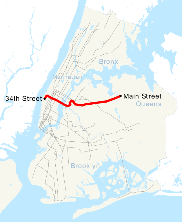
Bestand:NYCS map 7.svg

Afmetingen van deze voorvertoning van het type PNG van dit SVG-bestand: 490 × 599 pixels Andere resoluties: 196 × 240 pixels | 393 × 480 pixels | 628 × 768 pixels | 838 × 1.024 pixels | 1.676 × 2.048 pixels | 648 × 792 pixels.
Oorspronkelijk bestand (SVG-bestand, nominaal 648 × 792 pixels, bestandsgrootte: 379 kB)
| Dit is een bestand van Wikimedia Commons. Onderstaande beschrijving komt van de beschrijving van het bestand daar. |
Beschrijving
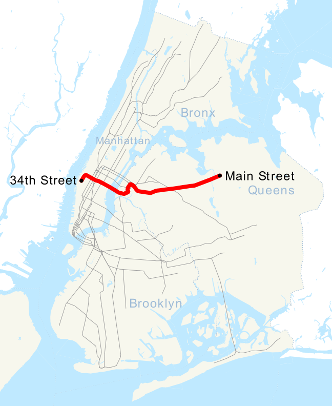
| Beschrijving | This is a map showing the New York City Subway's 7 service. It was created with TIGER/Line GIS data (water and boundaries) and my own data (subway lines and stations, traced on TIGER/Line road data). If you would like a copy of the subway data, email me. |
| Datum | 1 mei 2007 (originele uploaddatum) |
| Bron | Geen machineleesbare bron opgegeven. Eigen werk aangenomen (gebaseerd op auteursrechtclaims). |
| Auteur | Geen machineleesbare auteur aanwezig. Op basis van auteursrechtclaims wordt auteur NE2 aangenomen. |
Licentie
| Ik, de auteursrechthebbende van dit werk, geef dit werk vrij in het publieke domein. Dit is wereldwijd van toepassing. In sommige landen is dit wettelijk niet mogelijk; in die gevallen geldt: Ik sta iedereen toe dit werk voor eender welk doel te gebruiken, zonder enige voorwaarden, tenzij zulke voorwaarden door de wet worden voorgeschreven. |
Bestandsgeschiedenis
Klik op een datum/tijd om het bestand te zien zoals het destijds was.
| Datum/tijd | Miniatuur | Afmetingen | Gebruiker | Opmerking | |
|---|---|---|---|---|---|
| huidige versie | 12 sep 2015 08:49 | | 648 × 792 (379 kB) | Jc86035 | moved text marker for 34th St |
| 12 sep 2015 08:38 |  | 648 × 792 (377 kB) | Jc86035 | fixed text (sans-serif to Arial) to match and changed it to path, fixed/simplified path of 7 extension, cleaned up with SVGCleaner | |
| 11 sep 2015 21:27 |  | 648 × 792 (380 kB) | DMacks | remove "Times Square" label (previously-removed box had covered it) | |
| 11 sep 2015 17:29 |  | 648 × 792 (390 kB) | DMacks | remove white rectangle just above "Times Square" | |
| 2 sep 2015 17:45 |  | 648 × 792 (390 kB) | FlushingLocal | Reverted to version as of 15:43, 2 September 2015 | |
| 2 sep 2015 17:45 |  | 648 × 792 (390 kB) | FlushingLocal | Updated again to an issue with the original file. | |
| 2 sep 2015 17:43 |  | 648 × 792 (390 kB) | FlushingLocal | Updated 7 Train Map to 34 St - Hudson Yards as the new terminal and removed Times Square | |
| 29 okt 2011 12:48 |  | 648 × 792 (464 kB) | Robot8A | text to path because you can't see it properly in article | |
| 1 mei 2007 02:04 |  | 648 × 792 (389 kB) | NE2 | == Summary == This is a map showing the New York City Subway's 7 service. It was created with TIGER/Line GIS data (water and boundaries) and my own data (subway lines and stations, traced on TIGER/Line road data). If you would like a copy of the subway da |
Bestandsgebruik
Dit bestand wordt op de volgende 2 pagina's gebruikt:
Globaal bestandsgebruik
De volgende andere wiki's gebruiken dit bestand:
- Gebruikt op ca.wikipedia.org
- Gebruikt op de.wikipedia.org
- Gebruikt op en.wikipedia.org
- Gebruikt op es.wikipedia.org
- Gebruikt op et.wikipedia.org
- Gebruikt op fi.wikipedia.org
- Gebruikt op fr.wikipedia.org
- Gebruikt op he.wikipedia.org
- Gebruikt op ja.wikipedia.org
- Gebruikt op ko.wikipedia.org
- Gebruikt op lmo.wikipedia.org
- Gebruikt op no.wikipedia.org
- Gebruikt op pl.wikipedia.org
- Gebruikt op pt.wikipedia.org
- Gebruikt op ru.wikipedia.org
- Gebruikt op www.wikidata.org
- Gebruikt op zh.wikipedia.org