Bestand:Meghalaya locator map.svg

Afmetingen van deze voorvertoning van het type PNG van dit SVG-bestand: 734 × 600 pixels Andere resoluties: 294 × 240 pixels | 587 × 480 pixels | 940 × 768 pixels | 1.253 × 1.024 pixels | 2.506 × 2.048 pixels | 2.393 × 1.956 pixels.
Oorspronkelijk bestand (SVG-bestand, nominaal 2.393 × 1.956 pixels, bestandsgrootte: 260 kB)
| Dit is een bestand van Wikimedia Commons. Onderstaande beschrijving komt van de beschrijving van het bestand daar. |
| Titel |
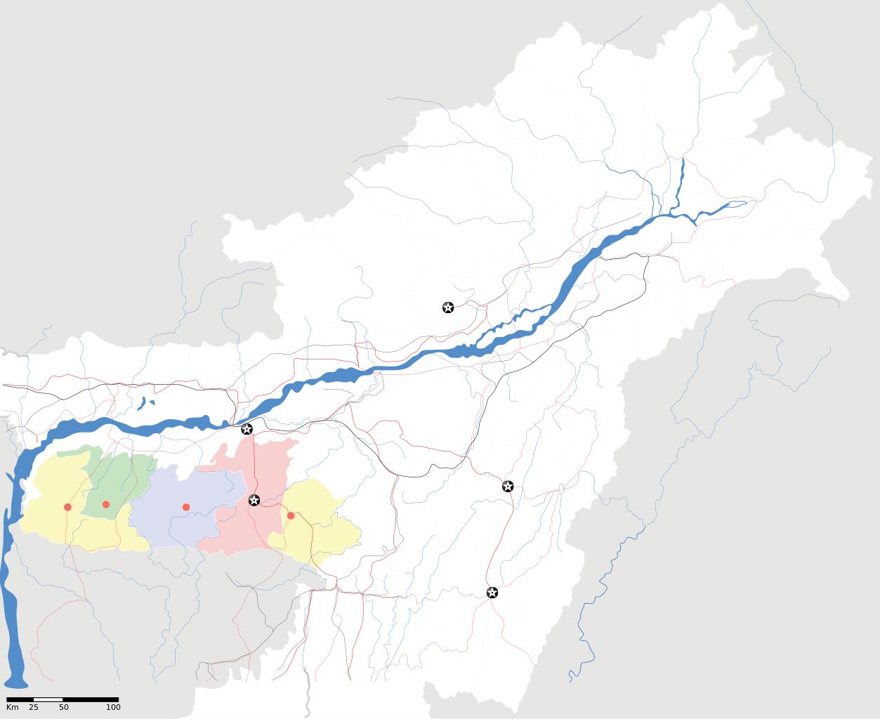
Meghalaya locator Map |
| Beschrijving |
Map of w:Meghalaya with road and rail lines. Equirectangular projection. Geographic limits of the map: top=29.49, bottom=23.74, left=89.61, right=97.52. |
| Datum | |
| Bron |
Eigen werk |
| Maker | |
| Toestemming (Hergebruik van dit bestand) |
Ik, de auteursrechthebbende van dit werk, maak het hierbij onder de volgende licentie beschikbaar: Dit bestand is gelicenseerd onder de Creative Commons-licentie Naamsvermelding-Gelijk delen 3.0 Unported
|
| Geotemporal data | |
| Weergegeven datum | tweede helft 20e eeuw en 21e eeuw |
| Georeferencing | If inappropriate please set warp_status = skip to hide. |
| Archival data | |
| Opmerkingen | Part of WikiProject India Maps |
Bestandsgeschiedenis
Klik op een datum/tijd om het bestand te zien zoals het destijds was.
| Datum/tijd | Miniatuur | Afmetingen | Gebruiker | Opmerking | |
|---|---|---|---|---|---|
| huidige versie | 16 apr 2007 20:56 | | 2.393 × 1.956 (260 kB) | Planemad | {{WikiProject_India_Maps |Title=Meghalaya locator Map |Description=Map of w:Meghalaya with road and rail lines |Source= [http://www.iitg.ernet.in/rcilts/assam_political.jpg IIT Guwahati - Assam Political map] |Date=April 2007 |Author=[[w:user:Planemad |
Bestandsgebruik
Dit bestand wordt op de volgende 2 pagina's gebruikt:
Globaal bestandsgebruik
De volgende andere wiki's gebruiken dit bestand:
- Gebruikt op ar.wikipedia.org
- Gebruikt op ast.wikipedia.org
- Gebruikt op as.wikipedia.org
- Gebruikt op ba.wikipedia.org
- Gebruikt op bn.wikipedia.org
- Gebruikt op bs.wikipedia.org
- Gebruikt op ceb.wikipedia.org
- Gebruikt op de.wikipedia.org
- Gebruikt op es.wikipedia.org
- Gebruikt op fa.wikipedia.org
- Gebruikt op gu.wikipedia.org
- Gebruikt op hif.wikipedia.org
- Gebruikt op hi.wikipedia.org
- Gebruikt op hr.wikipedia.org
- Gebruikt op id.wikipedia.org
- Gebruikt op ja.wikipedia.org
- Gebruikt op kbd.wikipedia.org
- Gebruikt op ml.wikipedia.org
- Gebruikt op ms.wikipedia.org
- Gebruikt op new.wikipedia.org
- Gebruikt op or.wikipedia.org
- Gebruikt op pam.wikipedia.org
- Gebruikt op pa.wikipedia.org
Globaal gebruik van dit bestand bekijken.