Bestand:Map of the National Roads of South Africa with labels.svg

Afmetingen van deze voorvertoning van het type PNG van dit SVG-bestand: 684 × 599 pixels Andere resoluties: 274 × 240 pixels | 548 × 480 pixels | 876 × 768 pixels | 1.168 × 1.024 pixels | 2.337 × 2.048 pixels | 809 × 709 pixels.
Oorspronkelijk bestand (SVG-bestand, nominaal 809 × 709 pixels, bestandsgrootte: 547 kB)
| Dit is een bestand van Wikimedia Commons. Onderstaande beschrijving komt van de beschrijving van het bestand daar. |
Beschrijving
| Beschrijving |
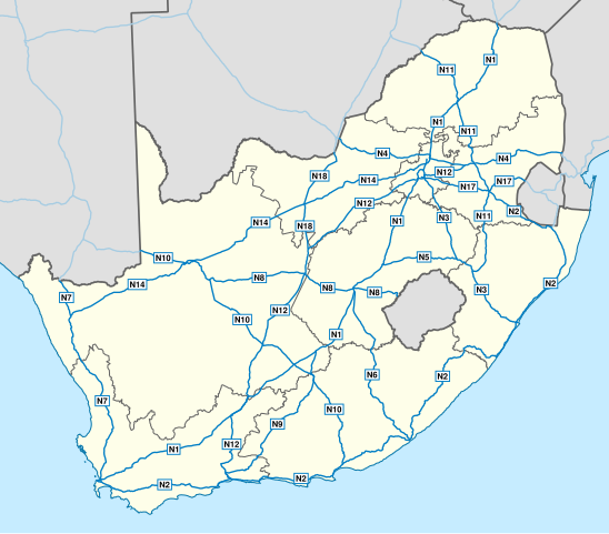
English: Map of South Africa showing the roads of the National Route System, with labels. |
| Datum | |
| Bron | Geodata from OpenStreetMap |
| Auteur | Htonl |
| Andere versies | File:Map of the National Roads of South Africa.svg, File:Map of the National Roads of South Africa with labels and cities.svg |
| SVG ontwikkeling |
Licentie
Dit bestand is gelicenseerd onder de Creative Commons-licentie Naamsvermelding-Gelijk delen 3.0 Unported
- De gebruiker mag:
- Delen – het werk kopiëren, verspreiden en doorgeven
- Remixen – afgeleide werken maken
- Onder de volgende voorwaarden:
- naamsvermelding – U moet op een gepaste manier aan naamsvermelding doen, een link naar de licentie geven, en aangeven of er wijzigingen in het werk zijn aangebracht. U mag dit op elke redelijke manier doen, maar niet zodanig dat de indruk wordt gewekt dat de licentiegever instemt met uw werk of uw gebruik van zijn werk.
- Gelijk delen – Als u het werk heeft geremixt, veranderd, of erop heeft voortgebouwd, moet u het gewijzigde materiaal verspreiden onder dezelfde licentie als het oorspronkelijke werk, of een daarmee compatibele licentie.
| Dit werk bevat informatie van OpenStreetMap, die beschikbaar wordt gesteld onder de Open Database License (ODbL).
De ODbL vereist geen specifieke licentie voor kaarten die zijn geproduceerd op basis van ODbL-gegevens. Vóór 1 augustus 2020 waren kaarttegels geproduceerd door de OpenStreetMap Foundation gelicentieerd onder de CC-BY-SA-2.0-licentie. Kaarten die door andere mensen zijn geproduceerd, kunnen onderworpen zijn aan andere licenties. |
Bestandsgeschiedenis
Klik op een datum/tijd om het bestand te zien zoals het destijds was.
| Datum/tijd | Miniatuur | Afmetingen | Gebruiker | Opmerking | |
|---|---|---|---|---|---|
| huidige versie | 1 feb 2014 20:45 | | 809 × 709 (547 kB) | Htonl | update w/ simpler labels, roads in neighbouring countries, ODbL data |
| 10 dec 2010 21:51 |  | 757 × 660 (1,08 MB) | Htonl | use appropriate projection; change basemap style | |
| 21 apr 2010 05:19 |  | 1.000 × 786 (1,5 MB) | Htonl | minor SVG tweak | |
| 21 apr 2010 05:11 |  | 1.000 × 786 (1,5 MB) | Htonl | new version based on OSM data | |
| 23 jul 2009 23:26 |  | 1.000 × 786 (2,14 MB) | Htonl | minor tweaks | |
| 23 jul 2009 22:25 |  | 1.000 × 786 (2,13 MB) | Htonl | colours, labels, widths | |
| 6 nov 2008 20:05 |  | 1.000 × 786 (2,08 MB) | Htonl | {{Information |Description={{en|1=Map of South Africa showing the roads of the National Road System, with labels.}} |Source=Own work by uploader |Author=Htonl |Date=2008-11-06 |Permission= |other_versions=[[:Image:Map of the National Roads |
Bestandsgebruik
Dit bestand wordt op de volgende pagina gebruikt:
Globaal bestandsgebruik
De volgende andere wiki's gebruiken dit bestand:
- Gebruikt op af.wikipedia.org
- Gebruikt op de.wikipedia.org
- Gebruikt op en.wikipedia.org
- Gebruikt op en.wikivoyage.org
- Gebruikt op fr.wikipedia.org
- Gebruikt op fy.wikipedia.org
- Gebruikt op it.wikipedia.org
- Gebruikt op ja.wikipedia.org
- Gebruikt op ro.wikipedia.org
- Gebruikt op uk.wikipedia.org
- Gebruikt op zu.wikipedia.org