Bestand:Map of the Krasnoyarsk Krai.png
Oorspronkelijk bestand (1.545 × 1.802 pixels, bestandsgrootte: 303 kB, MIME-type: image/png)
| Dit is een bestand van Wikimedia Commons. Onderstaande beschrijving komt van de beschrijving van het bestand daar. |
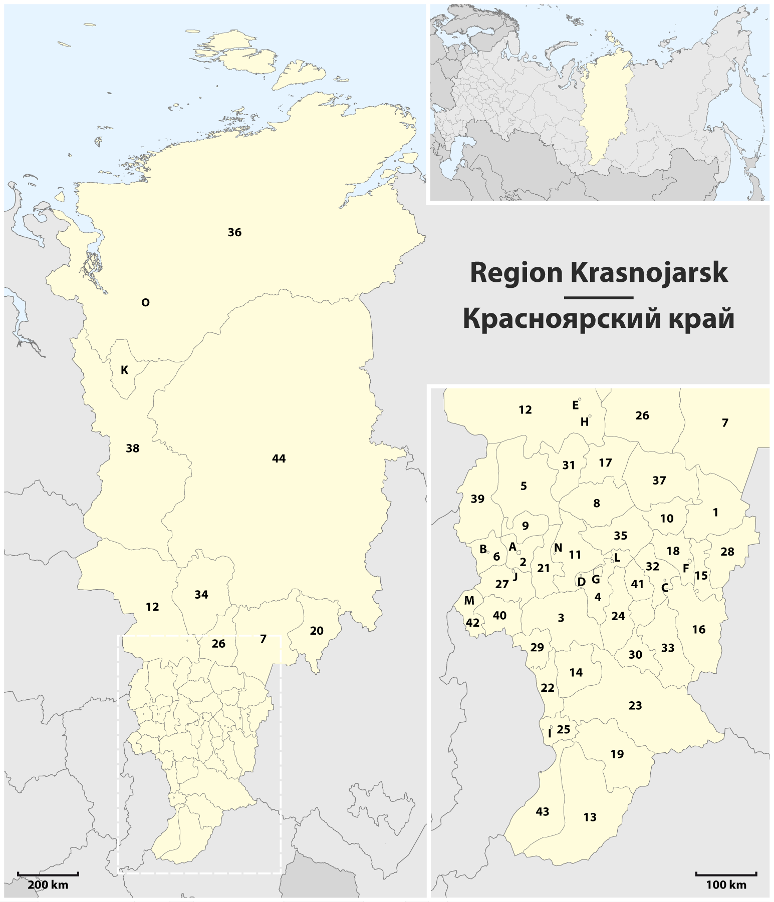
Beschrijving
| Beschrijving |
Deutsch: Karte der Region Krasnojarsk
English: Map of the Krasnoyarsk Krai
1 Aban • Абанский |
| Datum | |
| Bron | Eigen werk, using this file by Uwe Dedering for the orientation map |
| Auteur | Maximilian Dörrbecker (Chumwa) |
| Toestemming (Hergebruik van dit bestand) |
Ik, de auteursrechthebbende van dit werk, maak het hierbij onder de volgende licentie beschikbaar: Dit bestand is gelicenseerd onder de Creative Commons-licentie Naamsvermelding-Gelijk delen 2.5 Unported
|
| Andere versies |
Afgeleide werken van dit bestand: Map of the Krasnoyarsk Krai - 2.png |

.png)


Bestandsgeschiedenis
Klik op een datum/tijd om het bestand te zien zoals het destijds was.
| Datum/tijd | Miniatuur | Afmetingen | Gebruiker | Opmerking | |
|---|---|---|---|---|---|
| huidige versie | 23 dec 2014 14:40 | | 1.545 × 1.802 (303 kB) | Kaganer | Added "O" - Norilsk |
| 3 apr 2010 08:46 |  | 1.545 × 1.802 (390 kB) | Chumwa | Farbanpassung in Orientierungskarte | |
| 3 apr 2010 00:28 |  | 1.545 × 1.802 (390 kB) | Chumwa | == {{int:filedesc}} == {{Information |Description= {{de|Karte der Region Krasnojarsk}} {{en|Map of the Krasnoyarsk Krai}} |Author=Maximilian Dörrbecker (Chumwa) |Source={{Own}}, using [[:File:Russia edcp location m |
Bestandsgebruik
Dit bestand wordt op de volgende pagina gebruikt:
Globaal bestandsgebruik
De volgende andere wiki's gebruiken dit bestand:
- Gebruikt op ba.wikipedia.org
- Gebruikt op de.wikipedia.org
- Gebruikt op es.wikipedia.org
- Gebruikt op fr.wikipedia.org
- Gebruikt op sr.wikipedia.org
- Gebruikt op tt.wikipedia.org