Bestand:Map of the Far East of the USSR, Northern China (Manchuria) and Mongolia.tif

Oorspronkelijk bestand (1.404 × 1.024 pixels, bestandsgrootte: 4,11 MB, MIME-type: image/tiff)
| Dit is een bestand van Wikimedia Commons. Onderstaande beschrijving komt van de beschrijving van het bestand daar. |
Beschrijving
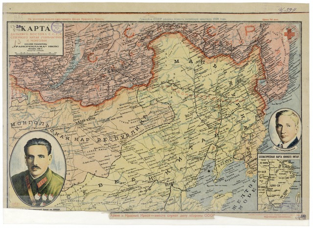
| Beschrijving | Map of the Far East of the USSR, Northern China (Manchuria) and Mongolia, 39 x 53 cm, 1:6 000 000 |
| Datum | |
| Bron |
http://www.wdl.org/zh/item/123/?ql=zho&a=-8000&b=2010&c=CN&r=EastAsia&view_type=gallery |
| Auteur | “Transreklama”NKPS, |
| Andere versies |

Licentie
|
Dit werk bevindt zich in het publiek domein in landen en gebieden waar de auteursrechttermijn het leven van de auteur plus 70 jaar of minder is.
| |
| Van dit bestand is vastgesteld dat er geen bekende auteursrechtaanspraken op rusten, alle aanverwante en naburige rechten daarbij inbegrepen. | |
Bestandsgeschiedenis
Klik op een datum/tijd om het bestand te zien zoals het destijds was.
| Datum/tijd | Miniatuur | Afmetingen | Gebruiker | Opmerking | |
|---|---|---|---|---|---|
| huidige versie | 15 feb 2011 18:57 |  | 1.404 × 1.024 (4,11 MB) | Shizhao | == {{int:filedesc}} == == {{int:filedesc}} == == {{int:filedesc}} == == {{int:filedesc}} == == {{int:filedesc}} == {{Information |Description=Map of the Far East of the USSR, Northern China (Manchuria) and Mongolia, 39 x 53 cm, 1:6 000 000 |Source=http:// |
Bestandsgebruik
Dit bestand wordt op de volgende pagina gebruikt:
Globaal bestandsgebruik
De volgende andere wiki's gebruiken dit bestand:
- Gebruikt op ba.wikipedia.org
- Gebruikt op cs.wikipedia.org
- Gebruikt op en.wikipedia.org
- Gebruikt op hu.wikipedia.org
- Gebruikt op ko.wikipedia.org
- Gebruikt op mn.wikipedia.org
- Gebruikt op ro.wikipedia.org
- Gebruikt op ru.wikipedia.org
- Gebruikt op th.wikipedia.org
- Gebruikt op uk.wikipedia.org
- Gebruikt op uz.wikipedia.org
- Gebruikt op zh.wikipedia.org