Bestand:Map of Washington highlighting Spokane County.svg

Afmetingen van deze voorvertoning van het type PNG van dit SVG-bestand: 800 × 521 pixels Andere resoluties: 320 × 208 pixels | 640 × 416 pixels | 1.024 × 666 pixels | 1.280 × 833 pixels | 2.560 × 1.666 pixels | 5.936 × 3.863 pixels.
Oorspronkelijk bestand (SVG-bestand, nominaal 5.936 × 3.863 pixels, bestandsgrootte: 215 kB)
| Dit is een bestand van Wikimedia Commons. Onderstaande beschrijving komt van de beschrijving van het bestand daar. |
Beschrijving
| Beschrijving |
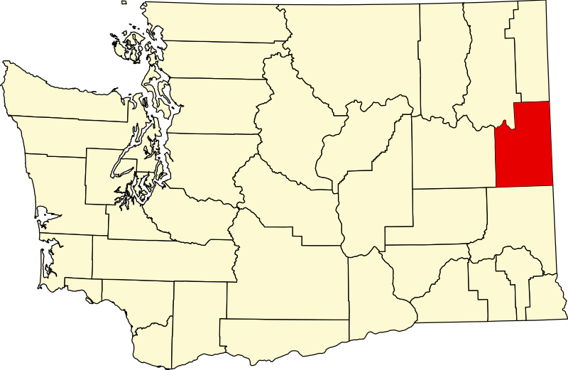
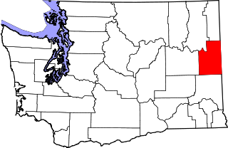
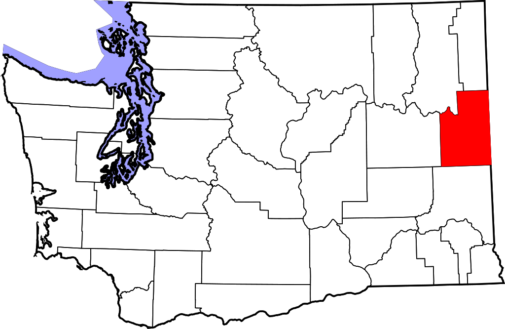
English: This is a locator map showing Spokane County in Washington. For more information, see Commons:United States county locator maps. |
| Datum | |
| Bron |
Eigen werk: English: The maps use data from nationalatlas.gov, specifically countyp020.tar.gz on the Raw Data Download page. The maps also use state outline data from statesp020.tar.gz. The Florida maps use hydrogm020.tar.gz to display Lake Okeechobee. |
| Auteur | David Benbennick |
Licentie
| Ik, de auteursrechthebbende van dit werk, geef dit werk vrij in het publieke domein. Dit is wereldwijd van toepassing. In sommige landen is dit wettelijk niet mogelijk; in die gevallen geldt: Ik sta iedereen toe dit werk voor eender welk doel te gebruiken, zonder enige voorwaarden, tenzij zulke voorwaarden door de wet worden voorgeschreven. |
Bestandsgeschiedenis
Klik op een datum/tijd om het bestand te zien zoals het destijds was.
| Datum/tijd | Miniatuur | Afmetingen | Gebruiker | Opmerking | |
|---|---|---|---|---|---|
| huidige versie | 12 feb 2006 20:06 | | 5.936 × 3.863 (215 kB) | David Benbennick | {{subst:User:Dbenbenn/clm|county=Spokane County|state=Washington|type=county}} |
Bestandsgebruik
Dit bestand wordt op de volgende pagina gebruikt:
Globaal bestandsgebruik
De volgende andere wiki's gebruiken dit bestand:
- Gebruikt op ar.wikipedia.org
- Gebruikt op bg.wikipedia.org
- Gebruikt op bpy.wikipedia.org
- Gebruikt op ca.wikipedia.org
- Spokane (Washington)
- Airway Heights
- Cheney (Washington)
- Country Homes
- Deer Park (Washington)
- Fairfield (Washington)
- Fairwood (comtat de Spokane)
- Latah (Washington)
- Liberty Lake
- Medical Lake
- Millwood (Washington)
- Otis Orchards-East Farms
- Rockford (Washington)
- Spangle
- Town and Country (Washington)
- Waverly (Washington)
- Plantilla:Comtat de Spokane
- Amber (Washington)
- Gebruikt op cdo.wikipedia.org
- Gebruikt op ceb.wikipedia.org
- Gebruikt op ce.wikipedia.org
- Gebruikt op cs.wikipedia.org
- Gebruikt op cy.wikipedia.org
- Gebruikt op de.wikipedia.org
- Gebruikt op en.wikipedia.org
Globaal gebruik van dit bestand bekijken.