Bestand:Map-DB-Nassau.svg

Afmetingen van deze voorvertoning van het type PNG van dit SVG-bestand: 684 × 599 pixels Andere resoluties: 274 × 240 pixels | 548 × 480 pixels | 877 × 768 pixels | 1.169 × 1.024 pixels | 2.337 × 2.048 pixels | 1.793 × 1.571 pixels.
Oorspronkelijk bestand (SVG-bestand, nominaal 1.793 × 1.571 pixels, bestandsgrootte: 1,67 MB)
| Dit is een bestand van Wikimedia Commons. Onderstaande beschrijving komt van de beschrijving van het bestand daar. |
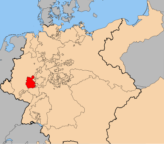
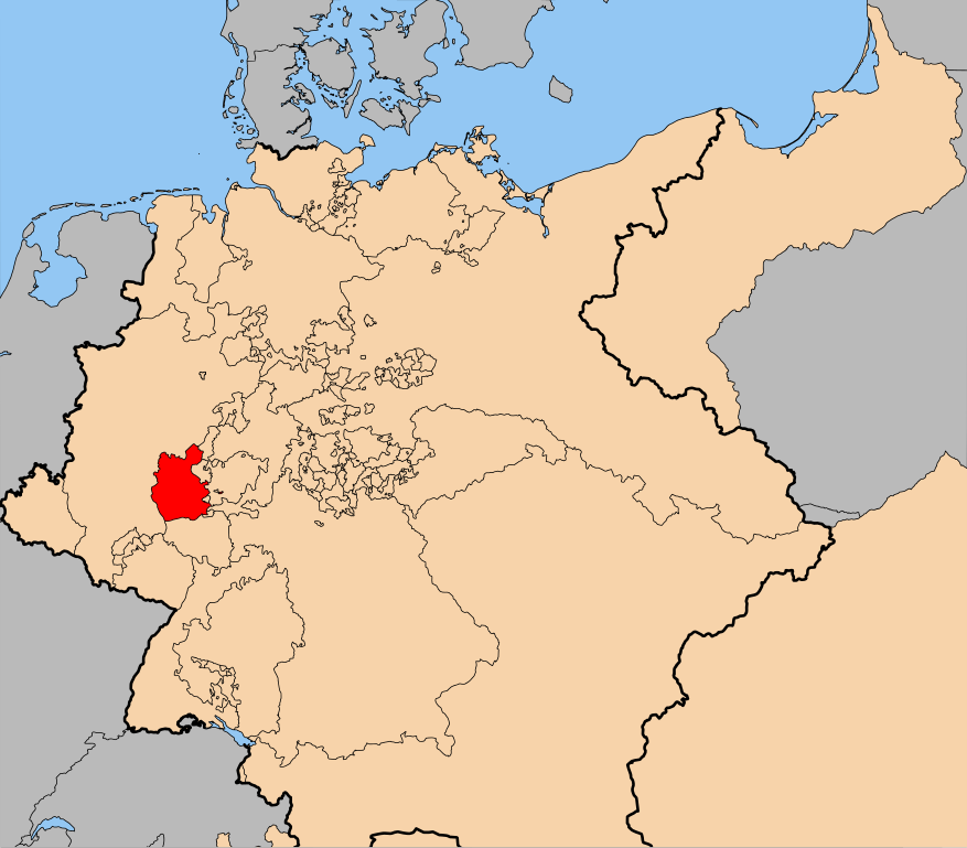
| Beschrijving | The en:Duchy of Nassau (within Germany at the time of the en:German Confederation) |
| Datum | |
| Bron | self-made, using the the map from Image:Map-DB-Hanover.svg. |
| Auteur | ZH2000 |
| Toestemming (Hergebruik van dit bestand) |
Dit bestand is gelicenseerd onder de Creative Commons-licentie Naamsvermelding-Gelijk delen 2.5 Unported
|
Bestandsgeschiedenis
Klik op een datum/tijd om het bestand te zien zoals het destijds was.
| Datum/tijd | Miniatuur | Afmetingen | Gebruiker | Opmerking | |
|---|---|---|---|---|---|
| huidige versie | 29 apr 2011 19:10 | | 1.793 × 1.571 (1,67 MB) | ZH2010 | {{Information |Description=The en:Duchy of Nassau (within Germany at the time of the en:German Confederation) |Source=self-made, using the the map from Image:Map-DB-Hanover.svg. |Date=2011-04-29 |Author= ZH2000 |Permission={{Cc-by-sa-2.5}} |
Bestandsgebruik
Dit bestand wordt op de volgende pagina gebruikt:
Globaal bestandsgebruik
De volgende andere wiki's gebruiken dit bestand:
- Gebruikt op cs.wikipedia.org
- Gebruikt op el.wikipedia.org
- Gebruikt op en.wikipedia.org
- Gebruikt op et.wikipedia.org
- Gebruikt op fr.wikipedia.org
- Gebruikt op he.wikipedia.org
- Gebruikt op hu.wikipedia.org
- Gebruikt op id.wikipedia.org
- Gebruikt op mk.wikipedia.org
- Gebruikt op oc.wikipedia.org
- Gebruikt op sv.wikipedia.org
- Gebruikt op vi.wikipedia.org
- Gebruikt op www.wikidata.org
- Gebruikt op zh.wikipedia.org