Bestand:MSH80 mailboxes along cowlitz river 1980.jpg
Grootte van deze voorvertoning: 800 × 522 pixels. Andere resoluties: 320 × 209 pixels | 640 × 418 pixels | 1.024 × 668 pixels | 1.280 × 835 pixels | 2.919 × 1.905 pixels.
Oorspronkelijk bestand (2.919 × 1.905 pixels, bestandsgrootte: 1,78 MB, MIME-type: image/jpeg)
| Dit is een bestand van Wikimedia Commons. Onderstaande beschrijving komt van de beschrijving van het bestand daar. |
Beschrijving
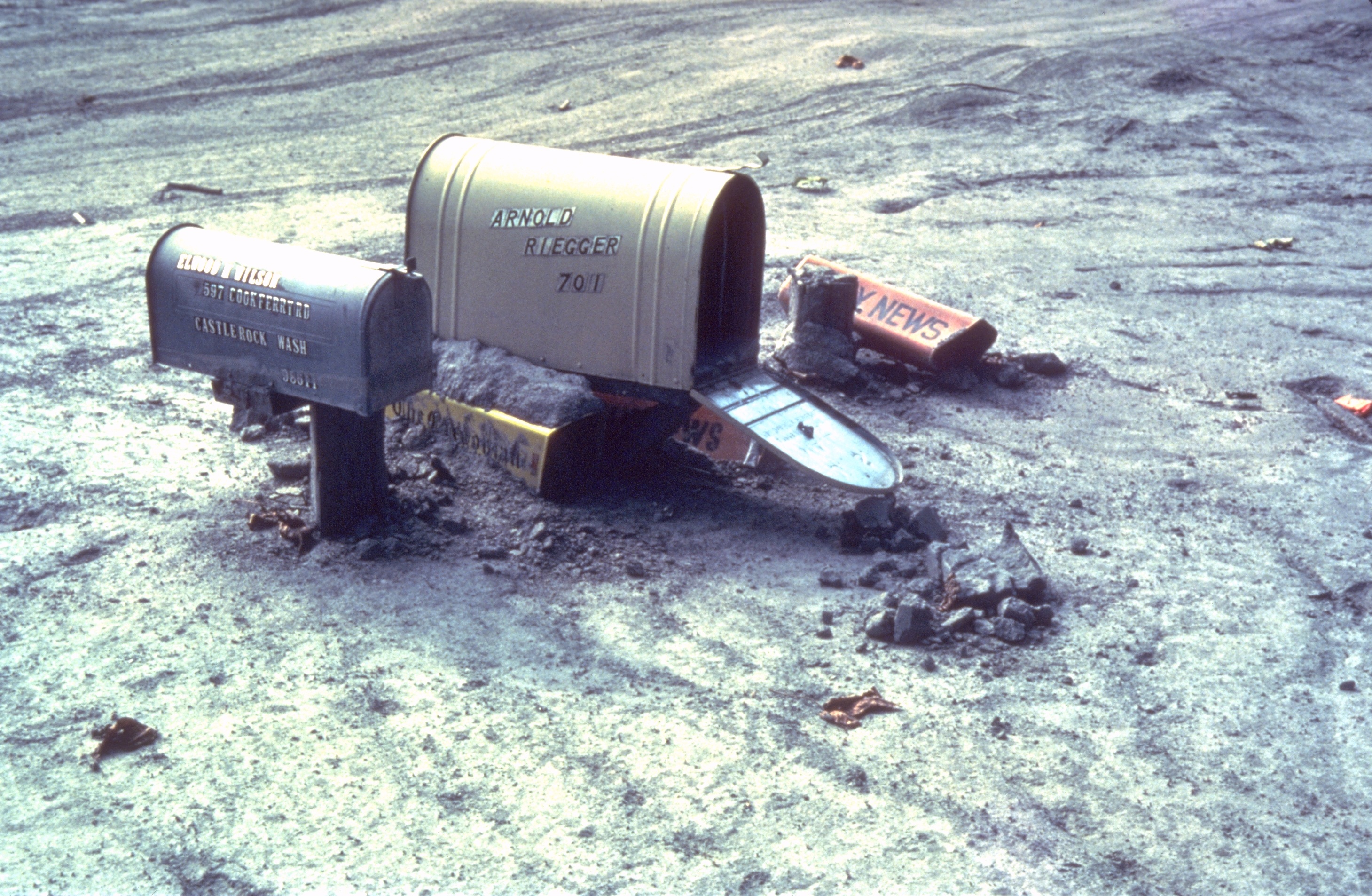
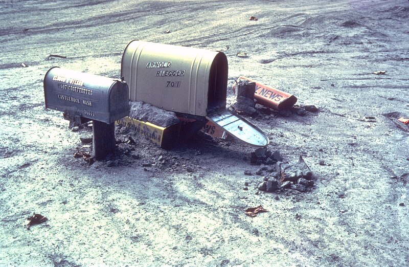
| Beschrijving | Mailboxes sticking out of a mudflow along the Cowlitz River in Castle Rock, Washington after the May 18, 1980 explosion of Mount St. Helens |
| Datum | zomer 1980 |
| Bron | Archived source link |
| Auteur | Lyn Topinka, USGS |
| Cameralocatie | | Deze en andere afbeeldingen in: OpenStreetMap |
|---|
Licentie
Deze afbeelding bevindt zich in het publiek domein omdat het materiaal bevat dat oorspronkelijk afkomstig is van de United States Geological Survey, een agentschap van de United States Department of the Interior. Voor meer informatie, zie het officiële USGS-auteursrechtenbeleid
|
Bestandsgeschiedenis
Klik op een datum/tijd om het bestand te zien zoals het destijds was.
| Datum/tijd | Miniatuur | Afmetingen | Gebruiker | Opmerking | |
|---|---|---|---|---|---|
| huidige versie | 31 mrt 2006 19:28 | | 2.919 × 1.905 (1,78 MB) | Mnh | ==English== {{Information| |Description=Mailboxes in the mudflow along the Cowlitz River created by the May 18th, 1980 eruption of the Mount St. Helens. |Source=[http://vulcan.wr.usgs.gov/Volcanoes/MSH/Images/mudflow_images.html USGS Cascades Volcano Obse |
Bestandsgebruik
Dit bestand wordt op de volgende pagina gebruikt:
Globaal bestandsgebruik
De volgende andere wiki's gebruiken dit bestand:
- Gebruikt op ar.wikipedia.org
- Gebruikt op de.wikipedia.org
- Gebruikt op en.wikipedia.org
- Gebruikt op eo.wikipedia.org
- Gebruikt op es.wikipedia.org
- Gebruikt op fr.wikipedia.org
- Gebruikt op fy.wikipedia.org
- Gebruikt op id.wikipedia.org
- Gebruikt op ig.wikipedia.org
- Gebruikt op ka.wikipedia.org
- Gebruikt op ko.wikipedia.org
- Gebruikt op la.wikipedia.org
- Gebruikt op lt.wikipedia.org
- Gebruikt op ms.wikipedia.org
- Gebruikt op nn.wikipedia.org
- Gebruikt op no.wikipedia.org
- Gebruikt op pt.wikipedia.org
- Gebruikt op simple.wikipedia.org
- Gebruikt op sv.wikipedia.org
- Gebruikt op uk.wikipedia.org
- Gebruikt op zh-yue.wikipedia.org