Bestand:MANCHURIA-U.S.S.R BOUNDARY Ct002999.jpg
Grootte van deze voorvertoning: 784 × 599 pixels. Andere resoluties: 314 × 240 pixels | 628 × 480 pixels | 1.005 × 768 pixels | 1.280 × 978 pixels | 2.560 × 1.957 pixels | 4.167 × 3.185 pixels.
Oorspronkelijk bestand (4.167 × 3.185 pixels, bestandsgrootte: 4,25 MB, MIME-type: image/jpeg)
| Dit is een bestand van Wikimedia Commons. Onderstaande beschrijving komt van de beschrijving van het bestand daar. |
Beschrijving
| Beschrijving |
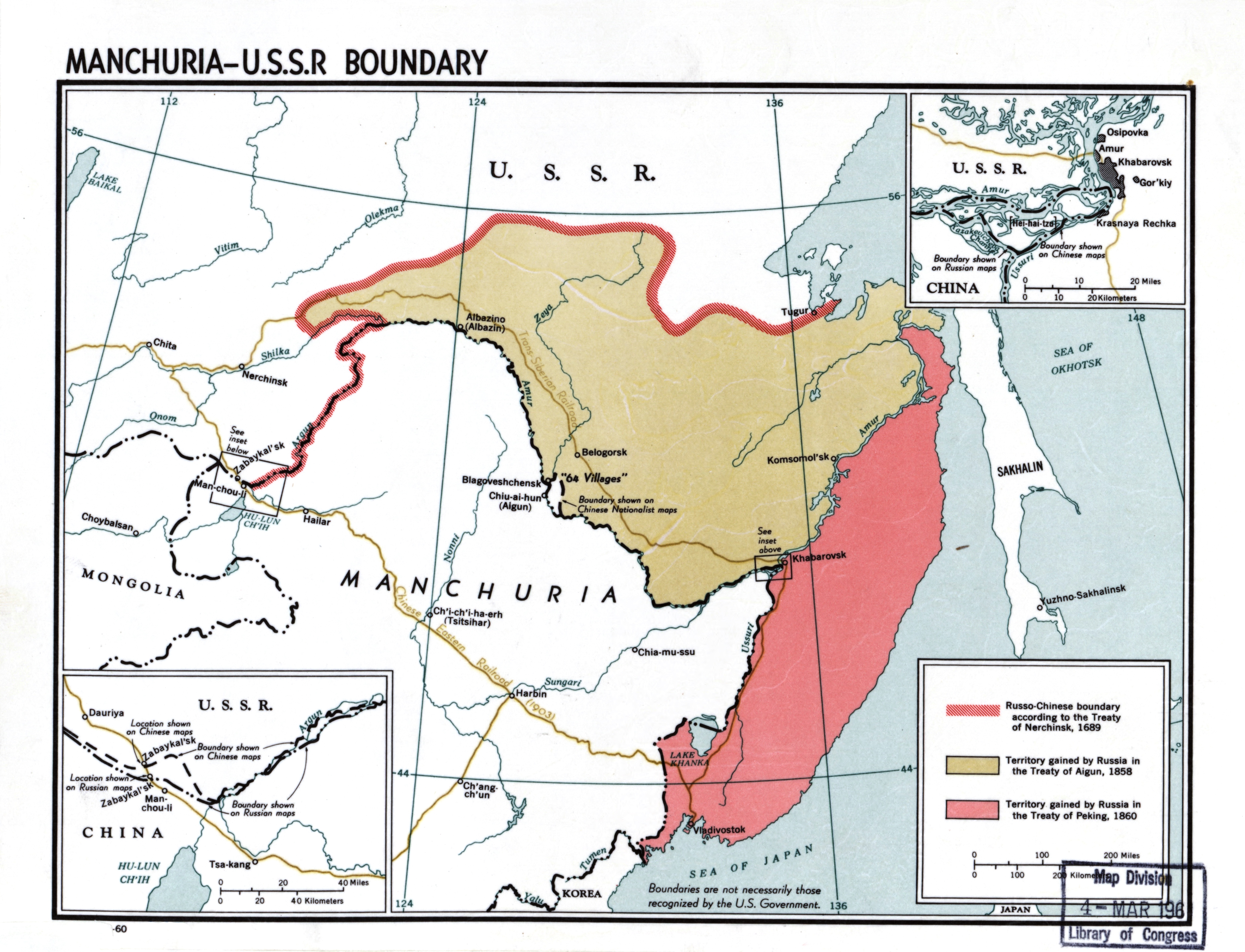
English: Manchuria-U.S.S.R. boundary |
| Datum | |
| Bron |
Library of Congress Geography and Map Division Washington, D.C. 20540-4650 USA DIGITAL ID g7822m ct002999 http://hdl.loc.gov/loc.gmd/g7822m.ct002999 |
| Auteur | CIA |
Licentie
| This image is a work of a Central Intelligence Agency employee, taken or made as part of that person's official duties. As a Work of the United States Government, this image or media is in the public domain in the United States.
|

|
Bestandsgeschiedenis
Klik op een datum/tijd om het bestand te zien zoals het destijds was.
| Datum/tijd | Miniatuur | Afmetingen | Gebruiker | Opmerking | |
|---|---|---|---|---|---|
| huidige versie | 23 nov 2020 22:50 | | 4.167 × 3.185 (4,25 MB) | Gryffindor | {{Information |Description= |Source= |Date= |Author= |Permission= |other_versions= }} |
| 22 feb 2014 16:53 |  | 4.167 × 3.185 (6,22 MB) | Viktoria Kunst | User created page with UploadWizard |
Bestandsgebruik
Dit bestand wordt op de volgende pagina gebruikt:
Globaal bestandsgebruik
De volgende andere wiki's gebruiken dit bestand:
- Gebruikt op af.wikipedia.org
- Gebruikt op ar.wikipedia.org
- Gebruikt op az.wikipedia.org
- Gebruikt op bn.wikipedia.org
- Gebruikt op ca.wikipedia.org
- Gebruikt op ckb.wikipedia.org
- Gebruikt op cs.wikipedia.org
- Gebruikt op da.wikipedia.org
- Gebruikt op de.wikipedia.org
- Gebruikt op en.wikipedia.org
- Manchuria
- History of Manchuria
- Treaty of Aigun
- Treaty of Nerchinsk
- Outer Manchuria
- Territorial evolution of Russia
- Sixty-Four Villages East of the River
- Bolshoy Ussuriysky Island
- Sino-Russian border conflicts
- Amur Annexation
- China–Russia relations
- China–Russia border
- Russia in the Opium Wars
- Timeline of the Qing dynasty
- User:Falcaorib
- Soviet deportations of Chinese people
- User:HNlander/Deportation of Chinese in the Soviet Union
- User:RedStorm1368/sandbox
- Gebruikt op en.wiktionary.org
- Gebruikt op es.wikipedia.org
- Gebruikt op fa.wikipedia.org
- Gebruikt op fi.wikipedia.org
- Gebruikt op fr.wikipedia.org
Globaal gebruik van dit bestand bekijken.