Bestand:Location of Lu'an Prefecture within Anhui (China).png
Geen hogere resolutie beschikbaar.
Location_of_Lu'an_Prefecture_within_Anhui_(China).png (800 × 600 pixels, bestandsgrootte: 83 kB, MIME-type: image/png)
| Dit is een bestand van Wikimedia Commons. Onderstaande beschrijving komt van de beschrijving van het bestand daar. |
.png)
Beschrijving
| Beschrijving |
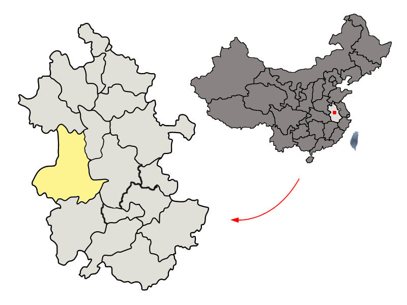
Location of Lu'an Prefecture (yellow) within Anhui Province of China Map drawn in december 2007 using various sources, mainly : |
| Datum | |
| Bron | Eigen werk |
| Auteur | Croquant |
Licentie
Ik, de auteursrechthebbende van dit werk, maak het hierbij onder de volgende licentie beschikbaar:
Dit bestand is gelicenseerd onder de Creative Commons-licentie Naamsvermelding 3.0 Unported
- De gebruiker mag:
- Delen – het werk kopiëren, verspreiden en doorgeven
- Remixen – afgeleide werken maken
- Onder de volgende voorwaarden:
- naamsvermelding – U moet op een gepaste manier aan naamsvermelding doen, een link naar de licentie geven, en aangeven of er wijzigingen in het werk zijn aangebracht. U mag dit op elke redelijke manier doen, maar niet zodanig dat de indruk wordt gewekt dat de licentiegever instemt met uw werk of uw gebruik van zijn werk.
Bestandsgeschiedenis
Klik op een datum/tijd om het bestand te zien zoals het destijds was.
| Datum/tijd | Miniatuur | Afmetingen | Gebruiker | Opmerking | |
|---|---|---|---|---|---|
| huidige versie | 6 feb 2018 01:52 | | 800 × 600 (83 kB) | NTooru | Changing administrative boundary of Huainan |
| 2 dec 2015 21:25 |  | 800 × 600 (83 kB) | ASDFGH | Zongyang County jurisdiction was transferred from Anqing to Tongling | |
| 11 feb 2012 02:19 |  | 800 × 600 (91 kB) | Mongol | ||
| 6 dec 2007 17:34 |  | 800 × 600 (77 kB) | Croquant | == Summary == {{Information |Description=Location of Lu'an Prefecture (yellow) within Anhui Province of China Map drawn in december 2007 using various sources, mainly : * [http://sedac.ciesin.org/china/admin/bnd90/t3490.html Anhui Province administrative |
Bestandsgebruik
Dit bestand wordt op de volgende pagina gebruikt:
Globaal bestandsgebruik
De volgende andere wiki's gebruiken dit bestand:
- Gebruikt op ar.wikipedia.org
- Gebruikt op cs.wikipedia.org
- Gebruikt op da.wikipedia.org
- Gebruikt op de.wikipedia.org
- Gebruikt op en.wikipedia.org
- Gebruikt op es.wikipedia.org
- Gebruikt op eu.wikipedia.org
- Gebruikt op fa.wikipedia.org
- Gebruikt op fi.wikipedia.org
- Gebruikt op fr.wikipedia.org
- Gebruikt op id.wikipedia.org
- Gebruikt op it.wikipedia.org
- Gebruikt op ja.wikipedia.org
- Gebruikt op ko.wikipedia.org
- Gebruikt op ku.wikipedia.org
- Gebruikt op nn.wikipedia.org
- Gebruikt op no.wikipedia.org
- Gebruikt op pam.wikipedia.org
- Gebruikt op pl.wikipedia.org
- Gebruikt op ru.wikipedia.org
- Gebruikt op simple.wikipedia.org
- Gebruikt op sv.wikipedia.org
- Gebruikt op ta.wikipedia.org
- Gebruikt op uk.wikipedia.org
- Gebruikt op ur.wikipedia.org
Globaal gebruik van dit bestand bekijken.
.png)
.png)