Bestand:LocationCzechoslovakia(1945-1992).png
Geen hogere resolutie beschikbaar.
LocationCzechoslovakia(1945-1992).png (250 × 115 pixels, bestandsgrootte: 4 kB, MIME-type: image/png)
| Dit is een bestand van Wikimedia Commons. Onderstaande beschrijving komt van de beschrijving van het bestand daar. |

|
Bestand:Czechoslovakia 1956–1990.svg is een vectorversie van dit bestand. Indien niet van slechtere kwaliteit dient deze gebruikt te worden in plaats van deze rasterafbeelding.
File:LocationCzechoslovakia(1945-1992).png → File:Czechoslovakia 1956–1990.svg
Zie Help:SVG voor meer informatie. |
 |
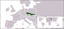
| Beschrijving | Location map of Czechoslovakia (1945-1992) | ||||||||
| Datum | |||||||||
| Bron | Based on Image:LocationCzechoslovakia.png | ||||||||
| Auteur | Domino theory | ||||||||
| Toestemming (Hergebruik van dit bestand) |
|
||||||||
| Andere versies | Image:LocationCzechoslovakia(1919-1938).png |

.png)
.png)
Bestandsgeschiedenis
Klik op een datum/tijd om het bestand te zien zoals het destijds was.
| Datum/tijd | Miniatuur | Afmetingen | Gebruiker | Opmerking | |
|---|---|---|---|---|---|
| huidige versie | 30 nov 2006 11:38 | | 250 × 115 (4 kB) | Domino theory | |
| 30 nov 2006 11:26 |  | 250 × 115 (4 kB) | Domino theory | {{Information |Description=Location map of Czechoslovakia (1945-1992) |Source=Based on Image:LocationCzechoslovakia.png |Date=November 30, 2006 |Author=Domino theory |Permission={{GFDL}} |other_versions=[[:Image:LocationCzechoslovakia(1919-1938). |
Bestandsgebruik
Dit bestand wordt op de volgende pagina gebruikt:
Globaal bestandsgebruik
De volgende andere wiki's gebruiken dit bestand:
- Gebruikt op be-tarask.wikipedia.org
- Gebruikt op ca.wikipedia.org
- Gebruikt op fi.wikipedia.org
- Gebruikt op hu.wikipedia.org
- Gebruikt op no.wikipedia.org
- Gebruikt op ro.wikipedia.org
- Gebruikt op uk.wikipedia.org
.png)