Bestand:Lewis and Clark Columbia River.jpg

Oorspronkelijk bestand (1.584 × 1.457 pixels, bestandsgrootte: 1,18 MB, MIME-type: image/jpeg)
| Dit is een bestand van Wikimedia Commons. Onderstaande beschrijving komt van de beschrijving van het bestand daar. |
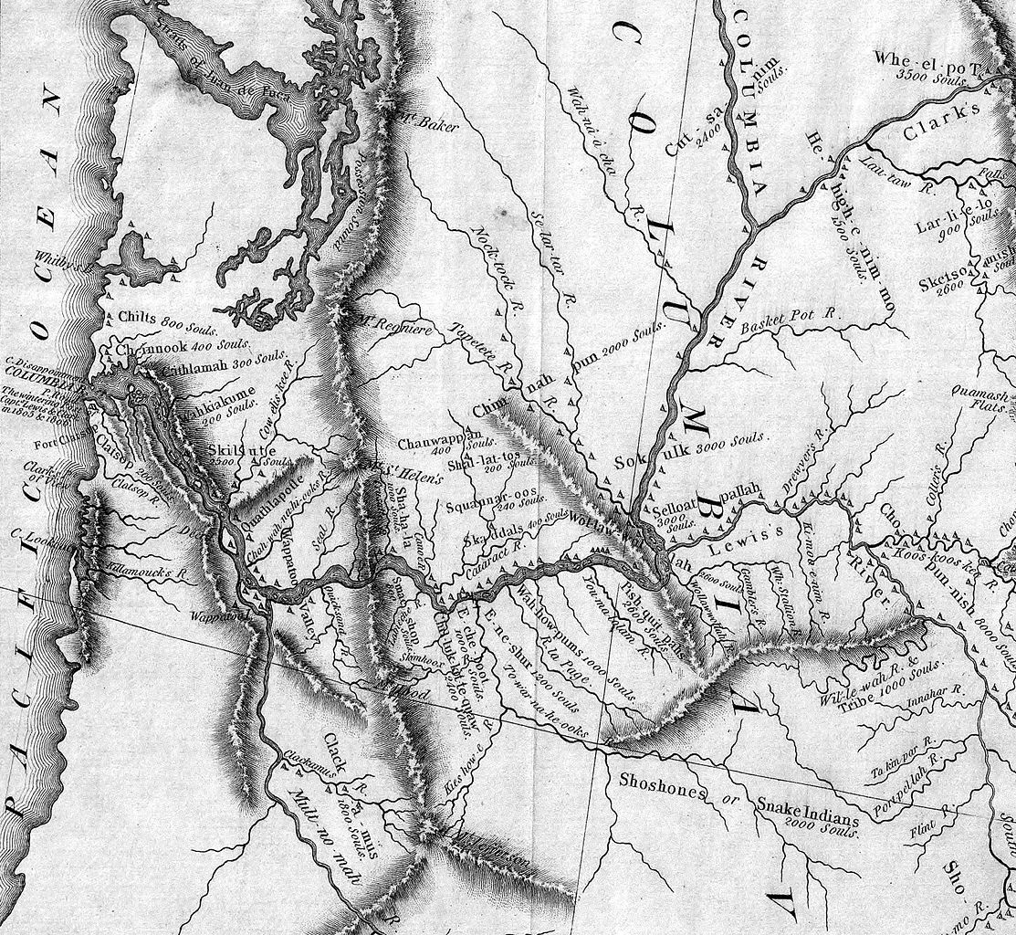
| Beschrijving | Detail of the Lewis & Clark expedition map showing the Columbia River. The Willamette River is identified as the "Multnomah River." The Snake River is "Lewis's River." |
| Datum | (UTC) |
| Bron | |
| Auteur |
|
|
Dit werk bevindt zich in het publiek domein in landen en gebieden waar de auteursrechttermijn het leven van de auteur plus 70 jaar of minder is.
| |
| Van dit bestand is vastgesteld dat er geen bekende auteursrechtaanspraken op rusten, alle aanverwante en naburige rechten daarbij inbegrepen. | |
Oorspronkelijk uploadlogboek
This image is a derivative work of the following images:
- Image:Map_of_Lewis_and_Clark's_Track,_Across_the_Western_Portion_of_North_America,_published_1814.jpg licensed with PD-old
- 2006-01-06T20:10:08Z Brian0918 7000x3043 (10674416 Bytes) Author: Lewis, Meriwether ; Clark, William ; Biddle, Nicholas ; Allen, Paul Date: 1814 Short Title: Map of Lewis and Clark's Track, Across the Western Portion of North America. Publisher: Philadelphia: Bradford and Insk
Uploaded with derivativeFX
Bestandsgeschiedenis
Klik op een datum/tijd om het bestand te zien zoals het destijds was.
| Datum/tijd | Miniatuur | Afmetingen | Gebruiker | Opmerking | |
|---|---|---|---|---|---|
| huidige versie | 31 mei 2008 23:48 | | 1.584 × 1.457 (1,18 MB) | Northwest-historian | {{Information |Description=Detail of the Lewis & Clark expedition map showing the Columbia River. The Willamette River is identified as the "Multnomah River." The Snake River is "Lewis's River." |Source=*[[:Image:Map_of_Lewis_and_Clark's_Track,_Across_the |
Bestandsgebruik
Dit bestand wordt op de volgende pagina gebruikt:
Globaal bestandsgebruik
De volgende andere wiki's gebruiken dit bestand:
- Gebruikt op ast.wikipedia.org
- Gebruikt op bg.wikipedia.org
- Gebruikt op de.wikipedia.org
- Gebruikt op en.wikipedia.org
- Gebruikt op es.wikipedia.org
- Gebruikt op fr.wikipedia.org
- Gebruikt op it.wikipedia.org
- Gebruikt op ja.wikipedia.org
- Gebruikt op ru.wikipedia.org
- Gebruikt op vi.wikipedia.org