Bestand:Jász-Nagykun-Szolnok county map (1891).jpg

Grootte van deze voorvertoning: 467 × 599 pixels. Andere resoluties: 187 × 240 pixels | 374 × 480 pixels | 599 × 768 pixels | 798 × 1.024 pixels | 1.641 × 2.105 pixels.
Oorspronkelijk bestand (1.641 × 2.105 pixels, bestandsgrootte: 732 kB, MIME-type: image/jpeg)
| Dit is een bestand van Wikimedia Commons. Onderstaande beschrijving komt van de beschrijving van het bestand daar. |
.jpg)
Beschrijving
| Beschrijving |
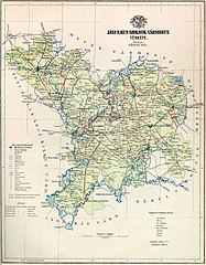
Magyar: Map of Jász-Nagykun-Szolnok county in the Kingdom of Hungary |
| Datum | |
| Bron | http://www.vasutallomasok.hu/terk/varm/jasznagykun.jpg |
| Auteur | Pál Gönczy (1817–1892) |
Licentie
|
Dit werk bevindt zich in het publiek domein in landen en gebieden waar de auteursrechttermijn het leven van de auteur plus 100 jaar of minder is. Dit werk bevindt zich in het publiek domein in de Verenigde Staten omdat het gepubliceerd werd (of geregistreerd bij de U.S. Copyright Office) voor 1 januari 1929. | |
| Van dit bestand is vastgesteld dat er geen bekende auteursrechtaanspraken op rusten, alle aanverwante en naburige rechten daarbij inbegrepen. | |
Bestandsgeschiedenis
Klik op een datum/tijd om het bestand te zien zoals het destijds was.
| Datum/tijd | Miniatuur | Afmetingen | Gebruiker | Opmerking | |
|---|---|---|---|---|---|
| huidige versie | 3 mrt 2019 16:09 | | 1.641 × 2.105 (732 kB) | Regasterios | clearer |
| 8 jun 2006 13:52 |  | 1.650 × 2.117 (447 kB) | Peppe83~commonswiki | Map of Jász-Nagykun-Szolnok county in the Kingdom of Hungary (1891). Category:Counties in the Kingdom of Hungary |
Bestandsgebruik
Dit bestand wordt op de volgende pagina gebruikt:
Globaal bestandsgebruik
De volgende andere wiki's gebruiken dit bestand:
- Gebruikt op cs.wikipedia.org
- Gebruikt op de.wikipedia.org
- Gebruikt op eo.wikipedia.org
- Gebruikt op hu.wikipedia.org
- Gebruikt op it.wikipedia.org
- Gebruikt op ro.wikipedia.org
.jpg)