Bestand:Himalayan Tectonic Summary.png
Grootte van deze voorvertoning: 800 × 519 pixels. Andere resoluties: 320 × 207 pixels | 640 × 415 pixels | 1.024 × 664 pixels | 1.280 × 830 pixels | 2.658 × 1.723 pixels.
Oorspronkelijk bestand (2.658 × 1.723 pixels, bestandsgrootte: 729 kB, MIME-type: image/png)
| Dit is een bestand van Wikimedia Commons. Onderstaande beschrijving komt van de beschrijving van het bestand daar. |
Beschrijving
| Beschrijving |
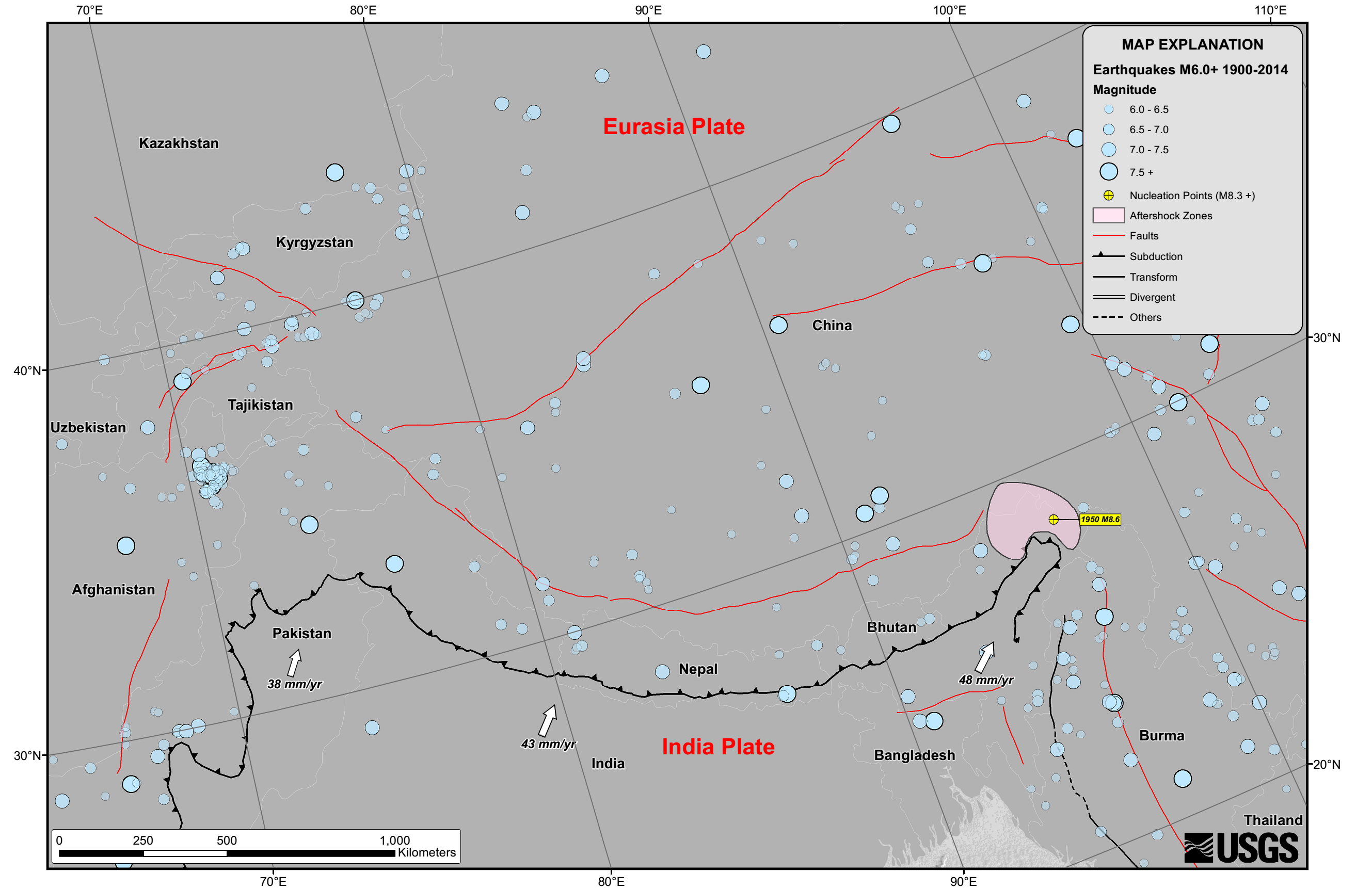
English: Seismicity in the Himalaya dominantly results from the continental collision of the India and Eurasia plates, which are converging at a relative rate of 40-50 mm/yr. Northward underthrusting of India beneath Eurasia generates numerous earthquakes and consequently makes this area one of the most seismically hazardous regions on Earth. The surface expression of the plate boundary is marked by the foothills of the north-south trending Sulaiman Range in the west, the Indo-Burmese Arc in the east and the east-west trending Himalaya Front in the north of India. |
| Datum | |
| Bron | https://earthquake.usgs.gov/earthquakes/tectonic/images/himalaya_tsum.pdf |
| Auteur | United States Geological Survey |
Licentie
Deze afbeelding bevindt zich in het publiek domein omdat het materiaal bevat dat oorspronkelijk afkomstig is van de United States Geological Survey, een agentschap van de United States Department of the Interior. Voor meer informatie, zie het officiële USGS-auteursrechtenbeleid
|
Bestandsgeschiedenis
Klik op een datum/tijd om het bestand te zien zoals het destijds was.
| Datum/tijd | Miniatuur | Afmetingen | Gebruiker | Opmerking | |
|---|---|---|---|---|---|
| huidige versie | 26 apr 2015 12:53 | | 2.658 × 1.723 (729 kB) | Tatiraju.rishabh | User created page with UploadWizard |
Bestandsgebruik
Dit bestand wordt op de volgende pagina gebruikt:
Globaal bestandsgebruik
De volgende andere wiki's gebruiken dit bestand:
- Gebruikt op af.wikipedia.org
- Gebruikt op ar.wikipedia.org
- Gebruikt op awa.wikipedia.org
- Gebruikt op be.wikipedia.org
- Gebruikt op en.wikipedia.org
- Gebruikt op es.wikipedia.org
- Gebruikt op hi.wikipedia.org
- Gebruikt op pnb.wikipedia.org
- Gebruikt op ru.wikipedia.org
- Gebruikt op sl.wikipedia.org
- Gebruikt op ta.wikipedia.org
- Gebruikt op tg.wikipedia.org
- Gebruikt op ur.wikipedia.org
- Gebruikt op zh.wikipedia.org