Bestand:Groningen en Ommelanden - Republic of the 7 United Netherlands map.jpg

Oorspronkelijk bestand (1.992 × 2.048 pixels, bestandsgrootte: 971 kB, MIME-type: image/jpeg)
| Dit is een bestand van Wikimedia Commons. Onderstaande beschrijving komt van de beschrijving van het bestand daar. |
Beschrijving
| Beschrijving |
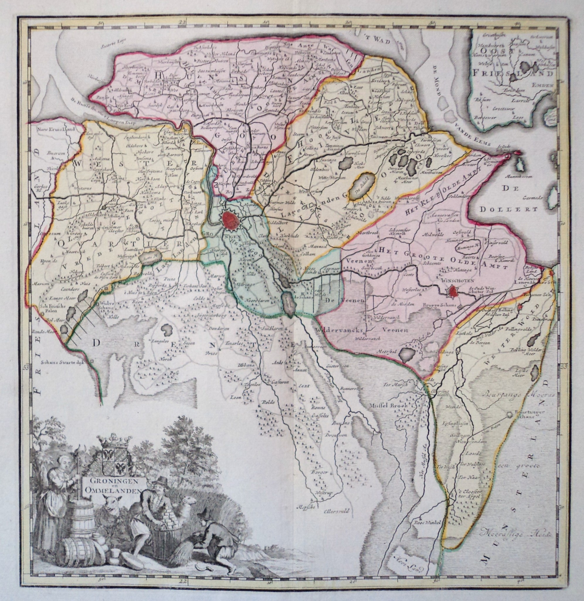
English: A map of Groningen and its surrounding countries during the Republican period. |
| Datum | Before the 19th (nineteenth) century. |
| Bron |
|
| Auteur | Scan by the Cartographic Antiquarian Edward Wells. |
Licentie
|
Dit werk bevindt zich in het publiek domein in landen en gebieden waar de auteursrechttermijn het leven van de auteur plus 70 jaar of minder is.
| |
| Van dit bestand is vastgesteld dat er geen bekende auteursrechtaanspraken op rusten, alle aanverwante en naburige rechten daarbij inbegrepen. | |
Bestandsgeschiedenis
Klik op een datum/tijd om het bestand te zien zoals het destijds was.
| Datum/tijd | Miniatuur | Afmetingen | Gebruiker | Opmerking | |
|---|---|---|---|---|---|
| huidige versie | 28 mei 2020 08:03 | | 1.992 × 2.048 (971 kB) | Donald Trung | Uploaded a work by Scan by the Cartographic Antiquarian Edward Wells. from * [http://www.edward-wells.nl/catalogus/index.php?productID=3669 Cartographic Antiquarian Edward Wells specialises in the purchase and sale of antique maps, city maps, atlases, topographical books and charts. We focus exclusively on authentic material, created and published during the period encompassing the 15th to the 19th century.] ([https://www.ecosia.org/images?q=Groningen+en+Ommelanden+stuivers#id=7AE2A9893A2A59... |
Bestandsgebruik
Dit bestand wordt op de volgende pagina gebruikt: