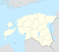
Bestand:Estonia adm location map.svg

Afmetingen van deze voorvertoning van het type PNG van dit SVG-bestand: 673 × 599 pixels Andere resoluties: 269 × 240 pixels | 539 × 480 pixels | 862 × 768 pixels | 1.150 × 1.024 pixels | 2.299 × 2.048 pixels | 1.666 × 1.484 pixels.
Oorspronkelijk bestand (SVG-bestand, nominaal 1.666 × 1.484 pixels, bestandsgrootte: 349 kB)
Bestandsgeschiedenis
Klik op een datum/tijd om het bestand te zien zoals het destijds was.
| Datum/tijd | Miniatuur | Afmetingen | Gebruiker | Opmerking | |
|---|---|---|---|---|---|
| huidige versie | 26 mrt 2022 20:27 |  | 1.666 × 1.484 (349 kB) | NordNordWest | upd |
| 8 nov 2017 19:17 |  | 1.666 × 1.391 (346 kB) | NordNordWest | corr | |
| 5 nov 2017 16:05 |  | 1.666 × 1.391 (346 kB) | NordNordWest | upd | |
| 24 sep 2014 19:19 |  | 1.666 × 1.391 (348 kB) | NordNordWest | == {{int:filedesc}} == {{Information |Description= {{de|1=Positionskarte von Estland}} {{en|1=Location map of Estonia}} {{Location map series N |stretching=180 |top=60.4 |bottom=57.2 |left=21.5 |right=28.4 }} |Source={{Own using}} * United States Natio... |
Bestandsgebruik
Meer dan 100 pagina's gebruiken dit bestand. De volgende lijst geeft alleen de eerste 100 pagina's weer die dit bestand gebruiken. Er is ook een volledige lijst beschikbaar.
- Aa (Estland)
- Aadma
- Aavere (Anija)
- Abruka (plaats)
- Adraku
- Aegviidu
- Alaküla (Lääneranna)
- Alekere
- Allika (Kuusalu)
- Allika (Saue)
- Allikmaa
- Alliku (Alutaguse)
- Altküla (Toila)
- Ammuta (Haapsalu)
- Amula
- Anseküla
- Audru (plaats)
- Avanduse (plaats)
- Elva (stad in Estland)
- Emmaste (plaats)
- Europees kampioenschap voetbal mannen onder 19 - 2012
- Haapsalu
- Järvakandi
- Jõgeva (stad)
- Jõhvi (stad)
- Kaali
- Kaarma
- Kabala (Türi)
- Kaisma
- Kallaste
- Keila (Estland)
- Kilingi-Nõmme
- Kiratsi
- Kiviõli
- Kohtla-Nõmme
- Kunda (stad in Estland)
- Kuressaare
- Käina (plaats)
- Kärdla
- Kärla
- Kõmsi
- Lavassaare
- Lehtse
- Leisi (vlek)
- Lindsi
- Loksa (stad)
- Luchthaven Kuressaare
- Luchthaven Kärdla
- Luchthaven Tallinn Lennart Meri
- Luchthaven Tartu
- Lutepää
- Lümanda
- Maardu (stad)
- Matsalu
- Mõisaküla (Viljandimaa)
- Narva-Jõesuu (stad)
- Narva (Estland)
- Nenu
- Oisu
- Olustvere
- Paide
- Paikuse (plaats)
- Paistu (plaats)
- Paldiski
- Peetri (Harjumaa)
- Piirissaar
- Pärnu
- Pärsti (plaats)
- Põltsamaa (stad)
- Põlva
- Pühalepa (plaats)
- Püssi
- Rakvere
- Saadjärv
- Saarepeedi (plaats)
- Saksi (Estland)
- Salme (plaats)
- Saue
- Sillamäe
- Sindi (Estland)
- Suure-Jaani (plaats)
- Tali (Estland)
- Tallinn
- Tamsalu (Tapa)
- Tapa (stad)
- Tartu
- Televisietoren van Tallinn
- Tootsi (Põhja-Pärnumaa)
- Tõstamaa (plaats)
- Upa
- Vaivara (concentratiekamp)
- Valga (stad in Estland)
- Vastemõisa
- Vatla
- Viiratsi (plaats)
- Viljandi
- Virtsu (Lääneranna)
- Vändra (Põhja-Pärnumaa)
- Võhma (stad)
- Võru
Meer koppelingen naar dit bestand bekijken.
Globaal bestandsgebruik
De volgende andere wiki's gebruiken dit bestand:
- Gebruikt op als.wikipedia.org
- Gebruikt op an.wikipedia.org
- Gebruikt op ar.wikipedia.org
- Gebruikt op ast.wikipedia.org
- Gebruikt op azb.wikipedia.org
- Gebruikt op az.wikipedia.org
Globaal gebruik van dit bestand bekijken.


