Bestand:CIA-TimorLeste.jpg

Grootte van deze voorvertoning: 643 × 600 pixels. Andere resoluties: 257 × 240 pixels | 515 × 480 pixels | 824 × 768 pixels | 1.054 × 983 pixels.
Oorspronkelijk bestand (1.054 × 983 pixels, bestandsgrootte: 209 kB, MIME-type: image/jpeg)
| Dit is een bestand van Wikimedia Commons. Onderstaande beschrijving komt van de beschrijving van het bestand daar. |
Beschrijving
| Beschrijving |
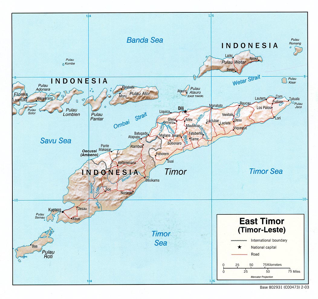
English: Map of East Timor (Timor-Leste). |
| Datum | |
| Bron | East Timor (Shaded Relief) U.S. Central Intelligence Agency 2003 from Perry-Castañeda Library Map Collection: East Timor (Timor-Leste) Maps |
| Auteur | U.S. Central Intelligence Agency |
| Toestemming (Hergebruik van dit bestand) |
Public domain |
Licentie
| This image is a work of a Central Intelligence Agency employee, taken or made as part of that person's official duties. As a Work of the United States Government, this image or media is in the public domain in the United States.
|

|
Bestandsgeschiedenis
Klik op een datum/tijd om het bestand te zien zoals het destijds was.
| Datum/tijd | Miniatuur | Afmetingen | Gebruiker | Opmerking | |
|---|---|---|---|---|---|
| huidige versie | 19 mrt 2020 00:36 | | 1.054 × 983 (209 kB) | Hohum | Cleanup |
| 25 apr 2005 09:39 |  | 1.054 × 983 (224 kB) | PMA~commonswiki | ||
| 22 jan 2005 11:11 |  | 1.052 × 989 (231 kB) | Hoshie | CIA map of Timor-Leste. {{PD-PCL|http://www.lib.utexas.edu/maps/middle_east_and_asia/east_timor_rel_03.jpg}} |
Bestandsgebruik
Dit bestand wordt op de volgende 2 pagina's gebruikt:
Globaal bestandsgebruik
De volgende andere wiki's gebruiken dit bestand:
- Gebruikt op be-tarask.wikipedia.org
- Gebruikt op bn.wikipedia.org
- Gebruikt op ca.wikipedia.org
- Gebruikt op ckb.wikipedia.org
- Gebruikt op de.wikinews.org
- Gebruikt op en.wikipedia.org
- Gebruikt op es.wikipedia.org
- Gebruikt op fa.wikipedia.org
- Gebruikt op fi.wikipedia.org
- Gebruikt op he.wikipedia.org
- Gebruikt op id.wikipedia.org
- Gebruikt op it.wikipedia.org
- Gebruikt op ja.wikinews.org
- Gebruikt op ku.wikipedia.org
- Gebruikt op lb.wikipedia.org
- Gebruikt op lt.wikipedia.org
- Gebruikt op mzn.wikipedia.org
- Gebruikt op pl.wikipedia.org
- Gebruikt op pt.wikipedia.org
- Gebruikt op sk.wikipedia.org
- Gebruikt op www.wikidata.org
- Gebruikt op zh.wikipedia.org