Bestand:Карта Вятской Губернии (1822).jpg

Grootte van deze voorvertoning: 609 × 599 pixels. Andere resoluties: 244 × 240 pixels | 488 × 480 pixels | 780 × 768 pixels | 1.040 × 1.024 pixels | 2.081 × 2.048 pixels | 4.834 × 4.758 pixels.
Oorspronkelijk bestand (4.834 × 4.758 pixels, bestandsgrootte: 7,44 MB, MIME-type: image/jpeg)
| Dit is een bestand van Wikimedia Commons. Onderstaande beschrijving komt van de beschrijving van het bestand daar. |
.jpg)
Beschrijving
| Beschrijving |
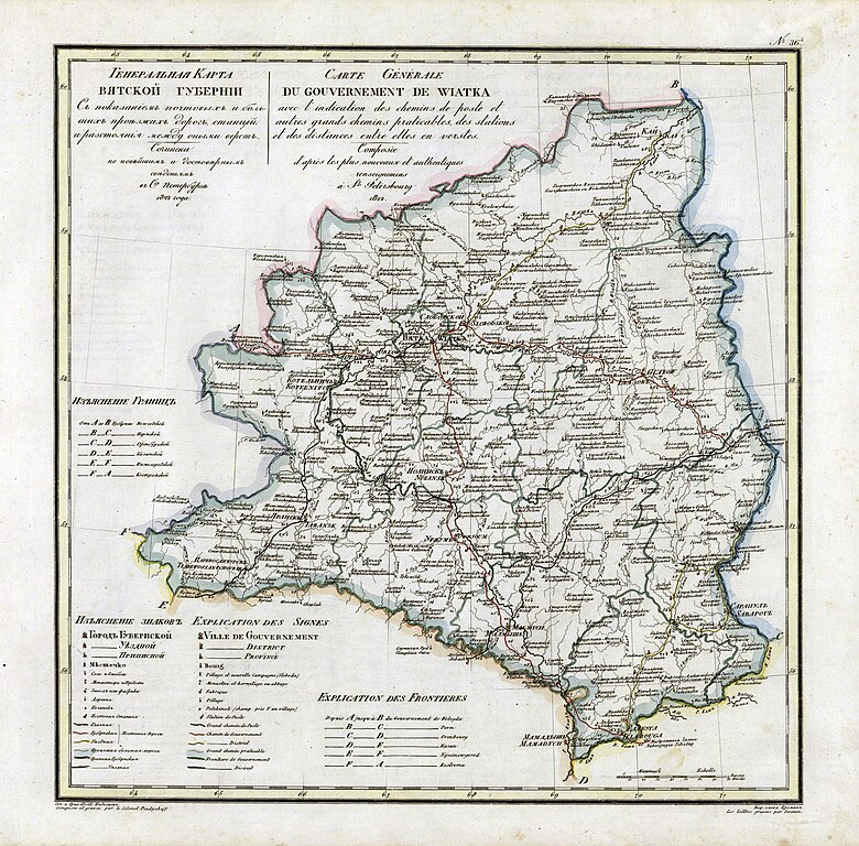
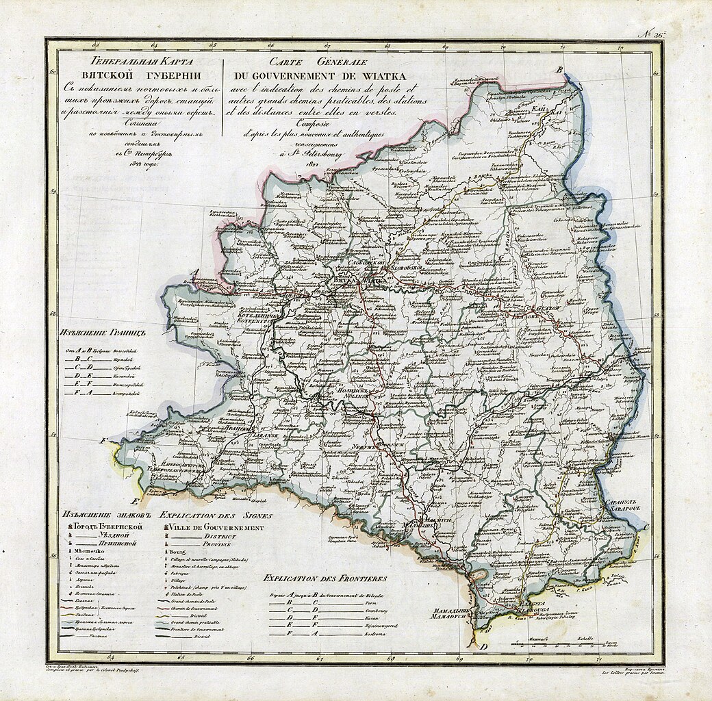
Русский: Карта Вятской Губернии из атласа 1821 года
English: Vyatka Governorate map from geographic atlas of the Russian Empire (1821) |
| Datum | |
| Bron |
Geographic atlas of the Russian Empire is located in governorates in Russian and French (1821) |
| Auteur | Пядышев |
Licentie
|
Dit werk bevindt zich in het publiek domein in landen en gebieden waar de auteursrechttermijn het leven van de auteur plus 100 jaar of minder is. | |
| Van dit bestand is vastgesteld dat er geen bekende auteursrechtaanspraken op rusten, alle aanverwante en naburige rechten daarbij inbegrepen. | |
Oorspronkelijk uploadlogboek
De oorspronkelijke beschrijving van deze afbeelding stond hier. Alle volgende gebruikersnamen verwijzen naar ru.wikipedia.
- 2008-04-04 12:53 AGOT 4834×4758× (7801071 bytes) {{Изображение | Описание = Карта Вятской Губернии | Автор = Пядышев | Время создания = 1821 | Источник = Атлас Российской империи }}
Bestandsgeschiedenis
Klik op een datum/tijd om het bestand te zien zoals het destijds was.
| Datum/tijd | Miniatuur | Afmetingen | Gebruiker | Opmerking | |
|---|---|---|---|---|---|
| huidige versie | 26 okt 2009 15:43 | | 4.834 × 4.758 (7,44 MB) | Transcend (rus) | {{Information |Description={{ru|Карта Вятской Губернии из атласа 1821 года}} {{en|Vyatka Governorate map from geographic atlas of the Russian Empire (1821)}} |Source=Geographic atlas of the Russian Empire is located in gove |
Bestandsgebruik
Dit bestand wordt op de volgende pagina gebruikt:
Globaal bestandsgebruik
De volgende andere wiki's gebruiken dit bestand:
- Gebruikt op azb.wikipedia.org
- Gebruikt op ba.wikipedia.org
- Gebruikt op be.wikipedia.org
- Gebruikt op ca.wikipedia.org
- Gebruikt op cs.wikipedia.org
- Gebruikt op de.wikipedia.org
- Gebruikt op fi.wikipedia.org
- Gebruikt op fr.wikipedia.org
- Gebruikt op it.wikipedia.org
- Gebruikt op ko.wikipedia.org
- Gebruikt op pl.wikipedia.org
- Gebruikt op ru.wikipedia.org
- Gebruikt op sv.wikipedia.org
- Gebruikt op tr.wikipedia.org
- Gebruikt op tt.wikipedia.org
- Gebruikt op uk.wikipedia.org
- Gebruikt op www.wikidata.org
.jpg)