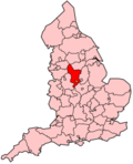
Erewash
Erewash is een Engels district in het shire-graafschap (non-metropolitan county OF county) Derbyshire en telt 115.000 inwoners. De oppervlakte bedraagt 110 km².
| Niet-metropolitaans district in Engeland | |||
|---|---|---|---|

| |||
| Situering | |||
| Land | Engeland | ||
| County | Derbyshire | ||
| Regio | East Midlands | ||
| Coördinaten | 52°55'0"NB, 1°19'0"WL | ||
| Algemeen | |||
| Oppervlakte | 109,6301[1] km² | ||
| Inwoners (2018[2]) |
115490 (1053 inw./km²) | ||
| Hoofdplaats ONS-code |
Ilkeston E07000036 | ||
| Detailkaart | |||
[[Bestand: |266px|class=notpageimage|alt=Kaart van Erewash]] |266px|class=notpageimage|alt=Kaart van Erewash]]
| |||
| |||
Van de bevolking is 15,8% ouder dan 65 jaar. De werkloosheid bedraagt 3,3% van de beroepsbevolking (cijfers volkstelling 2001).
Plaatsen in district Erewash bewerken
Ilkeston (hoofdplaats), Long Eaton.
Civil parishes in district Erewash bewerken
Breadsall, Breaston, Dale Abbey, Draycott and Church Wilne, Hopwell, Little Eaton, Morley, Ockbrook and Borrowash, Risley, Sandiacre, Sawley, Stanley and Stanley Common, Stanton by Dale, West Hallam.
Bronnen, noten en/of referenties
|