Bestand:Virginia counties and independent cities map.gif
Grootte van deze voorvertoning: 800 × 389 pixels. Andere resoluties: 320 × 156 pixels | 640 × 311 pixels | 1.009 × 491 pixels.
Oorspronkelijk bestand (1.009 × 491 pixels, bestandsgrootte: 63 kB, MIME-type: image/gif)
| Dit is een bestand van Wikimedia Commons. Onderstaande beschrijving komt van de beschrijving van het bestand daar. |
Beschrijving
| Beschrijving |
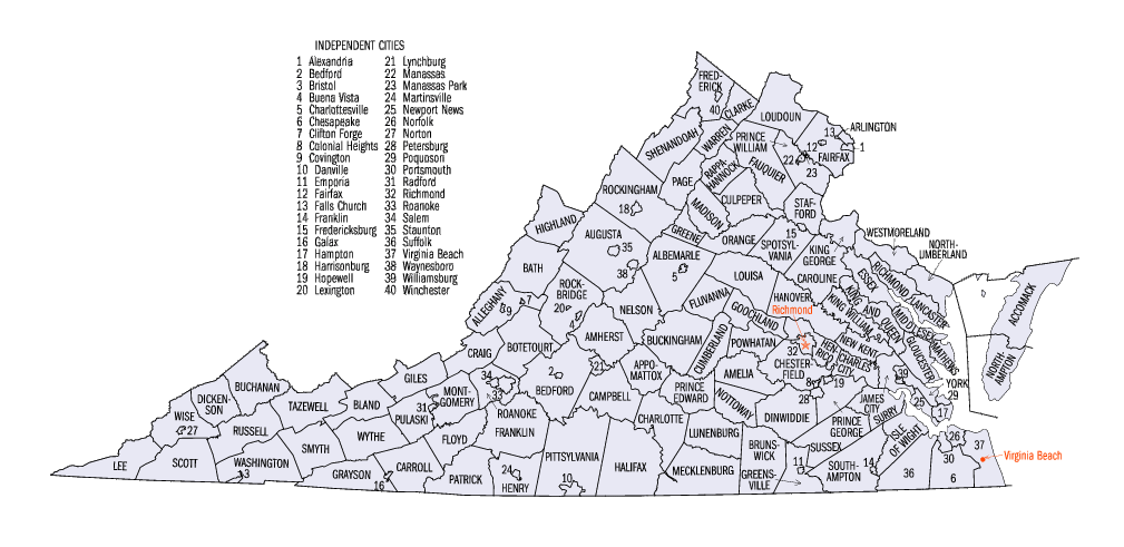
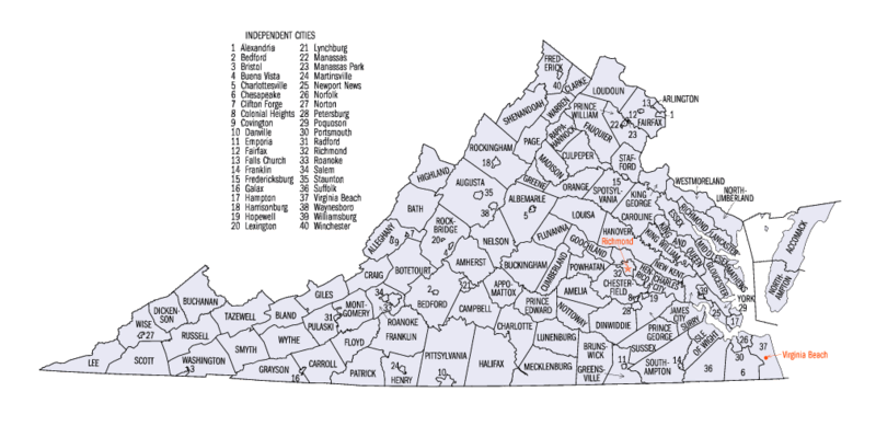
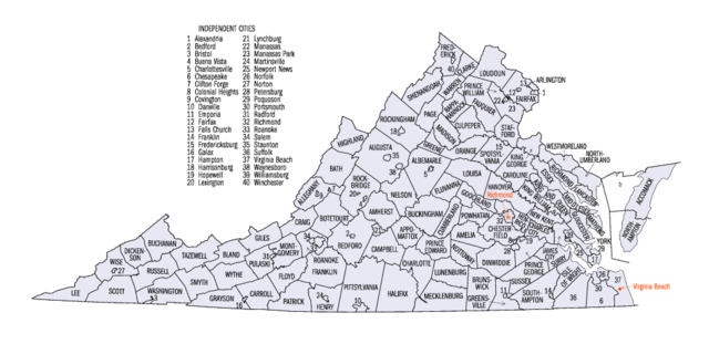
English: Map of Virginia counties and independent cities as of the 2000 Census. |
|||
| Bron | [1] | |||
| Auteur | United States Census Bureau | |||
| Toestemming (Hergebruik van dit bestand) |

|


Licentie
This image or file is a work of a United States Census Bureau employee, taken or made as part of that person's official duties. As a work of the U.S. federal government, the image is in the public domain.
|
 |
Oorspronkelijk uploadlogboek
De oorspronkelijke beschrijving van deze afbeelding stond hier. Alle volgende gebruikersnamen verwijzen naar en.wikipedia.
- 2005-06-24 23:00 Jengod 1009×491× (71702 bytes) {{PD-USGov-DOC-Census}}[[Category:Virginia maps]]
Bestandsgeschiedenis
Klik op een datum/tijd om het bestand te zien zoals het destijds was.
| Datum/tijd | Miniatuur | Afmetingen | Gebruiker | Opmerking | |
|---|---|---|---|---|---|
| huidige versie | 15 mei 2010 19:45 | | 1.009 × 491 (63 kB) | DieBuche | fix |
| 16 okt 2006 22:34 | Geen miniatuurafbeelding | (70 kB) | JosN | Map of Virginia counties and independant cities. |
Bestandsgebruik
Dit bestand wordt op de volgende pagina gebruikt:
Globaal bestandsgebruik
De volgende andere wiki's gebruiken dit bestand:
- Gebruikt op es.wikipedia.org
- Gebruikt op fr.wikipedia.org
- Gebruikt op he.wikipedia.org
- Gebruikt op it.wikipedia.org
- Gebruikt op ja.wikipedia.org
- Gebruikt op ko.wikipedia.org
- Gebruikt op nds.wikipedia.org
- Gebruikt op pt.wikipedia.org
- Gebruikt op sv.wikipedia.org
- Gebruikt op ur.wikipedia.org
- Gebruikt op vi.wikipedia.org