Bestand:UE Soils.png

Grootte van deze voorvertoning: 800 × 575 pixels. Andere resoluties: 320 × 230 pixels | 640 × 460 pixels | 1.024 × 736 pixels | 1.280 × 920 pixels | 2.560 × 1.841 pixels | 2.872 × 2.065 pixels.
Oorspronkelijk bestand (2.872 × 2.065 pixels, bestandsgrootte: 364 kB, MIME-type: image/png)
| Dit is een bestand van Wikimedia Commons. Onderstaande beschrijving komt van de beschrijving van het bestand daar. |
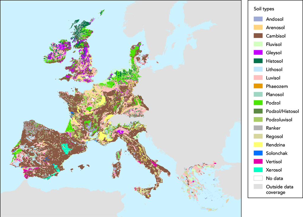
- Source :
- The map was made on data in GISCO delivery 12-2002 which was slightly revised compared to the available dataset (GISCO delivery 09-2000).
- Date:
- 05/03/2003
- Keyword(s):
- desertification,soil,geographic,DISMED Natlan.
- Type:
- Map
- Technical producer:
- European Environment Agency
- http://www.eea.eu.int archief kopie op de Wayback Machine
- View the full description here:
This image is in the public domain because it is extracted from the European Environment Agency Website, whose material is in the public domain unless otherwise stated (see the copyright notice). Online access: www.eea.eu.int
This is valid despite the copyright notice at the bottom of each page, see this confirmation e-mail. | |
Bestandsgeschiedenis
Klik op een datum/tijd om het bestand te zien zoals het destijds was.
| Datum/tijd | Miniatuur | Afmetingen | Gebruiker | Opmerking | |
|---|---|---|---|---|---|
| huidige versie | 27 nov 2005 17:44 | | 2.872 × 2.065 (364 kB) | Tvpm | *Source : ::The map was made on data in GISCO delivery 12-2002 which was slightly revised compared to the available dataset (GISCO delivery 09-2000). *Date: ::05/03/2003 *Keyword(s): ::desertification,soil,geographic,DISMED Natlan. *Type: ::Map *Technical |
Bestandsgebruik
Dit bestand wordt op de volgende 2 pagina's gebruikt:
Globaal bestandsgebruik
De volgende andere wiki's gebruiken dit bestand:
- Gebruikt op ca.wikipedia.org
- Gebruikt op de.wikipedia.org
- Gebruikt op et.wikipedia.org
- Gebruikt op fr.wikipedia.org