Bestand:Tarrant County Texas Incorporated Areas Fort Worth highlighted.svg

Afmetingen van deze voorvertoning van het type PNG van dit SVG-bestand: 800 × 436 pixels Andere resoluties: 320 × 175 pixels | 640 × 349 pixels | 1.024 × 559 pixels | 1.280 × 698 pixels | 2.560 × 1.396 pixels.
Oorspronkelijk bestand (SVG-bestand, nominaal 1.100 × 600 pixels, bestandsgrootte: 235 kB)
| Dit is een bestand van Wikimedia Commons. Onderstaande beschrijving komt van de beschrijving van het bestand daar. |
Beschrijving
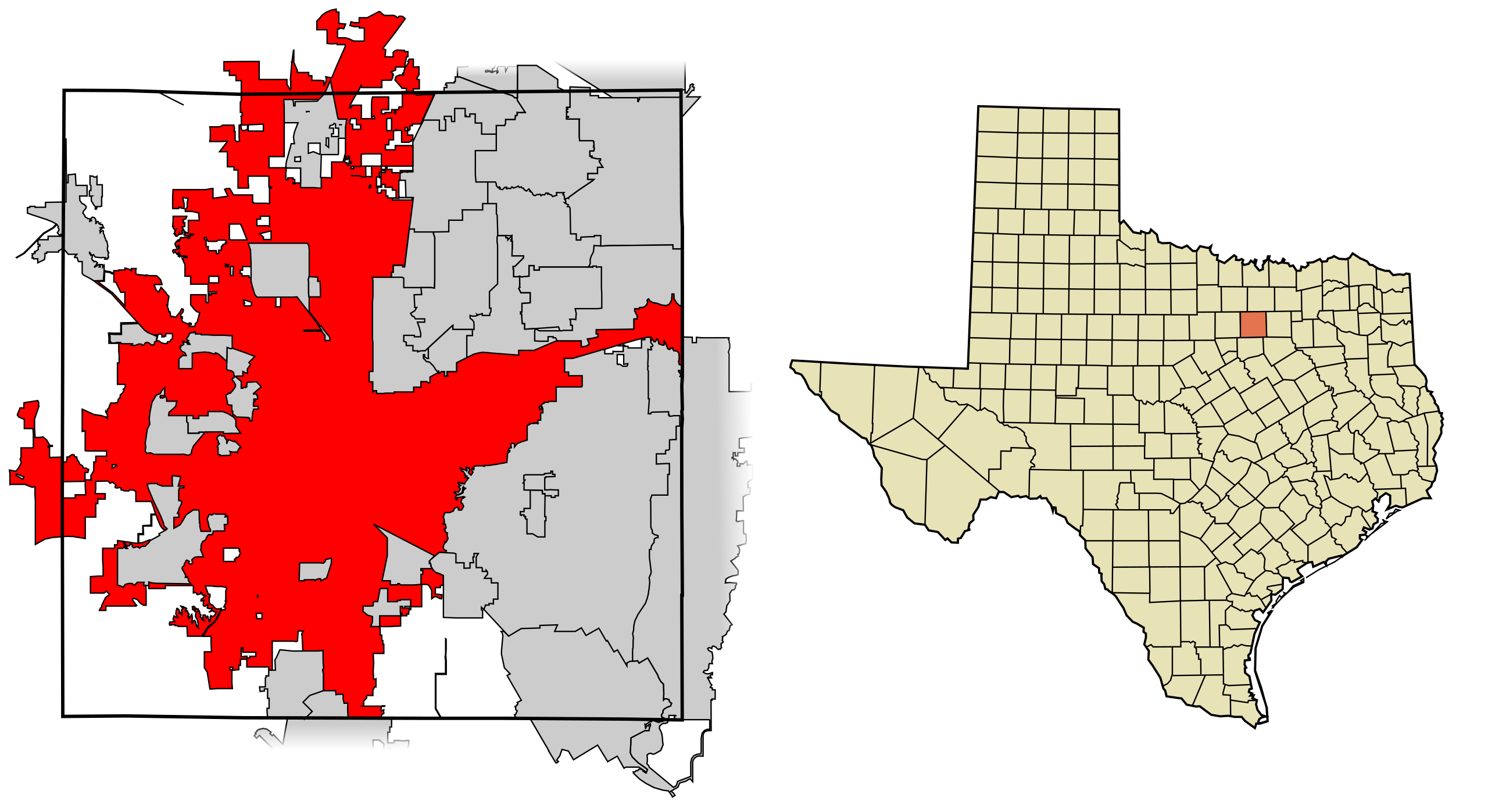
| Beschrijving | This map shows the incorporated areas in Tarrant County, Texas. Fort Worth is highlighted in red. I created it in Inkscape using data from the following links: North Central Texas Council of Governments Maps Website, City of Fort Worth Interactive Zoning Map |
| Datum | |
| Bron | My own work, based on government information. Though I strove to be as accurate in the detail as possible, the information shown is not guaranteed to be completely accurate. |
| Auteur | Ixnayonthetimmay |
| Toestemming (Hergebruik van dit bestand) |
Public Domain |
| Andere versies | See Category:Maps of Tarrant County, Texas for other versions of this image. |
Licentie
| Ik, de auteursrechthebbende van dit werk, geef dit werk vrij in het publieke domein. Dit is wereldwijd van toepassing. In sommige landen is dit wettelijk niet mogelijk; in die gevallen geldt: Ik sta iedereen toe dit werk voor eender welk doel te gebruiken, zonder enige voorwaarden, tenzij zulke voorwaarden door de wet worden voorgeschreven. |
Bestandsgeschiedenis
Klik op een datum/tijd om het bestand te zien zoals het destijds was.
| Datum/tijd | Miniatuur | Afmetingen | Gebruiker | Opmerking | |
|---|---|---|---|---|---|
| huidige versie | 31 aug 2007 07:44 | | 1.100 × 600 (235 kB) | Ixnayonthetimmay | |
| 29 aug 2007 04:29 |  | 1.100 × 600 (235 kB) | Ixnayonthetimmay | == Summary == {{Information |Description=This map shows the incorporated areas in Tarrant County, Texas. Fort Worth is highlighted in red. I created it in [[en:Inkscape |
Bestandsgebruik
Dit bestand wordt op de volgende pagina gebruikt:
Globaal bestandsgebruik
De volgende andere wiki's gebruiken dit bestand:
- Gebruikt op af.wikipedia.org
- Gebruikt op ang.wikipedia.org
- Gebruikt op ar.wikipedia.org
- Gebruikt op arz.wikipedia.org
- Gebruikt op ast.wikipedia.org
- Gebruikt op bn.wikipedia.org
- Gebruikt op br.wikipedia.org
- Gebruikt op ca.wikipedia.org
- Gebruikt op ceb.wikipedia.org
- Gebruikt op de.wikipedia.org
- Gebruikt op el.wikipedia.org
- Gebruikt op en.wikipedia.org
- Gebruikt op eo.wikipedia.org
- Gebruikt op et.wikipedia.org
- Gebruikt op eu.wikipedia.org
- Gebruikt op fa.wikipedia.org
- Gebruikt op fi.wikipedia.org
- Gebruikt op fo.wikipedia.org
- Gebruikt op fr.wikipedia.org
- Gebruikt op fy.wikipedia.org
- Gebruikt op ga.wikipedia.org
- Gebruikt op gd.wikipedia.org
- Gebruikt op gl.wikipedia.org
- Gebruikt op ha.wikipedia.org
- Gebruikt op he.wikipedia.org
- Gebruikt op ht.wikipedia.org
- Gebruikt op hu.wikipedia.org
- Gebruikt op ia.wikipedia.org
- Gebruikt op is.wikipedia.org
- Gebruikt op it.wikipedia.org
- Gebruikt op ja.wikipedia.org
- Gebruikt op ko.wikipedia.org
- Gebruikt op ku.wikipedia.org
- Gebruikt op kw.wikipedia.org
- Gebruikt op la.wikipedia.org
- Gebruikt op ml.wikipedia.org
- Gebruikt op ms.wikipedia.org
- Gebruikt op nn.wikipedia.org
- Gebruikt op pa.wikipedia.org
- Gebruikt op pnb.wikipedia.org
- Gebruikt op pt.wikipedia.org
- Gebruikt op qu.wikipedia.org
- Gebruikt op ro.wikipedia.org
- Gebruikt op sco.wikipedia.org
- Gebruikt op sc.wikipedia.org
- Gebruikt op simple.wikipedia.org
- Gebruikt op sk.wikipedia.org
- Gebruikt op sl.wikipedia.org
Globaal gebruik van dit bestand bekijken.