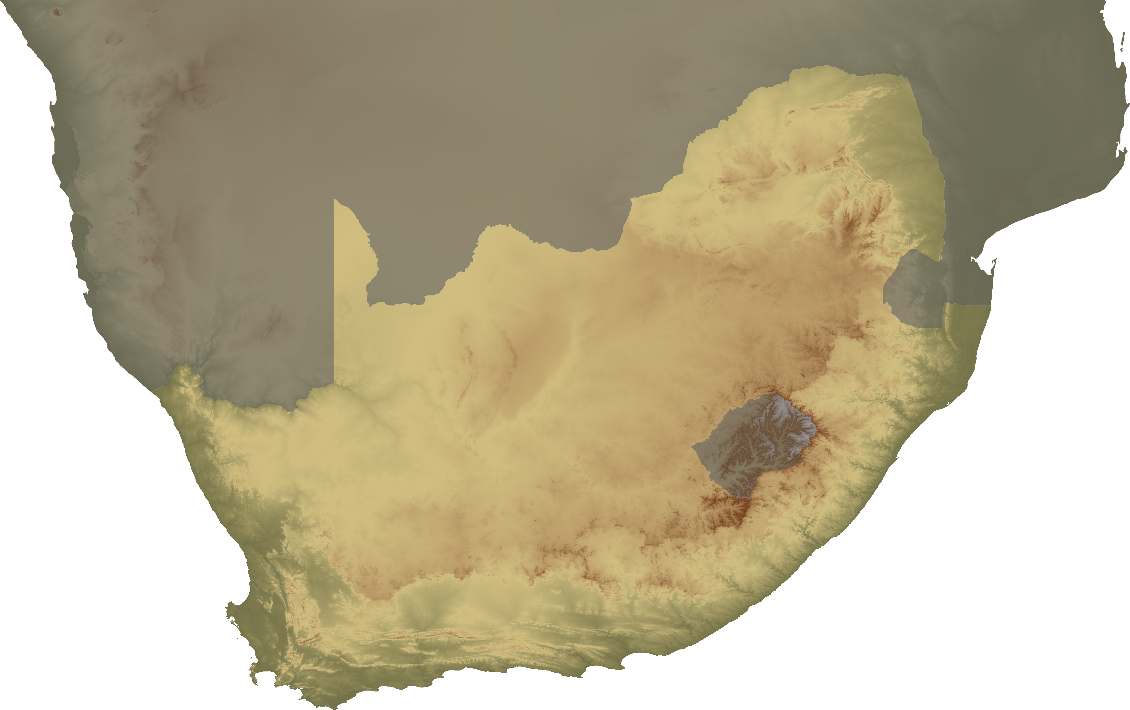
Bestand:South Africa topo continent.png
Grootte van deze voorvertoning: 800 × 503 pixels. Andere resoluties: 320 × 201 pixels | 640 × 403 pixels | 1.024 × 644 pixels | 1.280 × 805 pixels | 2.560 × 1.610 pixels | 3.658 × 2.301 pixels.
Oorspronkelijk bestand (3.658 × 2.301 pixels, bestandsgrootte: 3,84 MB, MIME-type: image/png)
| Dit is een bestand van Wikimedia Commons. Onderstaande beschrijving komt van de beschrijving van het bestand daar. |
| Beschrijving | Topographical map of South Africa, continent version |
| Datum | |
| Bron | Eigen werk |
| Auteur | SFC9394 |
| Toestemming (Hergebruik van dit bestand) |
Topo data from SRTM, NASA PD |
| Andere versies | Image:South Africa topo island.png |
Dit bestand is gelicenseerd onder de Creative Commons-licentie Naamsvermelding 2.5 Unported
- De gebruiker mag:
- Delen – het werk kopiëren, verspreiden en doorgeven
- Remixen – afgeleide werken maken
- Onder de volgende voorwaarden:
- naamsvermelding – U moet op een gepaste manier aan naamsvermelding doen, een link naar de licentie geven, en aangeven of er wijzigingen in het werk zijn aangebracht. U mag dit op elke redelijke manier doen, maar niet zodanig dat de indruk wordt gewekt dat de licentiegever instemt met uw werk of uw gebruik van zijn werk.
Bestandsgeschiedenis
Klik op een datum/tijd om het bestand te zien zoals het destijds was.
| Datum/tijd | Miniatuur | Afmetingen | Gebruiker | Opmerking | |
|---|---|---|---|---|---|
| huidige versie | 2 feb 2008 22:00 | | 3.658 × 2.301 (3,84 MB) | SFC9394 | {{Information |Description= Topographical map of South Africa, continent version |Source=self-made |Date=02-02-08 |Author= SFC9394 |Permission=Topo data from SRTM, NASA PD |other_versions=Image:South Africa topo island.png }} {{CC-BY- |
Bestandsgebruik
Dit bestand wordt op de volgende pagina gebruikt:
Globaal bestandsgebruik
De volgende andere wiki's gebruiken dit bestand:
- Gebruikt op ar.wikipedia.org
- Gebruikt op bn.wikipedia.org
- Gebruikt op en.wikipedia.org
- Cape Colony
- Union of South Africa
- History of South Africa
- Bophuthatswana
- Transkei
- Kingdom of Mutapa
- Stellaland
- Ciskei
- Venda
- Potchefstroom
- Natalia Republic
- Griqualand West
- Griqualand East
- Ndwandwe
- Lydenburg
- Utrecht, South Africa
- Winburg
- Griekwastad
- Swellendam
- Klein Vrystaat
- Nieuwe Republiek
- Mthethwa Clan
- Template:Historical states of South Africa sidebar
- Zulu Kingdom
- Dutch Cape Colony
- State of Goshen
- Stafford Parker
- Timeline of Durban
- Timeline of Port Elizabeth
- Timeline of Pietermaritzburg
- Republic of Graaff-Reinet
- Gebruikt op no.wikipedia.org
- Gebruikt op ta.wikipedia.org
- Gebruikt op tum.wikipedia.org
- Gebruikt op vi.wikipedia.org