Bestand:South Africa Western Cape relief location map.svg

Afmetingen van deze voorvertoning van het type PNG van dit SVG-bestand: 749 × 600 pixels Andere resoluties: 300 × 240 pixels | 600 × 480 pixels | 959 × 768 pixels | 1.279 × 1.024 pixels | 2.558 × 2.048 pixels | 1.214 × 972 pixels.
Oorspronkelijk bestand (SVG-bestand, nominaal 1.214 × 972 pixels, bestandsgrootte: 1,98 MB)
| Dit is een bestand van Wikimedia Commons. Onderstaande beschrijving komt van de beschrijving van het bestand daar. |
| Beschrijving |
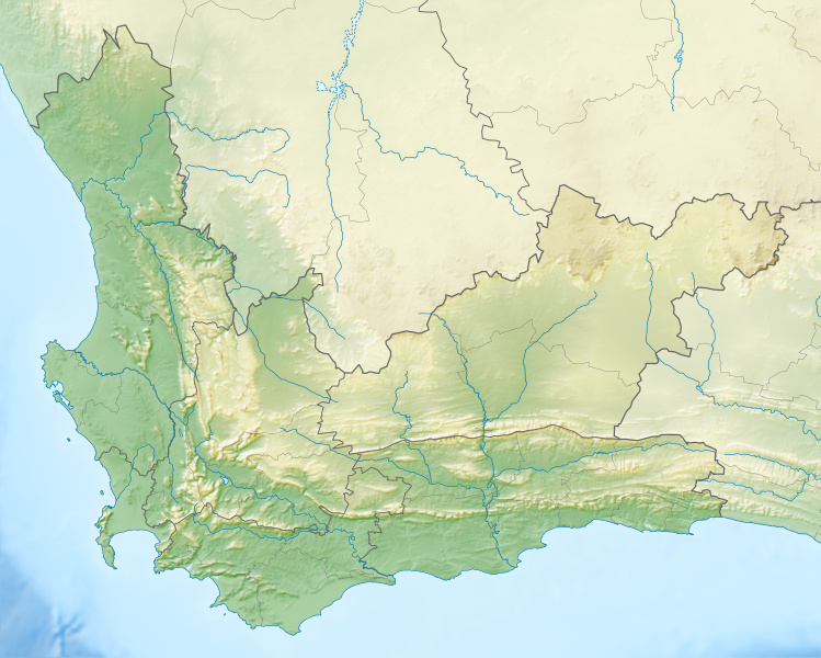
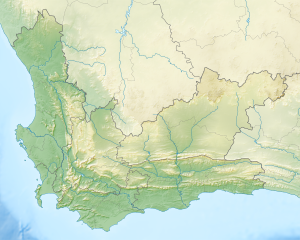
English: Relief location map of the Western Cape
Equirectangular projection, N/S stretching 118%. Geographic limits of the map:
|
| Datum | |
| Bron |
|
| Auteur | Htonl |
| Toestemming (Hergebruik van dit bestand) |
Ik, de auteursrechthebbende van dit werk, maak het hierbij onder de volgende licentie beschikbaar: Dit bestand is gelicenseerd onder de Creative Commons-licentie Naamsvermelding-Gelijk delen 3.0 Unported
|
| Andere versies | File:South Africa Western Cape location map.svg |
Bestandsgeschiedenis
Klik op een datum/tijd om het bestand te zien zoals het destijds was.
| Datum/tijd | Miniatuur | Afmetingen | Gebruiker | Opmerking | |
|---|---|---|---|---|---|
| huidige versie | 4 jan 2013 21:44 | | 1.214 × 972 (1,98 MB) | Htonl | {{Information |Description ={{en|1=Relief location map of the Western Cape Equirectangular projection, N/S stretching 118%. Geographic limits of the map: * N: 30.25° S * S: 35.0° S * W: 17.5° E * E: 24.5° E}} |Source ... |
Bestandsgebruik
Dit bestand wordt op de volgende 17 pagina's gebruikt:
- Boosmansbos
- De Hoop (West-Kaap)
- Du Toitskloofpas
- Duivelskop
- Grootvadersbosch
- Knersvlakte
- Matjiesrivier (natuurreservaat)
- Meiringspoort
- Michellspas
- Montagupas
- Nationaal park Agulhas
- Nationaal park Bontebok
- Nationaal park Tafelberg
- Nationaal park Weskus
- Outeniquapas
- Vogeleiland (Lambertsbaai)
- Sjabloon:Positiekaart Zuid-Afrika West-Kaap
Globaal bestandsgebruik
De volgende andere wiki's gebruiken dit bestand:
- Gebruikt op ar.wikipedia.org
- Gebruikt op ban.wikipedia.org
- Gebruikt op be.wikipedia.org
- Gebruikt op bg.wikipedia.org
- Gebruikt op ceb.wikipedia.org
- Gebruikt op de.wikipedia.org
- Tafelbucht
- Boulders Beach
- Saldanha Bay
- Montagu-Pass
- Wikipedia:Kartenwerkstatt/Positionskarten/Afrika
- Dyer Island (Südafrika)
- False Bay
- Vorlage:Positionskarte Südafrika Westkap
- Duiker Island
- Dassen Island
- Benutzer:Olga Ernst/Walker Bay (Südafrika)
- Walker Bay (Südafrika)
- Matroosberg
- Still Bay
- Sankt-Helena-Bucht
- Bergwerk Steenkampskraal
- Gebruikt op en.wikipedia.org
- Stellenbosch
- Cederberg
- False Bay
- Chapman's Peak
- Blombos Cave
- Dassen Island
- Rondevlei Nature Reserve
- Seal Island, South Africa
- Marloth Nature Reserve
- Karoo National Park
- Dimension Data Pro-Am
- BOS 400
- De Hoop Nature Reserve
- Duiker Island
- Hex River Mountains
- Arniston (East Indiaman)
- Boosmansbos Wilderness Area
- Johanna (East Indiaman)
- Module:Location map/data/South Africa Western Cape/doc
- Coca-Cola Charity Championship
- Grootrivier Pass
- Akkedisberg Pass
- Attakwaskloof Pass
Globaal gebruik van dit bestand bekijken.