Bestand:Slovenia map.png
Oorspronkelijk bestand (2.466 × 1.890 pixels, bestandsgrootte: 1,59 MB, MIME-type: image/png)
| Dit is een bestand van Wikimedia Commons. Onderstaande beschrijving komt van de beschrijving van het bestand daar. |
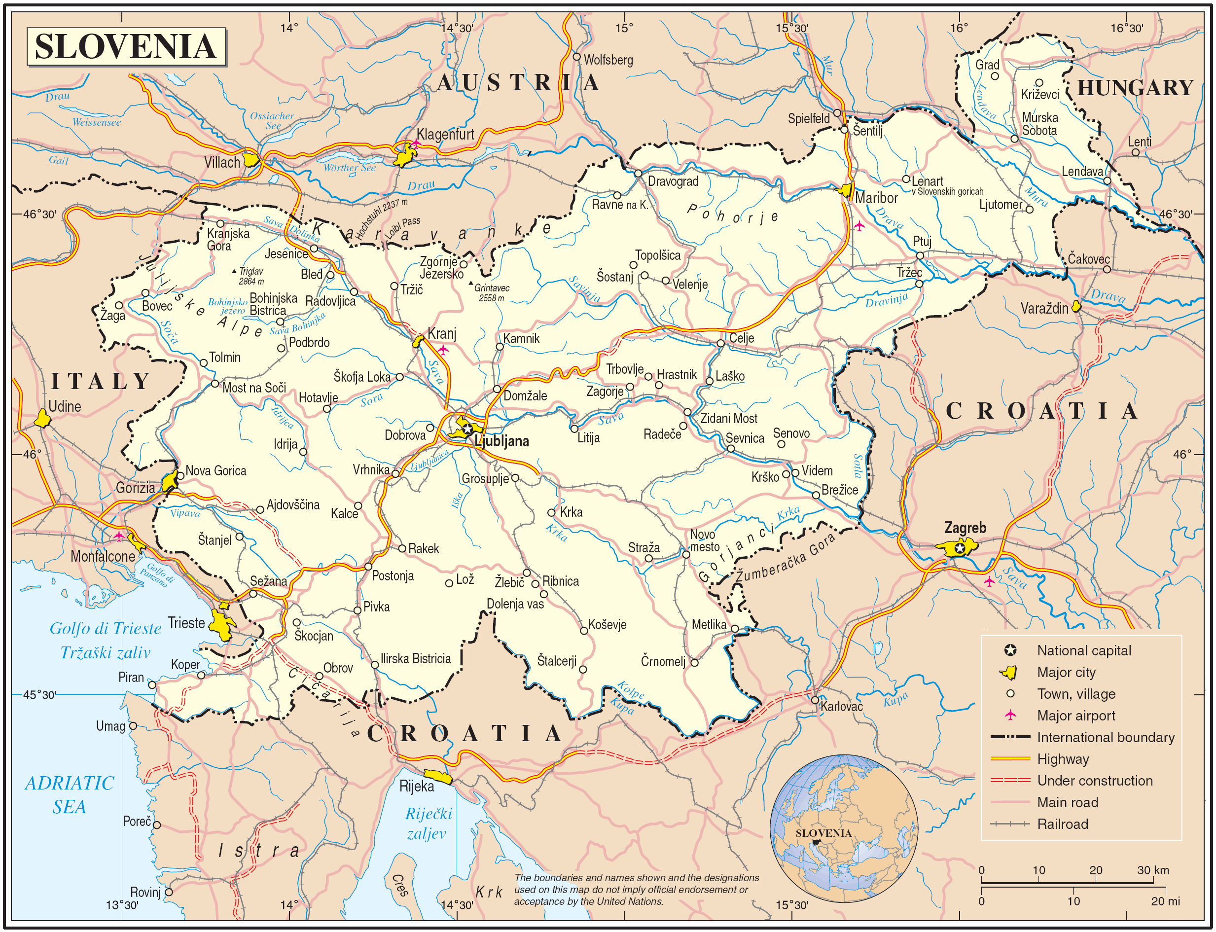
Map of Slovenia
| Beschrijving | Map of Slovenia | |||
| Datum | June 2004 (uploaded to wikimedia 2007-03-10) | |||
| Bron | The Cartographic Section of the United Nations (CSUN) | |||
| Auteur | Cartographer of the United Nations | |||
| Toestemming (Hergebruik van dit bestand) |
|

Bestandsgeschiedenis
Klik op een datum/tijd om het bestand te zien zoals het destijds was.
| Datum/tijd | Miniatuur | Afmetingen | Gebruiker | Opmerking | |
|---|---|---|---|---|---|
| huidige versie | 11 mrt 2007 01:42 | | 2.466 × 1.890 (1,59 MB) | Gugganij | |
| 10 mrt 2007 19:05 |  | 2.466 × 1.890 (1,59 MB) | Minestrone | Map of Slovenia {{Information |Description=Map of Slovenia |Source=The Cartographic Section of the United Nations (CSUN) |Date=2007-03-10 |Author=Cartographer of the United Nations |Permission={{Template:UN map}} and the cartographer of the UN [mail |
Bestandsgebruik
Dit bestand wordt op de volgende pagina gebruikt:
Globaal bestandsgebruik
De volgende andere wiki's gebruiken dit bestand:
- Gebruikt op als.wikipedia.org
- Gebruikt op avk.wikipedia.org
- Gebruikt op azb.wikipedia.org
- Gebruikt op cs.wikipedia.org
- Gebruikt op da.wikipedia.org
- Gebruikt op de.wikipedia.org
- Gebruikt op el.wikipedia.org
- Gebruikt op en.wikipedia.org
- Gebruikt op fa.wikipedia.org
- Gebruikt op fr.wikipedia.org
- Gebruikt op gag.wikipedia.org
- Gebruikt op gd.wikipedia.org
- Gebruikt op gom.wikipedia.org
- Gebruikt op hr.wikipedia.org
- Gebruikt op hu.wikipedia.org
- Gebruikt op it.wikipedia.org
- Gebruikt op ko.wikipedia.org
- Gebruikt op lb.wikipedia.org
- Gebruikt op lfn.wikipedia.org
- Gebruikt op mzn.wikipedia.org
- Gebruikt op pl.wiktionary.org
- Gebruikt op ps.wikipedia.org
- Gebruikt op sl.wikipedia.org
- Gebruikt op to.wikipedia.org
- Gebruikt op tr.wiktionary.org
- Gebruikt op uk.wikipedia.org
- Gebruikt op uk.wiktionary.org
- Gebruikt op www.wikidata.org