Bestand:Sanctuary marker, Holyrood Abbey - geograph.org.uk - 1336716.jpg
Grootte van deze voorvertoning: 450 × 600 pixels. Andere resoluties: 180 × 240 pixels | 480 × 640 pixels.
Oorspronkelijk bestand (480 × 640 pixels, bestandsgrootte: 118 kB, MIME-type: image/jpeg)
| Dit is een bestand van Wikimedia Commons. Onderstaande beschrijving komt van de beschrijving van het bestand daar. |
Beschrijving
| Beschrijving |
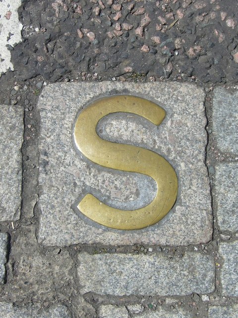
English: Sanctuary marker, Holyrood Abbey One of three brass markers in the roadway outside Holyrood Palace, delineating the former sanctuary boundary of Holyrood Abbey. Although records go back further, the policy of granting sanctuary to debtors appears to have been formalised after Charles I appointed the Duke of Hamilton and his heirs to be Keepers of the Palace in 1646. The 'abbey lairds', as the debtors were called, enjoyed the privilege of being allowed to leave the sanctuary between midnight on Saturday and midnight on Sunday without fear of arrest. Their number included Thomas de Quincey, author of Confessions of an English Opium Eater, who lived within the sanctuary at various times between 1833 and 1840. Another famous resident was Charles-Philippe, Comte d'Artois, brother of the deposed Louis XVIII of France. His first arrival in 1796 was prompted by the massive debts he had incurred supplying the émigré army after the French Revolution. He returned in 1830 after reigning briefly as Charles X, complete with his retinue of a hundred, most of whom lodged in the Canongate. But the political climate in Britain was changing at the time of the 1832 Reform Act and this induced him to leave, embarking from the Chain Pier near Newhaven on a steam-boat to Hamburg. The last occasion a person sought sanctuary at Holyrood was in 1880. |
| Datum | |
| Bron | From geograph.org.uk |
| Auteur | kim traynor |
| Naamsvermelding (required by the license) | kim traynor / Sanctuary marker, Holyrood Abbey / |
| Cameralocatie | | Deze en andere afbeeldingen in: OpenStreetMap |
|---|
_heading:247.00&language=nl)
| Objectlocatie | | Deze en andere afbeeldingen in: OpenStreetMap |
|---|
_heading:247.00&language=nl)
Licentie

|
Deze afbeelding komt uit de Geograph British Isles-collectie. Zie de pagina van deze foto op de website van Geograph voor contactinformatie van de fotograaf. Het auteursrecht van deze foto is in handen van kim traynor en de foto is gelicenceerd voor hergebruik onder de Creative Commons Naamsvermelding-Gelijk delen 2.0 licentie.
|
Dit bestand is gelicenseerd onder de Creative Commons-licentie Naamsvermelding-Gelijk delen 2.0 Unported
Naamsvermelding: kim traynor
- De gebruiker mag:
- Delen – het werk kopiëren, verspreiden en doorgeven
- Remixen – afgeleide werken maken
- Onder de volgende voorwaarden:
- naamsvermelding – U moet op een gepaste manier aan naamsvermelding doen, een link naar de licentie geven, en aangeven of er wijzigingen in het werk zijn aangebracht. U mag dit op elke redelijke manier doen, maar niet zodanig dat de indruk wordt gewekt dat de licentiegever instemt met uw werk of uw gebruik van zijn werk.
- Gelijk delen – Als u het werk heeft geremixt, veranderd, of erop heeft voortgebouwd, moet u het gewijzigde materiaal verspreiden onder dezelfde licentie als het oorspronkelijke werk, of een daarmee compatibele licentie.
Bestandsgeschiedenis
Klik op een datum/tijd om het bestand te zien zoals het destijds was.
| Datum/tijd | Miniatuur | Afmetingen | Gebruiker | Opmerking | |
|---|---|---|---|---|---|
| huidige versie | 28 feb 2011 04:14 | | 480 × 640 (118 kB) | GeographBot | == {{int:filedesc}} == {{Information |description={{en|1=Sanctuary marker, Holyrood Abbey One of three brass markers in the roadway outside Holyrood Palace, delineating the former sanctuary boundary of Holyrood Abbey. Although records go back further, the |
Bestandsgebruik
Dit bestand wordt op de volgende pagina gebruikt:
Globaal bestandsgebruik
De volgende andere wiki's gebruiken dit bestand:
- Gebruikt op en.wikipedia.org