Bestand:Rur Urft map.png
Oorspronkelijk bestand (1.899 × 1.750 pixels, bestandsgrootte: 3,05 MB, MIME-type: image/png)
| Dit is een bestand van Wikimedia Commons. Onderstaande beschrijving komt van de beschrijving van het bestand daar. |
| Beschrijving |
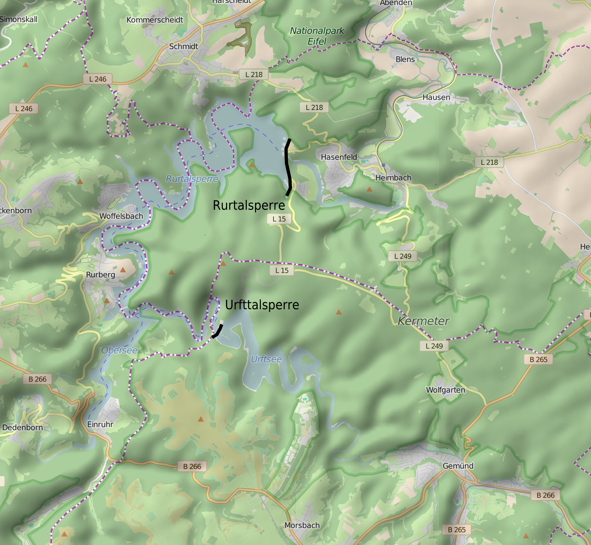
English: Location map for Rurtalsperre and Urfttalsperre, Germany Nederlands: Lokatiekaart van de Roerdaldam en Urftdaldam, Duitsland Deutsch: Lagekarte der Rurtalsperre und Urfttalsperre |
| Datum | (UTC) |
| Bron | Eigen werk, OpenStreetmap, SRTM |
| Auteur | Hans Erren, OpenStreetMap, NASA-SRTM |
SRTM hillshade added using QGIS
| Dit bestand is gelicenseerd onder de Creative Commons-licentie Naamsvermelding-Gelijk delen 3.0 Unported | ||
| ||
| Deze licentietag is toegevoegd aan dit bestand in verband met de GFDL licentie-update. |
This image uses high-resolution digital topography data from NASA's Shuttle Radar Topography Mission (SRTM) at JPL-Caltech [1]. It is in the public domain in the United States.
|
 | |
| Beschrijving |
Deze kaart is gemaakt op basis van OpenStreetMap projectgegevens, verzameld door de gemeenschap. Deze kaart kan onvolledig zijn en fouten bevatten. Vertrouw er niet op voor navigatie. |
|||
| Datum | (geschiedenis bestand) | |||
| Bron | openstreetmap.org | |||
| Maker |
OpenStreetMap bijdragers |
|||
| Toestemming (Hergebruik van dit bestand) |
OpenStreetMap-gegevens zijn beschikbaar onder de Open Database Licentie (details). Kaarttegels zijn gelicentieerd onder de Creative Commons Attribution-ShareAlike 2.0-licentie (CC-BY-SA 2.0).
Dit bestand is gelicenseerd onder de Creative Commons-licentie Naamsvermelding-Gelijk delen 2.0 Unported
|
|||
| Georeferencing | If inappropriate please set warp_status = skip to hide. |
Bestandsgeschiedenis
Klik op een datum/tijd om het bestand te zien zoals het destijds was.
| Datum/tijd | Miniatuur | Afmetingen | Gebruiker | Opmerking | |
|---|---|---|---|---|---|
| huidige versie | 1 aug 2016 20:26 | | 1.899 × 1.750 (3,05 MB) | Hans Erren | extent of first version |
| 31 jul 2016 00:12 |  | 1.546 × 1.692 (2,96 MB) | Hans Erren | smooth SRTM hillshade rendering using QGIS | |
| 3 dec 2010 17:20 |  | 1.883 × 1.750 (1,35 MB) | Hans Erren | {{Information |Description={{en|1=Location map for Rurtalsperre and Urfttalsperre, Germany}} {{nl|1=Lokatiekaart van de Roerdaldam en Urftdaldam, Duitsland}} {{de|1=Lagekarte der Rurtalsperre und Urfttalsperre}} |Source=*File:Rur_Urft_map.svg |Date= |
Bestandsgebruik
Dit bestand wordt op de volgende 4 pagina's gebruikt:
Globaal bestandsgebruik
De volgende andere wiki's gebruiken dit bestand:
- Gebruikt op ceb.wikipedia.org
- Gebruikt op it.wikipedia.org
- Gebruikt op www.wikidata.org