Bestand:Netherlands, Province of Drenthe, map of 1866.PNG
Grootte van deze voorvertoning: 483 × 600 pixels. Andere resoluties: 193 × 240 pixels | 387 × 480 pixels | 619 × 768 pixels | 1.198 × 1.487 pixels.
Oorspronkelijk bestand (1.198 × 1.487 pixels, bestandsgrootte: 1,51 MB, MIME-type: image/png)
| Dit is een bestand van Wikimedia Commons. Onderstaande beschrijving komt van de beschrijving van het bestand daar. |
Beschrijving
| Beschrijving |
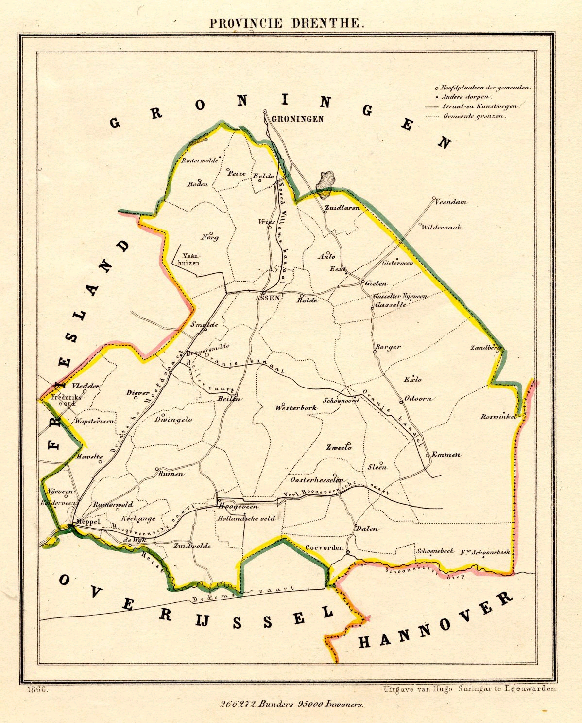
Nederlands: Een kaart van Drenthe uit 1866, uit de Gemeente Atlas van Jacob Kuyper.
English: A map of the Dutch province of Drenthe, from 1866. |
| Datum | |
| Bron | http://www.atlas1868.nl/dr/provdrenthe.html |
| Auteur | J. Kuyper |
| Toestemming (Hergebruik van dit bestand) |
This image is in the public domain. The author died in 1908. [In the Netherlands copyright expires 70 years after the death of the author or 70 years after first publication in the case of anonymous or pseudonymous works or works published by a legal entity]. [Het auteursrecht in Nederland vervalt 70 jaar na de dood van de auteur of 70 jaar na de eerste openbaarmaking van het werk, indien het gaat om een anoniem of om een onder pseudoniem verschenen werk of werk van een rechtspersoon]. |
The caputal of Drenthe (Assen) is at:
| Cameralocatie | | Deze en andere afbeeldingen in: OpenStreetMap |
|---|
Licentie
|
Dit werk bevindt zich in het publiek domein in landen en gebieden waar de auteursrechttermijn het leven van de auteur plus 100 jaar of minder is. | |
| Van dit bestand is vastgesteld dat er geen bekende auteursrechtaanspraken op rusten, alle aanverwante en naburige rechten daarbij inbegrepen. | |
Bestandsgeschiedenis
Klik op een datum/tijd om het bestand te zien zoals het destijds was.
| Datum/tijd | Miniatuur | Afmetingen | Gebruiker | Opmerking | |
|---|---|---|---|---|---|
| huidige versie | 17 nov 2011 16:03 | | 1.198 × 1.487 (1,51 MB) | Loranchet | {{Information |Description ={{nl|1=Een kaart van Drenthe uit 1866, uit de Gemeente Atlas van Jacob Kuyper.}} {{en|1=A map of the Dutch province of Drenthe, from 1866.}} |Source =http://www.atlas1868.nl/dr/provdrenthe.html |Author =J. Ku |
Bestandsgebruik
Dit bestand wordt op de volgende pagina gebruikt:
Globaal bestandsgebruik
De volgende andere wiki's gebruiken dit bestand: