Bestand:National-atlas-new-york.png
Geen hogere resolutie beschikbaar.
National-atlas-new-york.png (764 × 591 pixels, bestandsgrootte: 102 kB, MIME-type: image/png)
| Dit is een bestand van Wikimedia Commons. Onderstaande beschrijving komt van de beschrijving van het bestand daar. |
Beschrijving
| Beschrijving |
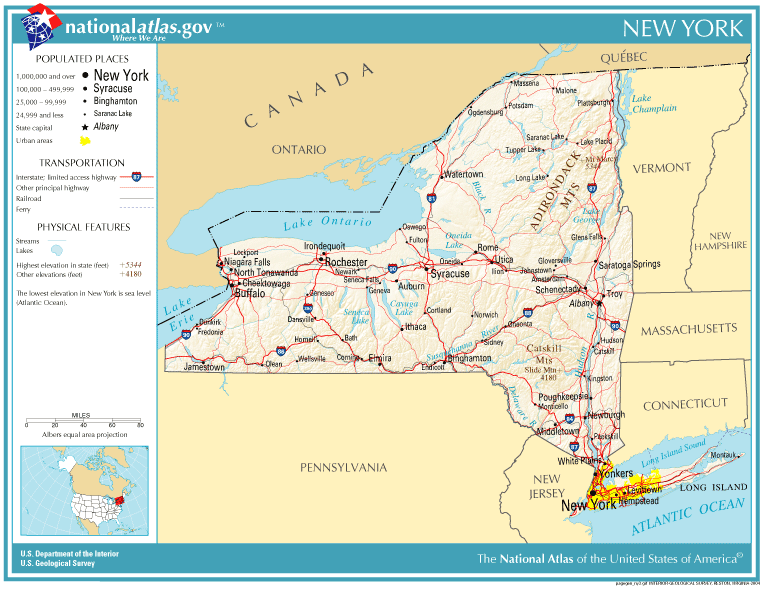
English: This map shows the roads of the state of New York. |
| Datum | |
| Bron | National Atlas of the United States of America |
| Auteur | United States Department of the Interior |
Licentie
This map was obtained from an edition of the National Atlas of the United States. Like almost all works of the U.S. federal government, works from the National Atlas are in the public domain in the United States.
Online access: NationalAtlas.gov | 1970 print edition: Library of Congress, Perry-Castañeda Library
|
Bestandsgeschiedenis
Klik op een datum/tijd om het bestand te zien zoals het destijds was.
| Datum/tijd | Miniatuur | Afmetingen | Gebruiker | Opmerking | |
|---|---|---|---|---|---|
| huidige versie | 20 jun 2005 21:18 | | 764 × 591 (102 kB) | Leslie | {{PD-USGov-Atlas}} |
Bestandsgebruik
Dit bestand wordt op de volgende pagina gebruikt:
Globaal bestandsgebruik
De volgende andere wiki's gebruiken dit bestand:
- Gebruikt op en.wikipedia.org
- Gebruikt op hr.wiktionary.org
- Gebruikt op pam.wikipedia.org
- Gebruikt op pl.wiktionary.org