Bestand:Messinian palaeogeography.svg

Afmetingen van deze voorvertoning van het type PNG van dit SVG-bestand: 423 × 501 pixels Andere resoluties: 203 × 240 pixels | 405 × 480 pixels | 648 × 768 pixels | 864 × 1.024 pixels | 1.729 × 2.048 pixels.
Oorspronkelijk bestand (SVG-bestand, nominaal 423 × 501 pixels, bestandsgrootte: 24 kB)
| Dit is een bestand van Wikimedia Commons. Onderstaande beschrijving komt van de beschrijving van het bestand daar. |
Beschrijving
| Beschrijving |
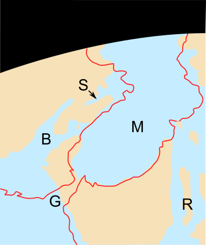
English: The palaeogeography of the Mediterranean region during the Messinian. After a "Google Earth" style mock-up, original paper unknown.
|
| Bron | Eigen werk |
| Auteur | Verisimilus |
Licentie
Ik, de auteursrechthebbende van dit werk, maak het hierbij onder de volgende licentie beschikbaar:
Dit bestand is gelicenseerd onder de Creative Commons-licentie Naamsvermelding 3.0 Unported
- De gebruiker mag:
- Delen – het werk kopiëren, verspreiden en doorgeven
- Remixen – afgeleide werken maken
- Onder de volgende voorwaarden:
- naamsvermelding – U moet op een gepaste manier aan naamsvermelding doen, een link naar de licentie geven, en aangeven of er wijzigingen in het werk zijn aangebracht. U mag dit op elke redelijke manier doen, maar niet zodanig dat de indruk wordt gewekt dat de licentiegever instemt met uw werk of uw gebruik van zijn werk.
Bestandsgeschiedenis
Klik op een datum/tijd om het bestand te zien zoals het destijds was.
| Datum/tijd | Miniatuur | Afmetingen | Gebruiker | Opmerking | |
|---|---|---|---|---|---|
| huidige versie | 24 jun 2011 15:01 | | 423 × 501 (24 kB) | Ciaurlec | Changed colours, to uniform all the palaeogeographic maps |
| 4 apr 2008 23:11 |  | 423 × 501 (29 kB) | Smith609 | {{Information |Description=The palaeogeography of the Mediterranean region during the Messinian. After a "Google Earth" style mock-up, original paper unknown. |Source=self-made |Date= |Author= Verisimilus |Permission= |other_versions |
Bestandsgebruik
Dit bestand wordt op de volgende pagina gebruikt:
Globaal bestandsgebruik
De volgende andere wiki's gebruiken dit bestand:
- Gebruikt op ca.wikipedia.org
- Gebruikt op de.wikipedia.org
- Gebruikt op en.wikipedia.org
- Gebruikt op es.wikipedia.org
- Gebruikt op hu.wikipedia.org
- Gebruikt op it.wikipedia.org
- Gebruikt op ru.wikipedia.org
- Gebruikt op zh.wikipedia.org