Bestand:Maricopa County Incorporated and Planning areas Peoria highlighted.svg

Afmetingen van deze voorvertoning van het type PNG van dit SVG-bestand: 694 × 599 pixels Andere resoluties: 278 × 240 pixels | 556 × 480 pixels | 889 × 768 pixels | 1.185 × 1.024 pixels | 2.371 × 2.048 pixels | 940 × 812 pixels.
Oorspronkelijk bestand (SVG-bestand, nominaal 940 × 812 pixels, bestandsgrootte: 1,05 MB)
| Dit is een bestand van Wikimedia Commons. Onderstaande beschrijving komt van de beschrijving van het bestand daar. |
Beschrijving
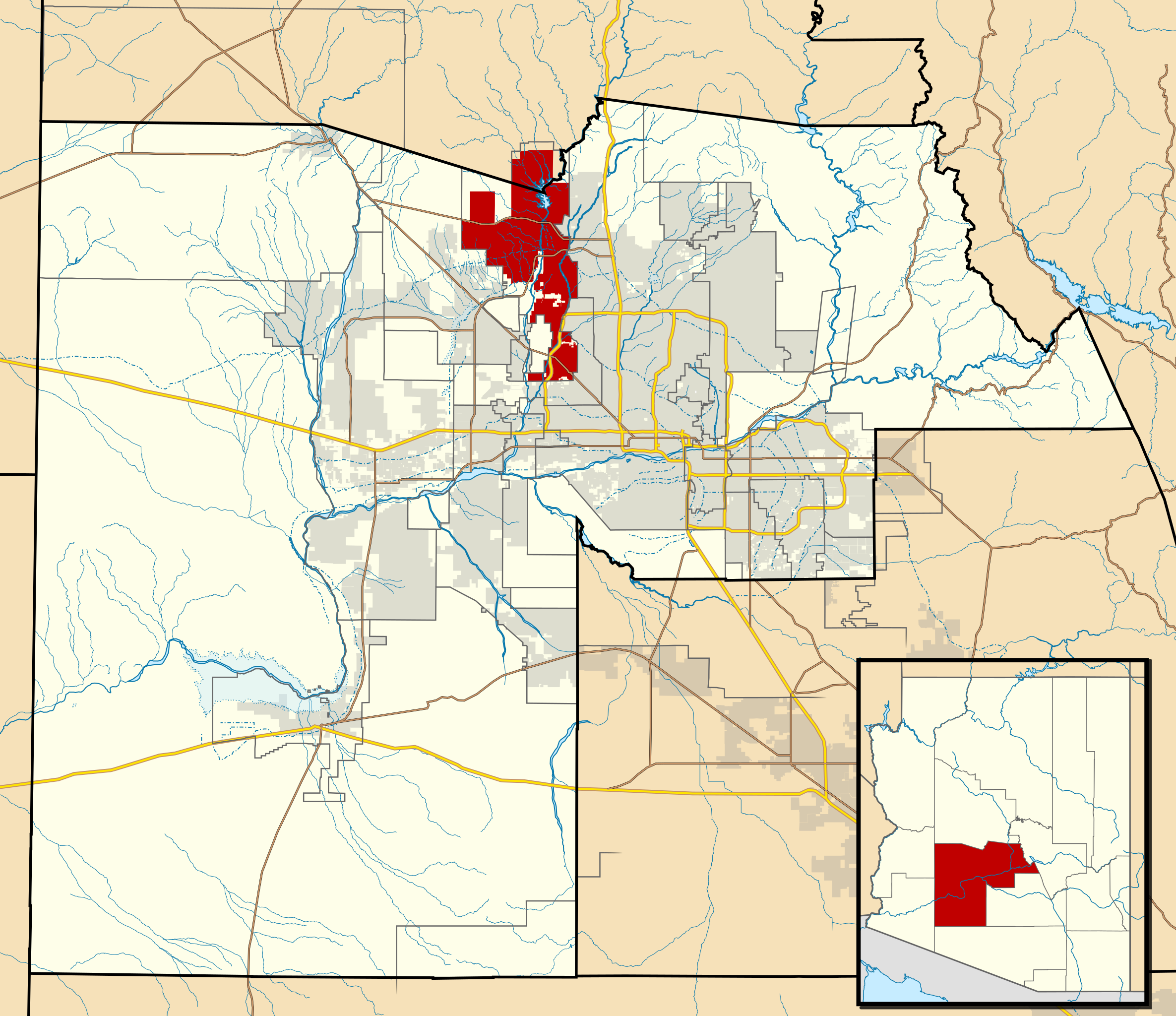
| Beschrijving | This map shows the incorporated areas and Indian reservation boundaries in Maricopa County, Arizona, along with water bodies and major highways and roads. Peoria is highlighted in red. Other incorporated cities are shown in gray, planning area borders for these cities and Indian reservation borders are shown as solid black lines. Changes from Previous Version: Updated the maps to include water bodies and to make "less boring" than the plain black/white/gray maps. Format was updated to match standards laid out by WikiProject Maps/Conventions. Map data is based on data from the following Webpage: Maricopa County Interactive GIS Map. I created this map in Inkscape. |
| Datum | |
| Bron | My own work, based on government information |
| Auteur | Ixnayonthetimmay |
| Toestemming (Hergebruik van dit bestand) |
Public Domain |
| Andere versies | See Category:Maps of Maricopa County for other versions of this image. |
Licentie
| Ik, de auteursrechthebbende van dit werk, geef dit werk vrij in het publieke domein. Dit is wereldwijd van toepassing. In sommige landen is dit wettelijk niet mogelijk; in die gevallen geldt: Ik sta iedereen toe dit werk voor eender welk doel te gebruiken, zonder enige voorwaarden, tenzij zulke voorwaarden door de wet worden voorgeschreven. |
Bestandsgeschiedenis
Klik op een datum/tijd om het bestand te zien zoals het destijds was.
| Datum/tijd | Miniatuur | Afmetingen | Gebruiker | Opmerking | |
|---|---|---|---|---|---|
| huidige versie | 20 mei 2011 08:39 | | 940 × 812 (1,05 MB) | Ixnayonthetimmay | Uploading new version |
| 30 aug 2008 06:33 |  | 900 × 800 (413 kB) | Ixnayonthetimmay | == Summary == {{Information |Description=This map shows the incorporated areas and unincorporated areas in Maricopa County, Arizona. [[:en:Paloma, Arizona|Pa | |
| 16 sep 2007 02:17 |  | 900 × 800 (384 kB) | Ixnayonthetimmay | {{Information |Description= |Source= |Date= |Author= |Permission= |other_versions= }} | |
| 28 mei 2007 12:10 |  | 900 × 780 (329 kB) | Ixnayonthetimmay | ||
| 22 mei 2007 02:54 |  | 900 × 780 (318 kB) | Ixnayonthetimmay | ||
| 30 jan 2007 07:21 |  | 904 × 758 (189 kB) | Ixnayonthetimmay | {{Information |Description=This map shows the incorporated areas in Maricopa County, Arizona, highlighting Peoria in red. It also shows the boundaries for the mun |
Bestandsgebruik
Dit bestand wordt op de volgende pagina gebruikt:
Globaal bestandsgebruik
De volgende andere wiki's gebruiken dit bestand:
- Gebruikt op azb.wikipedia.org
- Gebruikt op ceb.wikipedia.org
- Gebruikt op de.wikipedia.org
- Gebruikt op en.wikipedia.org
- Gebruikt op eo.wikipedia.org
- Gebruikt op fa.wikipedia.org
- Gebruikt op fi.wikipedia.org
- Gebruikt op ja.wikipedia.org
- Gebruikt op ml.wikipedia.org
- Gebruikt op pl.wikipedia.org
- Gebruikt op pt.wikipedia.org
- Gebruikt op sco.wikipedia.org
- Gebruikt op sr.wikipedia.org
- Gebruikt op sv.wikipedia.org
- Gebruikt op sw.wikipedia.org
- Gebruikt op ur.wikipedia.org
- Gebruikt op vi.wikipedia.org
- Gebruikt op zh.wikipedia.org