Bestand:Map of the RER Bruxelles - GEN Brussels.png

Grootte van deze voorvertoning: 779 × 600 pixels. Andere resoluties: 312 × 240 pixels | 623 × 480 pixels | 997 × 768 pixels | 1.280 × 986 pixels | 2.560 × 1.972 pixels | 2.746 × 2.115 pixels.
Oorspronkelijk bestand (2.746 × 2.115 pixels, bestandsgrootte: 7,03 MB, MIME-type: image/png)
| Dit is een bestand van Wikimedia Commons. Onderstaande beschrijving komt van de beschrijving van het bestand daar. |
Beschrijving
| Beschrijving |
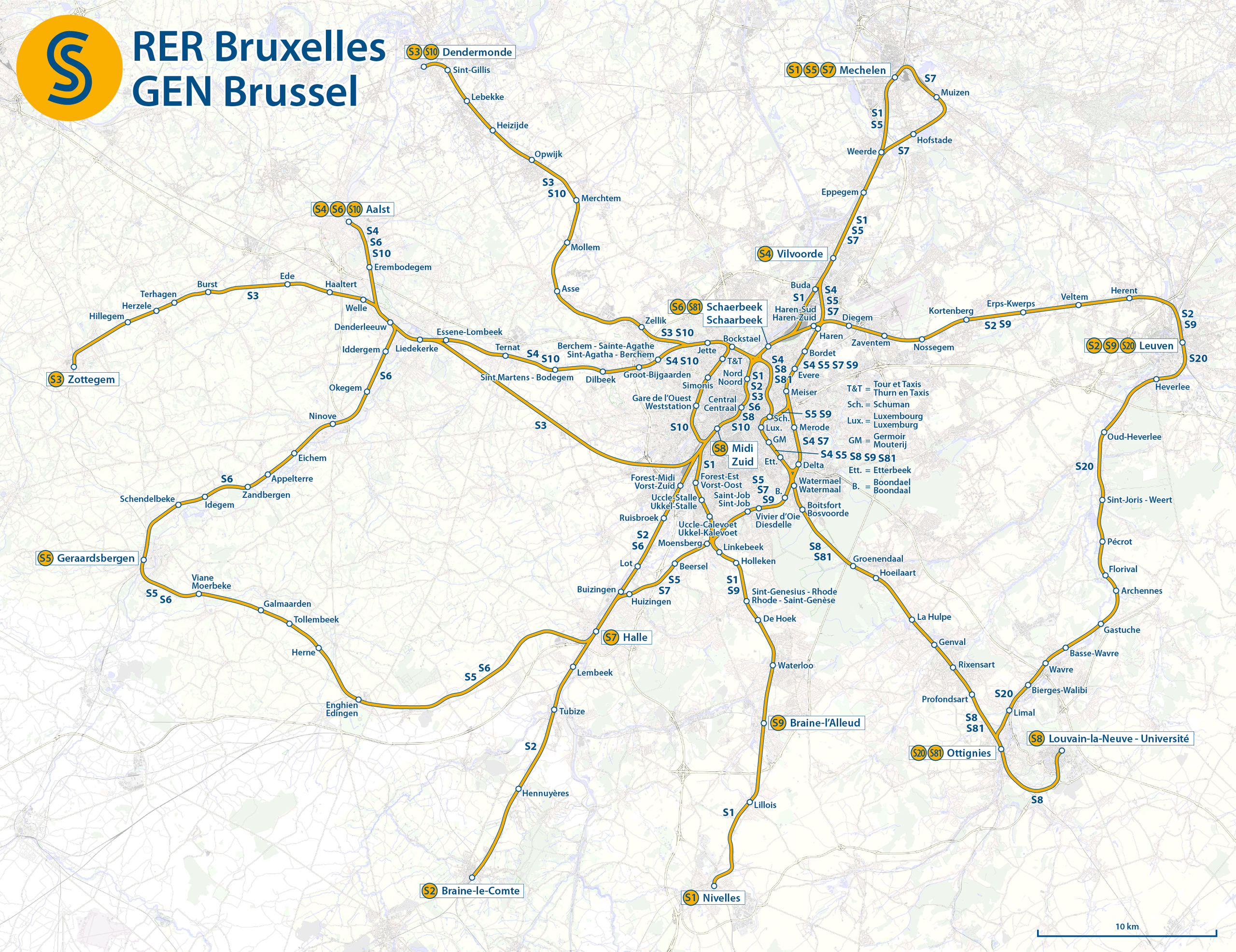
Deutsch: Karte der S-Bahn Brüssel
English: Map of the Brussels Regional Express Network
Français : Carte du Réseau express régional bruxellois (RER bruxellois, Train S)]]
Nederlands: Kaart van de Gewestelijk ExpresNet Brussel (GEN Brussel, S-Trein) |
|||
| Datum | see file history | |||
| Bron | Eigen werk, using OpenStreetMap data for the background | |||
| Auteur | Maximilian Dörrbecker (Chumwa) | |||
| Toestemming (Hergebruik van dit bestand) |
Dit bestand is gelicenseerd onder de Creative Commons-licentie Naamsvermelding-Gelijk delen 2.0 Unported
|

|
Deze kaartafbeelding zou opnieuw moeten worden aangemaakt als een SVG-bestand door vectorafbeeldingen te gebruiken. Dit heeft een aantal voordelen; zie Commons:Media for cleanup voor meer informatie. Als er een SVG-formaat van deze afbeelding bestaat, dan deze graag uploaden. Nadat u dit heeft gedaan, gelieve dit sjabloon te vervangen door het sjabloon {{vector version available|nieuwe bestandsnaam.svg}} op deze afbeeldingspagina.
|
Bestandsgeschiedenis
Klik op een datum/tijd om het bestand te zien zoals het destijds was.
| Datum/tijd | Miniatuur | Afmetingen | Gebruiker | Opmerking | |
|---|---|---|---|---|---|
| huidige versie | 9 feb 2016 08:12 | | 2.746 × 2.115 (7,03 MB) | Chumwa | |
| 8 feb 2016 23:10 |  | 2.746 × 2.115 (7,44 MB) | Chumwa | ||
| 7 feb 2016 11:43 |  | 2.746 × 2.115 (7,03 MB) | Chumwa | == {{int:filedesc}} == {{Information |Description = {{de|1=Karte der S-Bahn Brüssel}} {{en|1=Map of the Brussels Regional Express Network}} {{fr|1=Carte du Réseau express régional bruxellois (RER bruxellois, Train S)]]}} {{nl|1=Kaart van de Gewes... |
Bestandsgebruik
Dit bestand wordt op de volgende pagina gebruikt:
Globaal bestandsgebruik
De volgende andere wiki's gebruiken dit bestand:
- Gebruikt op de.wikipedia.org
- Gebruikt op de.wikivoyage.org
- Gebruikt op en.wikipedia.org
- Gebruikt op eu.wikipedia.org
- Gebruikt op fr.wikipedia.org
- Gebruikt op it.wikipedia.org
- Gebruikt op pl.wikipedia.org
- Gebruikt op ro.wikipedia.org
- Gebruikt op ru.wikipedia.org
- Gebruikt op www.wikidata.org
- Gebruikt op zh.wikipedia.org