Bestand:Map Whole East Bay.jpg

Grootte van deze voorvertoning: 799 × 600 pixels. Andere resoluties: 320 × 240 pixels | 640 × 480 pixels | 818 × 614 pixels.
Oorspronkelijk bestand (818 × 614 pixels, bestandsgrootte: 269 kB, MIME-type: image/jpeg)
| Dit is een bestand van Wikimedia Commons. Onderstaande beschrijving komt van de beschrijving van het bestand daar. |
Beschrijving
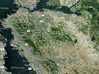
| Beschrijving | Map of the East Bay - color-coded |
| Datum | |
| Bron | NASA World Wind |
| Auteur | Boereck 17:27, 25 May 2006 (UTC) |
Licentie
| Deze afbeelding bevindt zich in het publiek domein omdat het een screenshot is van NASA’s software World Wind die gebruik maakt van een publiek domein-laag, zoals Blue Marble, MODIS, Landsat, SRTM, USGS of GLOBE.
|
 |
Bestandsgeschiedenis
Klik op een datum/tijd om het bestand te zien zoals het destijds was.
| Datum/tijd | Miniatuur | Afmetingen | Gebruiker | Opmerking | |
|---|---|---|---|---|---|
| huidige versie | 25 mei 2006 19:25 | | 818 × 614 (269 kB) | Boereck | == Summary == {{Information| |Description= Map of the East Bay - color-coded |Source= NASA World Wind |Date= 05/23/2006 |Author= Boereck 15:27, 23 May 2006 (UTC) |Permission= see below |other_versions= }} == Licensing == {{PD-WorldWind}} |
Bestandsgebruik
Dit bestand wordt op de volgende pagina gebruikt:
Globaal bestandsgebruik
De volgende andere wiki's gebruiken dit bestand:
- Gebruikt op en.wikipedia.org
- User:Staeiou
- User:Coro
- User:Hno3
- Category:Wikipedians in the East Bay (San Francisco Bay Area)
- Portal:San Francisco Bay Area
- Portal:San Francisco Bay Area/Selected articles
- User:ConradPino
- Template:User SF East Bay Area
- User:Paul Italiano/Userbox
- User:Jeffholton
- User:WikiWikiWayne
- User:Willy388
- User:Gpanger
- Wikipedia:Userboxes/Location/United States/Other locations
- Wikipedia talk:WikiProject Userboxes/Ideas/Archive 23
- Gebruikt op es.wikipedia.org
- Gebruikt op fr.wikipedia.org
- Gebruikt op ja.wikipedia.org
- Gebruikt op simple.wikipedia.org