Bestand:Map-Prussia-PWP.svg

Afmetingen van deze voorvertoning van het type PNG van dit SVG-bestand: 706 × 600 pixels Andere resoluties: 283 × 240 pixels | 565 × 480 pixels | 904 × 768 pixels | 1.205 × 1.024 pixels | 2.410 × 2.048 pixels | 1.185 × 1.007 pixels.
Oorspronkelijk bestand (SVG-bestand, nominaal 1.185 × 1.007 pixels, bestandsgrootte: 591 kB)
| Dit is een bestand van Wikimedia Commons. Onderstaande beschrijving komt van de beschrijving van het bestand daar. |
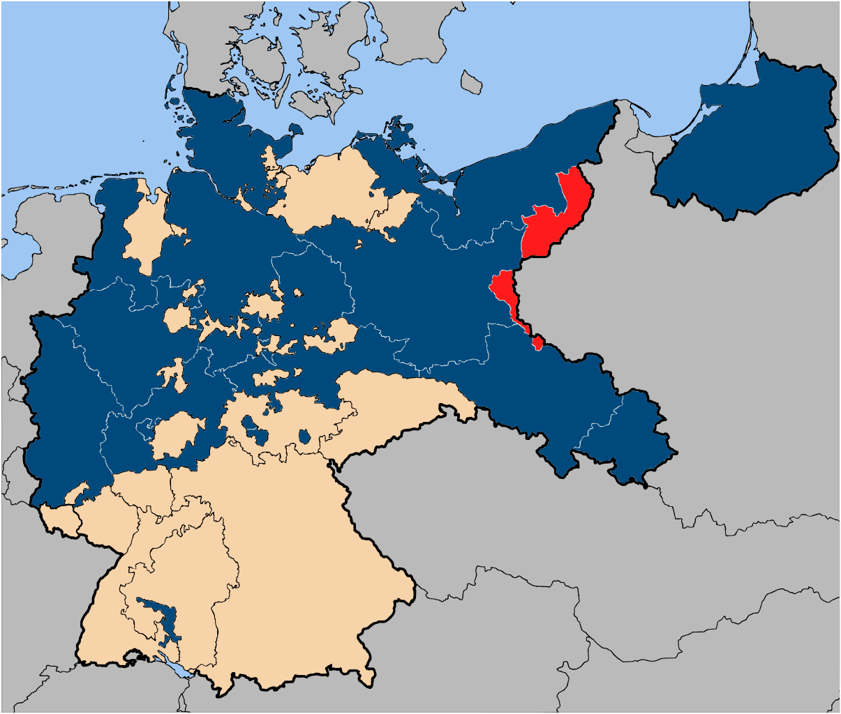
| Beschrijving | The province of Posen-West Prussia (red), within the Free State of Prussia (blue). |
| Datum | |
| Bron | Based on map data of the IEG-Maps project (Andreas Kunz, B. Johnen and Joachim Robert Moeschl: University of Mainz) - http://www.ieg-maps.uni-mainz.de |
| Auteur | User:52 Pickup |
| Toestemming (Hergebruik van dit bestand) |
Dit bestand is gelicenseerd onder de Creative Commons-licentie Naamsvermelding-Gelijk delen 2.5 Unported
|
Bestandsgeschiedenis
Klik op een datum/tijd om het bestand te zien zoals het destijds was.
| Datum/tijd | Miniatuur | Afmetingen | Gebruiker | Opmerking | |
|---|---|---|---|---|---|
| huidige versie | 14 jan 2007 11:05 | | 1.185 × 1.007 (591 kB) | 52 Pickup | {{Information| |Description=The province of {{link|Posen-West Prussia}} (red), within the {{link|Free State of Prussia}} (blue). |Source= Based on map data of the IEG-Maps project (Andreas Kunz, B. Johnen and Joachim Robert Moeschl: University of Mainz) |
Bestandsgebruik
Geen enkele pagina gebruikt dit bestand.
Globaal bestandsgebruik
De volgende andere wiki's gebruiken dit bestand:
- Gebruikt op de.wikipedia.org
- Gebruikt op eo.wikipedia.org
- Gebruikt op fr.wikipedia.org