Bestand:Maastricht1749LarcherDAubencourt2 (detail Vrijthof & 1e stadsmuur).jpg

Grootte van deze voorvertoning: 625 × 600 pixels. Andere resoluties: 250 × 240 pixels | 500 × 480 pixels | 801 × 768 pixels | 1.068 × 1.024 pixels | 1.301 × 1.248 pixels.
Oorspronkelijk bestand (1.301 × 1.248 pixels, bestandsgrootte: 658 kB, MIME-type: image/jpeg)
| Dit is een bestand van Wikimedia Commons. Onderstaande beschrijving komt van de beschrijving van het bestand daar. |
Beschrijving
| Beschrijving |
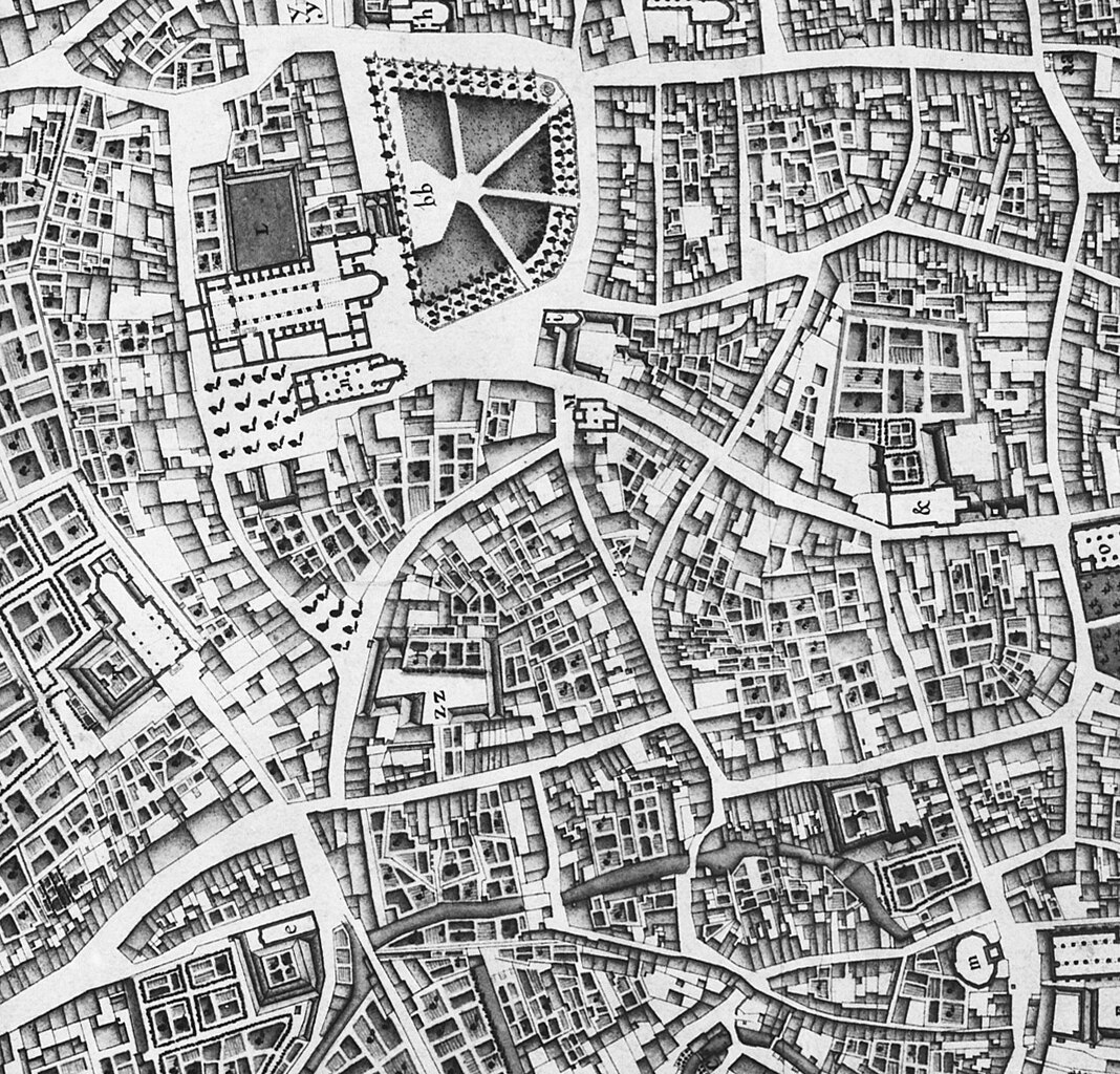
English: Maastricht, the Netherlands. Part of a map showing the southwestern part of the city in 1749. The map by French military engineer Jean-Baptiste Larcher d'Aubencourt was used to build the Maquette of Maastricht (1752), now in the Musée de Beaux Arts in Lille, France. The map (or a copy?) is in the collection of RHCL archives, Maastricht. |
| Datum | |
| Bron | http://beeldbank.cultureelerfgoed.nl/alle-afbeeldingen/weergave/search/layout/result/indeling/detail/start/2?searchfield=Larcher+d%5C%5C%5C%27Aubancourt |
| Auteur | Jean-Baptiste Larcher d'Aubencourt (1716–1796) |
| Andere versies |

.jpg)
Licentie
|
Dit werk bevindt zich in het publiek domein in landen en gebieden waar de auteursrechttermijn het leven van de auteur plus 100 jaar of minder is. | |
| Van dit bestand is vastgesteld dat er geen bekende auteursrechtaanspraken op rusten, alle aanverwante en naburige rechten daarbij inbegrepen. | |
Bestandsgeschiedenis
Klik op een datum/tijd om het bestand te zien zoals het destijds was.
| Datum/tijd | Miniatuur | Afmetingen | Gebruiker | Opmerking | |
|---|---|---|---|---|---|
| huidige versie | 19 jan 2024 18:46 | | 1.301 × 1.248 (658 kB) | Kleon3 | File:Maastricht1749LarcherDAubencourt2.jpg cropped 55 % horizontally, 42 % vertically, rotated -0.76° using CropTool with precise mode. |
Bestandsgebruik
Dit bestand wordt op de volgende pagina gebruikt:
.jpg)