Bestand:KiskaMap.jpg

Grootte van deze voorvertoning: 666 × 599 pixels. Andere resoluties: 267 × 240 pixels | 533 × 480 pixels | 1.000 × 900 pixels.
Oorspronkelijk bestand (1.000 × 900 pixels, bestandsgrootte: 248 kB, MIME-type: image/jpeg)
| Dit is een bestand van Wikimedia Commons. Onderstaande beschrijving komt van de beschrijving van het bestand daar. |
Beschrijving
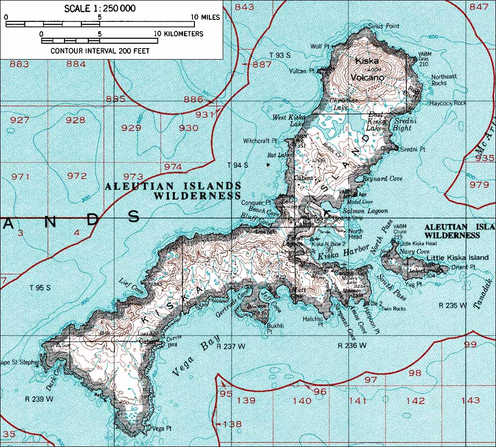
| Beschrijving | USGS map |
| Bron | http://www.skimountaineer.com/ROF/NorAm/Kiska/KiskaMap.jpg Originally from en.wikipedia; description page is/was here. |
| Auteur |
Licentie
Deze afbeelding bevindt zich in het publiek domein omdat het materiaal bevat dat oorspronkelijk afkomstig is van de United States Geological Survey, een agentschap van de United States Department of the Interior. Voor meer informatie, zie het officiële USGS-auteursrechtenbeleid
|
Oorspronkelijk uploadlogboek
(All user names refer to en.wikipedia)
- 2004-08-06 23:55 Foriskak 1000×900×8 (253710 bytes) from <http://www.skimountaineer.com/ROF/NorAm/Kiska/KiskaMap.jpg> USGS map {{noncommercial}}
Bestandsgeschiedenis
Klik op een datum/tijd om het bestand te zien zoals het destijds was.
| Datum/tijd | Miniatuur | Afmetingen | Gebruiker | Opmerking | |
|---|---|---|---|---|---|
| huidige versie | 6 apr 2007 18:53 | | 1.000 × 900 (248 kB) | Vaya | {{Information |Description=from <http://www.skimountaineer.com/ROF/NorAm/Kiska/KiskaMap.jpg> USGS map |Source=Originally from [http://en.wikipedia.org en.wikipedia]; description page is/was [http://en.wikipedia.org/w/index.php?title=Image%3AKiskaMap.jpg h |
Bestandsgebruik
Dit bestand wordt op de volgende 2 pagina's gebruikt:
Globaal bestandsgebruik
De volgende andere wiki's gebruiken dit bestand:
- Gebruikt op az.wikipedia.org
- Gebruikt op ca.wikipedia.org
- Gebruikt op ceb.wikipedia.org
- Gebruikt op cs.wikipedia.org
- Gebruikt op de.wikipedia.org
- Gebruikt op en.wikipedia.org
- Gebruikt op eo.wikipedia.org
- Gebruikt op es.wikipedia.org
- Gebruikt op es.wikibooks.org
- Gebruikt op fa.wikipedia.org
- Gebruikt op fr.wikipedia.org
- Gebruikt op he.wikipedia.org
- Gebruikt op he.wiktionary.org
- Gebruikt op it.wikipedia.org
- Gebruikt op ja.wikipedia.org
- Gebruikt op ko.wikipedia.org
- Gebruikt op nn.wikipedia.org
- Gebruikt op no.wikipedia.org
- Gebruikt op pl.wikipedia.org
- Gebruikt op pt.wikipedia.org
- Gebruikt op ru.wikipedia.org
- Gebruikt op uk.wikipedia.org
- Gebruikt op www.wikidata.org
- Gebruikt op zh.wikipedia.org