Bestand:JesuitChineseWorldMapEarly17thCentury.jpg
Oorspronkelijk bestand (2.924 × 1.462 pixels, bestandsgrootte: 1,36 MB, MIME-type: image/jpeg)
| Dit is een bestand van Wikimedia Commons. Onderstaande beschrijving komt van de beschrijving van het bestand daar. |
Beschrijving
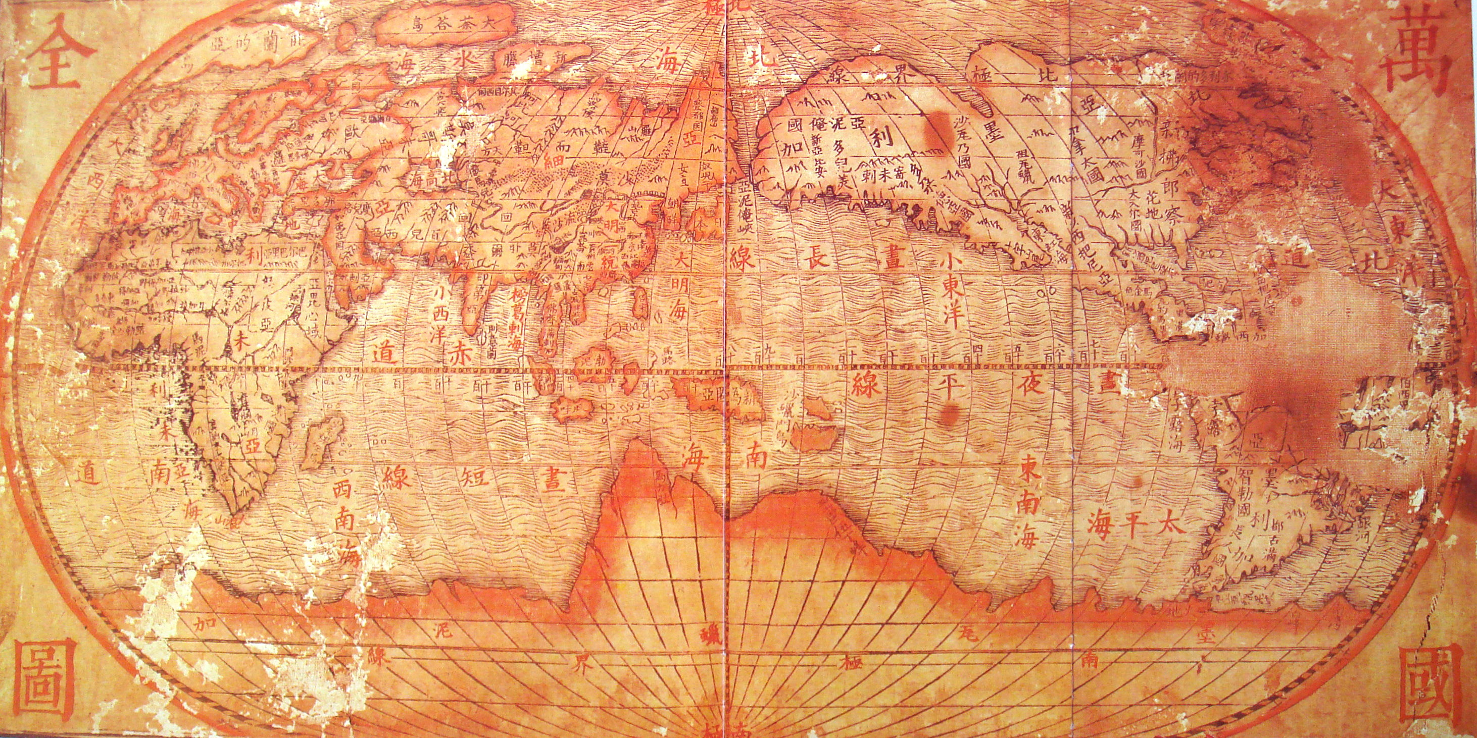
| Beschrijving | Chinese world map, drawn by the Jesuits (early 17th century). Reproduction in "Historic Maritime Maps" Donald Wigal |
| Datum | Early 17th century (Ming period) |
| Bron | 17th century Chinese map. |
| Auteur | Onbekend |
| Andere versies |
|

Licentie
|
Het tweedimensionale kunstwerk afgebeeld op deze afbeelding valt in het publiek domein omdat:
Reproducties van het werk kunnen ook worden beschouwd als publiek domein omdat ze geen oorspronkelijk karakter hebben. Dit geldt voor reproducties gemaakt in de Verenigde Staten (zie Bridgeman Art Library v. Corel Corp.), Duitsland en veel andere landen. {{PD-Art}} template without license parameter: please specify why the underlying work is public domain in both the source country and the United States
(Usage: {{PD-Art|1=|deathyear=''year of author's death''|country=''source country''}}, where parameter 1= can be PD-old-auto, PD-old-auto-expired, PD-old-auto-1996, PD-old-100 or similar. See Commons:Multi-license copyright tags for more information.) | ||||
Bestandsgeschiedenis
Klik op een datum/tijd om het bestand te zien zoals het destijds was.
| Datum/tijd | Miniatuur | Afmetingen | Gebruiker | Opmerking | |
|---|---|---|---|---|---|
| huidige versie | 24 apr 2008 09:30 | | 2.924 × 1.462 (1,36 MB) | World Imaging | {{Information |Description=Chinese world map, drawn by the Jesuits (early 17th century). Reproduction in "Historic Maritime Maps" Donald Wigal |Source=17th century Chinese map. |Date=Early 17th century (Ming period) |Author=Unknown |Permission= |other_ver |
Bestandsgebruik
Dit bestand wordt op de volgende pagina gebruikt:
Globaal bestandsgebruik
De volgende andere wiki's gebruiken dit bestand:
- Gebruikt op cs.wikipedia.org
- Gebruikt op en.wikipedia.org
- Gebruikt op es.wikipedia.org
- Gebruikt op fr.wikipedia.org
- Gebruikt op id.wikipedia.org
- Gebruikt op it.wikipedia.org
- Gebruikt op lmo.wikipedia.org
- Gebruikt op ms.wikipedia.org
- Gebruikt op ru.wikipedia.org
- Gebruikt op sk.wikipedia.org
- Gebruikt op uk.wikipedia.org
- Gebruikt op www.wikidata.org
- Gebruikt op zh.wikipedia.org