Bestand:Henichesk Strait.jpg
Grootte van deze voorvertoning: 800 × 543 pixels. Andere resoluties: 320 × 217 pixels | 640 × 434 pixels | 960 × 651 pixels.
Oorspronkelijk bestand (960 × 651 pixels, bestandsgrootte: 76 kB, MIME-type: image/jpeg)
| Dit is een bestand van Wikimedia Commons. Onderstaande beschrijving komt van de beschrijving van het bestand daar. |
Beschrijving
| Beschrijving |
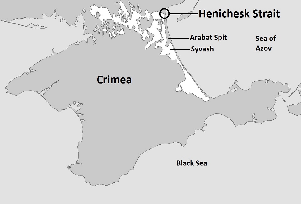
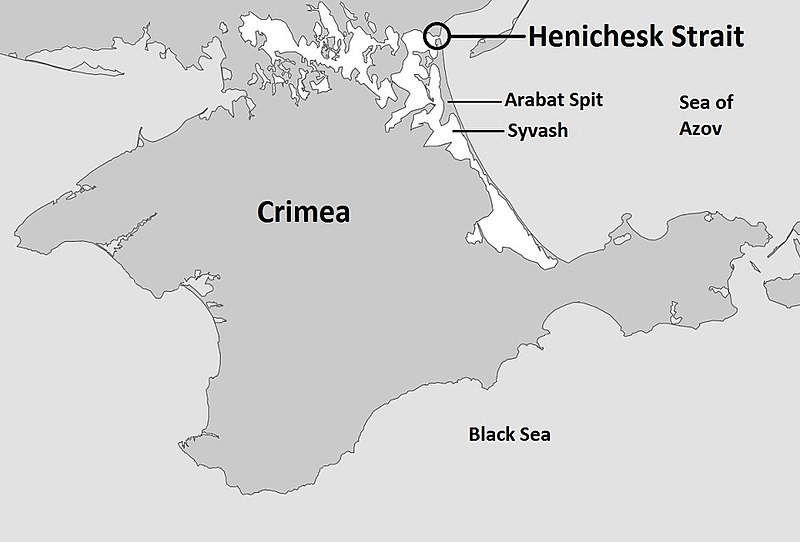
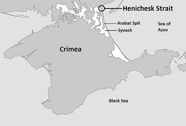
English: Map of the entire Crimea highlighting the Henichesk Strait, the body of water separating the Syvash with the Sea of Azov |
| Datum | |
| Bron | Eigen werk gebaseerd op: Sevastopol location map.svg |
| Auteur | Kelvinsong |
Licentie
| Dit werk vrijgegeven in het publieke domein door de auteur, Kelvinsong. Dit is wereldwijd van toepassing. In sommige landen is dit wettelijk niet mogelijk; in die gevallen geldt: |
Bestandsgeschiedenis
Klik op een datum/tijd om het bestand te zien zoals het destijds was.
| Datum/tijd | Miniatuur | Afmetingen | Gebruiker | Opmerking | |
|---|---|---|---|---|---|
| huidige versie | 5 okt 2014 07:10 | | 960 × 651 (76 kB) | Herostratus | ==Summary== {{Information |Description = Map of the entire Crimea highlighting the Syvash, the body of water separating the Crimea from the Ukraine |Source = https://commons.wikimedia.org/wiki/File:Sevastopol_location_map.svg |Date = 1 March 2014 (date... |
Bestandsgebruik
Dit bestand wordt op de volgende pagina gebruikt:
Globaal bestandsgebruik
De volgende andere wiki's gebruiken dit bestand:
- Gebruikt op en.wikipedia.org
- Gebruikt op hr.wikipedia.org
- Gebruikt op sv.wikipedia.org