Bestand:Hampshire UK relief location map.jpg
Grootte van deze voorvertoning: 704 × 599 pixels. Andere resoluties: 282 × 240 pixels | 564 × 480 pixels | 902 × 768 pixels | 1.203 × 1.024 pixels | 1.999 × 1.702 pixels.
Oorspronkelijk bestand (1.999 × 1.702 pixels, bestandsgrootte: 407 kB, MIME-type: image/jpeg)
| Dit is een bestand van Wikimedia Commons. Onderstaande beschrijving komt van de beschrijving van het bestand daar. |
| Beschrijving |
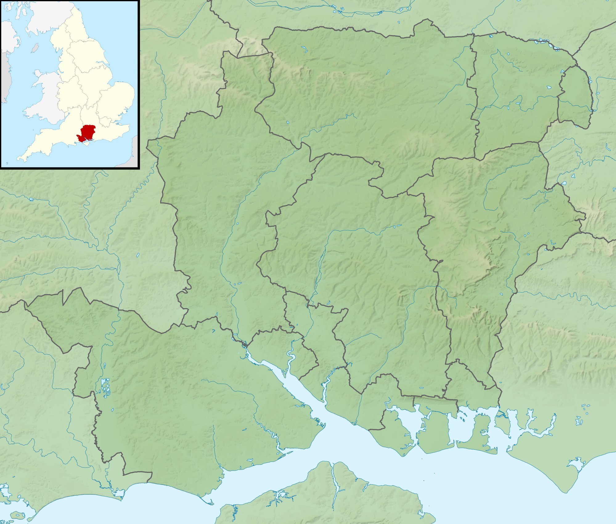
Relief map of Hampshire, UK. Equirectangular map projection on WGS 84 datum, with N/S stretched 155% Geographic limits:
|
| Datum | |
| Bron |
|
| Auteur | Nilfanion, created using Ordnance Survey data |
| Toestemming (Hergebruik van dit bestand) |
Dit bestand is gelicenseerd onder de Creative Commons-licentie Naamsvermelding-Gelijk delen 3.0 Unported Naamsvermelding: Contains Ordnance Survey data © Crown copyright and database right
|
| Andere versies | File:Hampshire UK district map (blank).svg - Blank map |
.svg)
Bestandsgeschiedenis
Klik op een datum/tijd om het bestand te zien zoals het destijds was.
| Datum/tijd | Miniatuur | Afmetingen | Gebruiker | Opmerking | |
|---|---|---|---|---|---|
| huidige versie | 29 nov 2011 03:39 | | 1.999 × 1.702 (407 kB) | Nilfanion | {{Information |Description=Relief map of Hampshire, UK. Equirectangular map projection on WGS 84 datum, with N/S stretched 155% Geographic limits: *West: 2.01W *East: 0.68W *North: 51.41N *South: 50.68N |Source=[[w:Ordnance Survey|Ordnan |
Bestandsgebruik
Dit bestand wordt op de volgende 2 pagina's gebruikt:
Globaal bestandsgebruik
De volgende andere wiki's gebruiken dit bestand:
- Gebruikt op ar.wikipedia.org
- Gebruikt op bg.wikipedia.org
- Gebruikt op ceb.wikipedia.org
- Gebruikt op en.wikipedia.org
- The Solent
- River Hamble
- Twyford Down
- Battle of Alton
- Lymington River
- Battle of the Solent
- Butser Hill
- Pilot Hill, Hampshire
- Battle of Cheriton
- River Alre
- Bartley Water
- Monks Brook
- List of hillforts in England
- Portsmouth and Southsea Synagogue
- Solent Rescue
- Dark Water (river)
- Siege of Basing House
- Gosport and Fareham Inshore Rescue Service
- Ladle Hill
- William Ogle, 1st Viscount Ogle
- Avon Water, Hampshire
- Hayling Island Lifeboat Station
- Portsmouth Lifeboat Station
- Calshot Lifeboat Station
- River Slea, Hampshire
- River Hart
- Philips PFA Golf Classic
- User:Que/sandbox
- Module:Location map/data/United Kingdom Hampshire
- Module:Location map/data/Hampshire
- Module:Location map/data/United Kingdom Hampshire/doc
- Humphrey Bennet
- Fleet Brook
- User:Que/hillforts
- Gebruikt op es.wikipedia.org
Globaal gebruik van dit bestand bekijken.