Bestand:Haiti relief location map.jpg

Grootte van deze voorvertoning: 770 × 599 pixels. Andere resoluties: 308 × 240 pixels | 617 × 480 pixels | 987 × 768 pixels | 1.156 × 900 pixels.
Oorspronkelijk bestand (1.156 × 900 pixels, bestandsgrootte: 314 kB, MIME-type: image/jpeg)
| Dit is een bestand van Wikimedia Commons. Onderstaande beschrijving komt van de beschrijving van het bestand daar. |
Beschrijving
| Beschrijving |
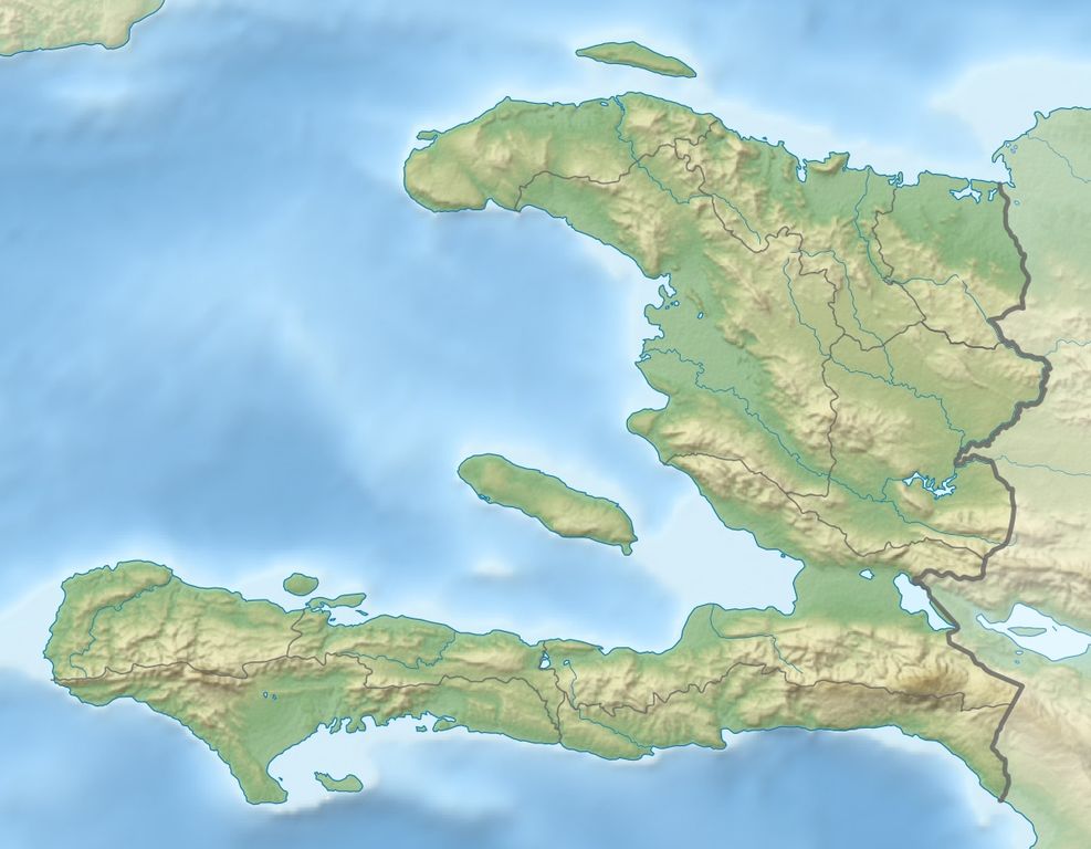
Deutsch: Physische Positionskarte Haiti mit Départements, Quadratische Plattkarte, N-S-Streckung 105 %. Geographische Begrenzung der Karte:
English: Physical Location map Haiti with departements, Equirectangular projection, N/S stretching 105 %. Geographic limits of the map:
|
| Datum | |
| Bron | Eigen werk, SRTM3, ETOPO1, VMAP0, OpenStreetMap for departements boundaries |
| Auteur | Alexrk2 |
| Toestemming (Hergebruik van dit bestand) |
All OpenStreetMap data and maps are Creative Commons "CC-BY-SA 2.0" licensed |
| Andere versies |
|


|
Deze kaart is gemaakt of verbeterd in de Duitse Kartenwerkstatt (Map Lab). Je kunt ook zelf kaarten ter verbetering voorstellen.
|
Licentie
Ik, de auteursrechthebbende van dit werk, maak het hierbij onder de volgende licentie beschikbaar:
Dit bestand is gelicenseerd onder de Creative Commons-licentie Naamsvermelding-Gelijk delen 3.0 Unported
- De gebruiker mag:
- Delen – het werk kopiëren, verspreiden en doorgeven
- Remixen – afgeleide werken maken
- Onder de volgende voorwaarden:
- naamsvermelding – U moet op een gepaste manier aan naamsvermelding doen, een link naar de licentie geven, en aangeven of er wijzigingen in het werk zijn aangebracht. U mag dit op elke redelijke manier doen, maar niet zodanig dat de indruk wordt gewekt dat de licentiegever instemt met uw werk of uw gebruik van zijn werk.
- Gelijk delen – Als u het werk heeft geremixt, veranderd, of erop heeft voortgebouwd, moet u het gewijzigde materiaal verspreiden onder dezelfde licentie als het oorspronkelijke werk, of een daarmee compatibele licentie.
Bestandsgeschiedenis
Klik op een datum/tijd om het bestand te zien zoals het destijds was.
| Datum/tijd | Miniatuur | Afmetingen | Gebruiker | Opmerking | |
|---|---|---|---|---|---|
| huidige versie | 8 feb 2010 19:29 | | 1.156 × 900 (314 kB) | Alexrk2 | == Summary == {{Information |Description= {{de|Physische Positionskarte Haiti mit Départements, Quadratische Plattkarte, N-S-Streckung 105 %. Geographische Begrenzung der Karte:}} {{en|Physical Location map Haiti with departem |
Bestandsgebruik
Dit bestand wordt op de volgende 21 pagina's gebruikt:
- Aardbeving Haïti 2010
- Aardbeving Haïti 2021
- Chaîne des Matheux
- Massif de la Hotte
- Massif de la Selle
- Massif du Nord
- Meer van Miragoâne
- Montagne Terrible
- Montagnes Noires (Haïti)
- Montagnes du Trou d'Eau
- Morne Bois-Pin
- Morne Degas
- Morne Jean
- Nationaal park La Visite
- Nationaal park Pic Macaya
- Pic Macaya
- Pic la Selle
- Péligre
- Trou Caïman
- Étang Saumâtre
- Sjabloon:Positiekaart Haïti
Globaal bestandsgebruik
De volgende andere wiki's gebruiken dit bestand:
- Gebruikt op ar.wikipedia.org
- Gebruikt op ast.wikipedia.org
- Gebruikt op az.wikipedia.org
- Gebruikt op ba.wikipedia.org
- Gebruikt op be.wikipedia.org
- Gebruikt op bg.wikipedia.org
- Gebruikt op bn.wikipedia.org
- Gebruikt op bs.wikipedia.org
- Gebruikt op ceb.wikipedia.org
- Gebruikt op ce.wikipedia.org
- Gebruikt op ckb.wikipedia.org
- Gebruikt op cs.wikipedia.org
- Gebruikt op da.wikipedia.org
- Gebruikt op de.wikipedia.org
- Haiti
- Île de la Tortue
- Vorlage:Positionskarte Haiti
- Pic la Selle
- Île de la Gonâve
- Wikipedia:Kartenwerkstatt/Positionskarten/Nordamerika
- Golf von Gonâve
- Erdbeben in Haiti 2010
- Île à Vache
- Cayemites
- Vorlage Diskussion:Infobox Erdbeben
- Kaiserreich Haiti (1804–1806)
- Erdbeben in Haiti 2018
- Erdbeben in Haiti 2021
- Étang Saumâtre
Globaal gebruik van dit bestand bekijken.