Bestand:Clingman's Dome Tower on a Sunny, Snowy Day.JPG

Grootte van deze voorvertoning: 800 × 600 pixels. Andere resoluties: 320 × 240 pixels | 640 × 480 pixels | 1.024 × 768 pixels | 1.280 × 960 pixels | 2.592 × 1.944 pixels.
Oorspronkelijk bestand (2.592 × 1.944 pixels, bestandsgrootte: 959 kB, MIME-type: image/jpeg)
| Dit is een bestand van Wikimedia Commons. Onderstaande beschrijving komt van de beschrijving van het bestand daar. |
|
Dit is een foto van een object in het National Register of Historic Places met nummer 12000515. |
Beschrijving
| Beschrijving |
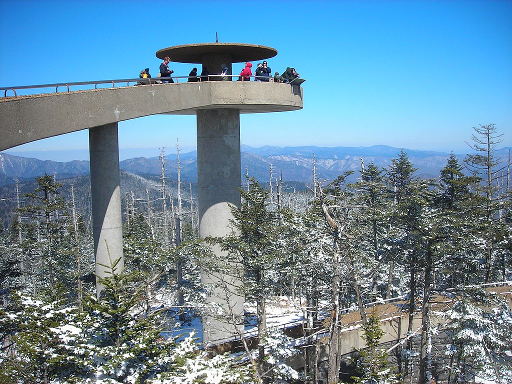
English: The Clingman's Dome Observation Tower rises 50 feet (15 m) from the summit of Clingman's Dome, the highest point both in the state of Tennessee and along the Appalachian Trail, in Great Smoky Mountains National Park. |
| Datum | |
| Bron | Eigen werk |
| Auteur | Scott Basford |
| Objectlocatie | | Deze en andere afbeeldingen in: OpenStreetMap |
|---|
Licentie
| Dit werk vrijgegeven in het publieke domein door de auteur, I, Blinutne. Dit is wereldwijd van toepassing. In sommige landen is dit wettelijk niet mogelijk; in die gevallen geldt: I, Blinutne staat iedereen toe dit werk voor eender welk doel te gebruiken, zonder enige voorwaarden, tenzij zulke voorwaarden door de wet worden voorgeschreven. |
Bestandsgeschiedenis
Klik op een datum/tijd om het bestand te zien zoals het destijds was.
| Datum/tijd | Miniatuur | Afmetingen | Gebruiker | Opmerking | |
|---|---|---|---|---|---|
| huidige versie | 24 jul 2007 01:37 | | 2.592 × 1.944 (959 kB) | Blinutne | {{Information |Description= The Clingman's Dome Observation Tower rises fifty feet from the pinnacle of Clingman's Dome, the highest point both in the state of Tennessee and along the Appalachian Trail, in the Great Smoky Mountains National Park. |Source= |
Bestandsgebruik
Dit bestand wordt op de volgende pagina gebruikt:
Globaal bestandsgebruik
De volgende andere wiki's gebruiken dit bestand:
- Gebruikt op ar.wikipedia.org
- Gebruikt op ca.wikipedia.org
- Gebruikt op da.wikipedia.org
- Gebruikt op de.wikipedia.org
- Gebruikt op en.wikipedia.org
- Great Smoky Mountains National Park
- Clingmans Dome
- Mountains-to-Sea Trail
- Mission 66
- National Register of Historic Places listings in Sevier County, Tennessee
- National Register of Historic Places listings in Swain County, North Carolina
- National Register of Historic Places listings in Great Smoky Mountains National Park
- List of federal lands in Tennessee
- Protected areas of North Carolina
- Gebruikt op fr.wikipedia.org
- Gebruikt op he.wikipedia.org
- Gebruikt op he.wikivoyage.org
- Gebruikt op hy.wikipedia.org
- Gebruikt op it.wikipedia.org
- Gebruikt op ja.wikipedia.org
- Gebruikt op kk.wikipedia.org
- Gebruikt op la.wikipedia.org
- Gebruikt op no.wikipedia.org
- Gebruikt op pl.wikipedia.org
- Gebruikt op pt.wikipedia.org
- Gebruikt op ru.wikipedia.org
- Gebruikt op tr.wikipedia.org
- Gebruikt op uk.wikipedia.org
- Gebruikt op ur.wikipedia.org