Bestand:Cape Dezhnev USCGS 1937.PNG
Grootte van deze voorvertoning: 800 × 350 pixels. Andere resoluties: 320 × 140 pixels | 816 × 357 pixels.
Oorspronkelijk bestand (816 × 357 pixels, bestandsgrootte: 567 kB, MIME-type: image/png)
| Dit is een bestand van Wikimedia Commons. Onderstaande beschrijving komt van de beschrijving van het bestand daar. |
Beschrijving
| Beschrijving |
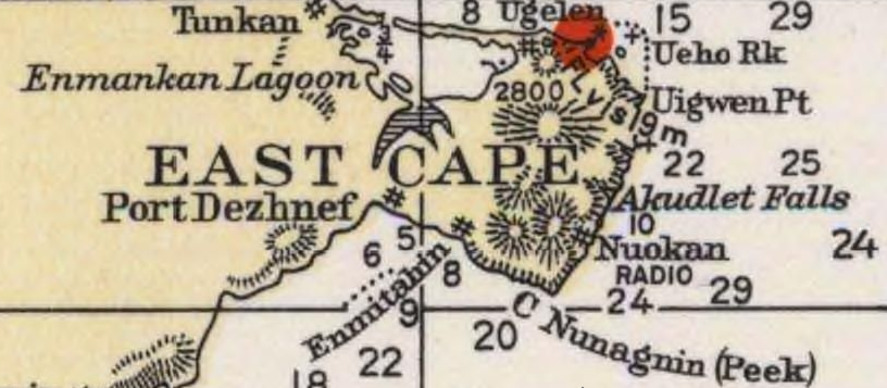
English: Detail of 1937 USCGS Bering Sea ahowing Cape Dezhnev aka East Cape with geographical features and villages marked. |
| Datum | |
| Bron | Historical Maps and Charts Project, Office of Coast Survey, US NOAA Bering Sea Chart 9302 6_1937 http://historicalcharts.noaa.gov/historicals/historical_zoom.asp |
| Auteur | USCGS |
Licentie
Deze afbeelding is in het publiek domein omdat het materiaal bevat dat oorspronkelijk van de National Oceanic and Atmospheric Administration kwam in de Verenigde Staten en genomen of gemaakt is tijdens de officiële werkzaamheden van een werknemer.
|
Bestandsgeschiedenis
Klik op een datum/tijd om het bestand te zien zoals het destijds was.
| Datum/tijd | Miniatuur | Afmetingen | Gebruiker | Opmerking | |
|---|---|---|---|---|---|
| huidige versie | 21 dec 2009 02:20 | | 816 × 357 (567 kB) | Dankarl | {{Information |Description={{en|1=Detail of 1937 USCGS Bering Sea ahowing Cape Dezhnev aka East Cape with geographical features and villages marked. }} |Source=Historical Maps and Charts Project, Office of Coast Survey, US NOAA Bering Sea Chart 9302 6_19 |
Bestandsgebruik
Globaal bestandsgebruik
De volgende andere wiki's gebruiken dit bestand:
- Gebruikt op de.wikipedia.org
- Gebruikt op en.wikipedia.org
- Gebruikt op et.wikipedia.org
- Gebruikt op fi.wikipedia.org
- Gebruikt op fr.wikipedia.org
- Gebruikt op ja.wikipedia.org
- Gebruikt op zh.wikipedia.org