Bestand:Angus UK relief location map.jpg

Grootte van deze voorvertoning: 611 × 600 pixels. Andere resoluties: 244 × 240 pixels | 489 × 480 pixels | 782 × 768 pixels | 1.043 × 1.024 pixels | 1.998 × 1.962 pixels.
Oorspronkelijk bestand (1.998 × 1.962 pixels, bestandsgrootte: 471 kB, MIME-type: image/jpeg)
| Dit is een bestand van Wikimedia Commons. Onderstaande beschrijving komt van de beschrijving van het bestand daar. |
| Beschrijving |
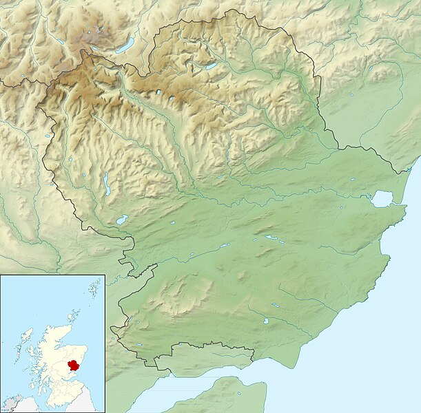
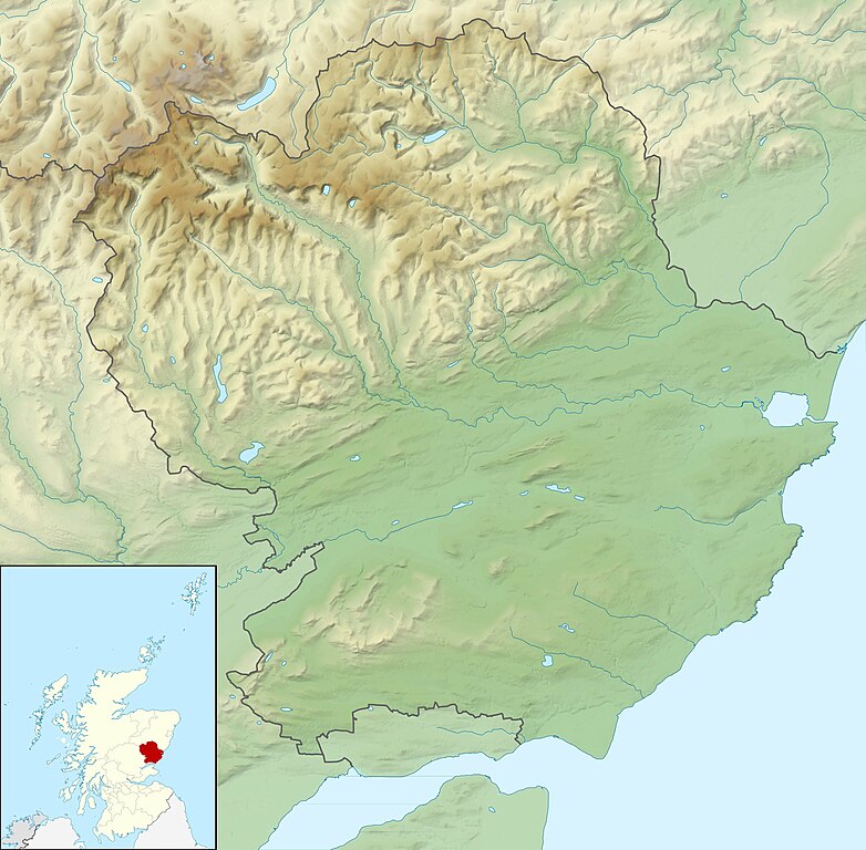
Relief map of Angus, UK. Equirectangular map projection on WGS 84 datum, with N/S stretched 180% Geographic limits:
|
| Datum | |
| Bron |
|
| Auteur | Nilfanion, created using Ordnance Survey data |
| Toestemming (Hergebruik van dit bestand) |
Dit bestand is gelicenseerd onder de Creative Commons-licentie Naamsvermelding-Gelijk delen 3.0 Unported Naamsvermelding: Contains Ordnance Survey data © Crown copyright and database right
|
| Andere versies | File:Angus UK blank map.svg - Blank map |
Bestandsgeschiedenis
Klik op een datum/tijd om het bestand te zien zoals het destijds was.
| Datum/tijd | Miniatuur | Afmetingen | Gebruiker | Opmerking | |
|---|---|---|---|---|---|
| huidige versie | 30 nov 2011 14:15 | | 1.998 × 1.962 (471 kB) | Nilfanion | {{Information |Description=Relief map of Angus, UK. Equirectangular map projection on WGS 84 datum, with N/S stretched 180% Geographic limits: *West: 3.5W *East: 2.4W *North: 57.0N *South: 56.4N |Source=Ordnance Survey |
Bestandsgebruik
Dit bestand wordt op de volgende 7 pagina's gebruikt:
Globaal bestandsgebruik
De volgende andere wiki's gebruiken dit bestand:
- Gebruikt op ar.wikipedia.org
- Gebruikt op ba.wikipedia.org
- Gebruikt op bg.wikipedia.org
- Gebruikt op ceb.wikipedia.org
- Gebruikt op de.wikipedia.org
- Airlie Castle
- Cortachy Castle
- Edzell Castle
- Vorlage:Positionskarte Schottland Angus
- Finavon Castle
- Farnell Castle
- Forter Castle
- Forfar Castle
- Gardyne Castle
- Invermark Castle
- Inverquharity Castle
- Melgund Castle
- Panmure Castle
- Red Castle
- Glas Maol
- Cairn of Claise
- Creag Leacach
- Tom Buidhe
- Driesh
- Mayar
- Loch of Forfar
- Gebruikt op en.wikipedia.org
- Sidlaws
- Carnoustie Golf Links
- 2007 Open Championship
- Loch Lee
- Corrie Fee
- Balfour Castle, Angus
- User:Catfish Jim and the soapdish/Double Disc (Pictish symbol)
- Module:Location map/data/Scotland Angus/doc
- Rescobie Loch
- Loch Fithie
- Loch of Forfar
- 2018 Open Championship
- West Seaton House
- Module:Location map/data/Scotland Angus
- 2010 Senior Open Championship
- Loch of Lintrathen
- Long Loch (Angus)
Globaal gebruik van dit bestand bekijken.