Bestand:1814ThompsonMap.jpg
Oorspronkelijk bestand (4.020 × 2.593 pixels, bestandsgrootte: 3,83 MB, MIME-type: image/jpeg)
| Dit is een bestand van Wikimedia Commons. Onderstaande beschrijving komt van de beschrijving van het bestand daar. |
Beschrijving
| Beschrijving |
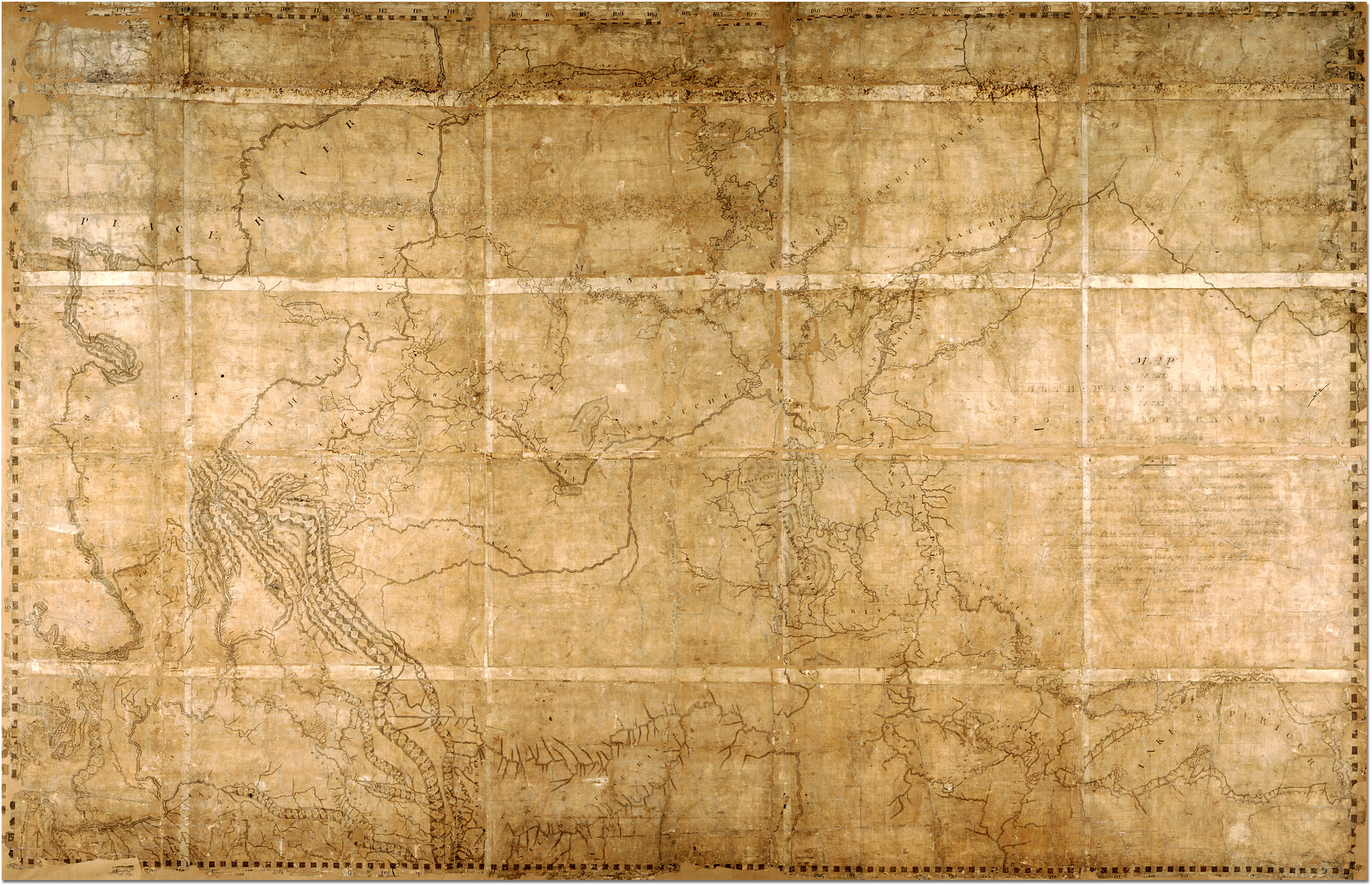
English: Map of the North-West Territory of the Province of Canada by David Thompson, 1814 Archives of Ontario, I0012850 Map is in the public domain. See:http://ao.minisisinc.com/scripts/mwimain.dll/144/ARCH_DESC_FACT/FACTSDESC/REFD%2BF%2B443-6?SESSIONSEARCH Full Title: "Map of the North-West Territory of the Province of Canada from actual Survey during the years 1792-1812. This map made for the North West Company in 1813 and 1814 and delivered to the Honorable William McGillivray then agent Embraces the Region lying between 45 and 60 degrees North Latitude and 84 and 124 degrees West Longitude comprising the Survey's and Discoveries of 20 years namely the Discovery and Survey of the Oregon Territory to the Pacific Ocean the Survey of the Athabasca Lake Slave River and Lake from which flows Mackenzie's River to the Arctic Sea by Mr. Philip Turner the Route of Alexander Mackenzie in 1792 down part of Fraser's river together with the Survey of this River to the Pacific Ocean by the late John Stuart of the North-West Company by David Thompson Astronomer and Surveyor." |
| Datum | tussen 1813 en 1814 |
| Bron | https://aims.archives.gov.on.ca/scripts/mwimain.dll/144/DESCRIPTION_WEB/WEB_DESC_DET?SESSIONSEARCH&exp=sisn%2013129 |
| Auteur | David Thompson |
Beschrijving ==

|
This image is available from the Archives of Ontario under the item reference code F 443, R-C(U), AO 1541 This tag does not indicate the copyright status of the attached work. A normal copyright tag is still required. See Commons:Licensing. |
Licentie ==
|
Dit werk bevindt zich in het publiek domein in landen en gebieden waar de auteursrechttermijn het leven van de auteur plus 70 jaar of minder is.
| |
| Van dit bestand is vastgesteld dat er geen bekende auteursrechtaanspraken op rusten, alle aanverwante en naburige rechten daarbij inbegrepen. | |
Bestandsgeschiedenis
Klik op een datum/tijd om het bestand te zien zoals het destijds was.
| Datum/tijd | Miniatuur | Afmetingen | Gebruiker | Opmerking | |
|---|---|---|---|---|---|
| huidige versie | 7 feb 2007 23:41 | | 4.020 × 2.593 (3,83 MB) | Ccscott~commonswiki | Map of the North-West Territory of the Province of Canada by David Thompson, 1814 Reference Code: F 443, R-C(U), AO 1541 Archives of Ontario, I0012850 Image URL: http://www.archives.gov.on.ca/english/interloan/big/thompson_mapa.htm Map is in the public d |
Bestandsgebruik
Dit bestand wordt op de volgende pagina gebruikt:
Globaal bestandsgebruik
De volgende andere wiki's gebruiken dit bestand:
- Gebruikt op ar.wikipedia.org
- Gebruikt op ca.wikipedia.org
- Gebruikt op de.wikipedia.org
- Gebruikt op en.wikipedia.org
- Gebruikt op es.wikipedia.org
- Gebruikt op it.wikipedia.org
- Gebruikt op ja.wikipedia.org
- Gebruikt op no.wikipedia.org
- Gebruikt op ru.wikipedia.org